Eldon Parish, New Brunswick
| Eldon | |
|---|---|
| Parish | |
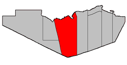 Location within Restigouche County. | |
| Coordinates: 47°45′00″N 67°04′30″W / 47.75°N 67.075°W | |
| Country |
|
| Province |
|
| County | Restigouche |
| Established | 1826 |
| Area[1] | |
| • Land | 1,681.54 km2 (649.25 sq mi) |
| Population (2011)[1] | |
| • Total | 698 |
| • Density | 0.4/km2 (1/sq mi) |
| • Pop 2006-2011 |
|
| • Dwellings | 375 |
| Time zone | AST (UTC-4) |
| • Summer (DST) | ADT (UTC-3) |
Eldon is a Canadian parish in Restigouche County, New Brunswick.[2]
Delineation
Eldon Parish is defined in the Territorial Division Act[3] as being bounded:
- Northerly by the Province of Quebec Boundary line, easterly by a line beginning on the southern bank or shore of Restigouche River at the northwest angle of lot number twenty-two, granted to George Firth below Metapedia, thence southerly along the western line of said lot and its prolongation to the northeast angle of lot number one, in Dawsonville, thence continuing southerly along the eastern line of said lot number one and its southern prolongation, to the southeast angle of lot number two (Thomas Gracie) and thence true south to the County limits; southerly by the County line and westerly by a straight line extending from the Province of Quebec Boundary line in the Restigouche River, at the mouth of Upper Thorn Point Brook to Whites Brook railway station on the Canadian National Railways, and thence prolonged southerly to the Victoria County Boundary line.
Communities
All municipalities within Eldon Parish are unincorporated.
Demographics
Population
| Canada census – Eldon Parish, New Brunswick community profile | |||
|---|---|---|---|
| 2011 | 2006 | 2001 | |
| Population: | 698 (-10.4% from 2006) | 779 (-13.6% from 2001) | 902 (-10.2% from 1996) |
| Land area: | 1,681.54 km2 (649.25 sq mi) | 1,681.51 km2 (649.23 sq mi) | 1,681.51 km2 (649.23 sq mi) |
| Population density: | 0.4/km2 (1.0/sq mi) | 0.5/km2 (1.3/sq mi) | 0.5/km2 (1.3/sq mi) |
| Median age: | 52.0 (M: 51.8, F: 52.1) | 47.5 (M: 47.1, F: 47.7) | 43.5 (M: 43.5, F: 43.4) |
| Total private dwellings: | 375 | 494 | 411 |
| Median household income: | $.N/A | $25,587 | $25,563 |
| Notes: 2011 income data for this area has been suppressed for data quality or confidentiality reasons. – References: 2011[1] 2006[4] 2001[5] | |||
| Historical Census Data - Eldon Parish, New Brunswick[6] | ||||||||||||||||||||||||||
|---|---|---|---|---|---|---|---|---|---|---|---|---|---|---|---|---|---|---|---|---|---|---|---|---|---|---|
|
|
| ||||||||||||||||||||||||
Language
| Canada Census Mother Tongue - Eldon Parish, New Brunswick[6] | ||||||||||||||||||
|---|---|---|---|---|---|---|---|---|---|---|---|---|---|---|---|---|---|---|
| Census | Total | English |
French |
English & French |
Other | |||||||||||||
| Year | Responses | Count | Trend | Pop % | Count | Trend | Pop % | Count | Trend | Pop % | Count | Trend | Pop % | |||||
| 2011 |
695 |
360 | |
51.80% | 330 | |
47.48% | 5 | |
0.72% | 0 | |
0.00% | |||||
| 2006 |
780 |
355 | |
45.51% | 410 | |
52.56% | 15 | |
1.92% | 0 | |
0.00% | |||||
| 2001 |
900 |
460 | |
51.11% | 420 | |
46.67% | 20 | |
2.22% | 0 | |
0.00% | |||||
| 1996 |
1,045 |
570 | n/a | 54.55% | 475 | n/a | 45.45% | 0 | n/a | 0.00% | 0 | n/a | 0.00% | |||||
Access Routes
Highways and numbered routes that run through the parish, including external routes that start or finish at the parish limits:[7]
|
|
See also
References
- 1 2 3 2011 Statistics Canada Census Profile: Eldon Parish, New Brunswick
- ↑ New Brunswick Provincial Archives - Eldon Parish
- ↑ "Territorial Division Act (R.S.N.B. 1973, c. T-3)". Government of New Brunswick website. Retrieved 19 August 2016.
- ↑ "2006 Community Profiles". Canada 2006 Census. Statistics Canada. March 30, 2011. Retrieved 2014-03-21.
- ↑ "2001 Community Profiles". Canada 2001 Census. Statistics Canada. February 17, 2012. Retrieved 2014-03-21.
- 1 2 Statistics Canada: 1996, 2001, 2006, 2011 census
- ↑ Atlantic Canada Back Road Atlas ISBN 978-1-55368-618-7 Pages 4-5, 12-13
 |
Avignon Regional County Municipality |
| ||
| Grimmer Parish | |
Addington Parish | ||
| ||||
| | ||||
| Saint-Quentin Parish | Lorne Parish (Victoria County) |
Northesk Parish (Northumberland County) |
| Subdivisions | |
|---|---|
| Cities | |
| Counties | |
| |
Coordinates: 47°45′00″N 67°04′30″W / 47.75000°N 67.07500°W
This article is issued from Wikipedia - version of the 8/19/2016. The text is available under the Creative Commons Attribution/Share Alike but additional terms may apply for the media files.