Kittitas County, Washington
| Kittitas County, Washington | |
|---|---|
 Kittitas County Courthouse in Ellensburg | |
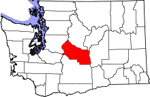 Location in the U.S. state of Washington | |
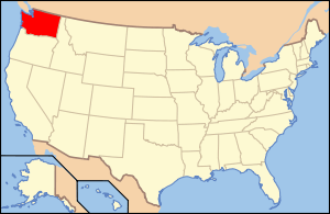 Washington's location in the U.S. | |
| Founded | November 24, 1883 |
| Seat | Ellensburg |
| Largest city | Ellensburg |
| Area | |
| • Total | 2,333 sq mi (6,042 km2) |
| • Land | 2,297 sq mi (5,949 km2) |
| • Water | 36 sq mi (93 km2), 1.5% |
| Population (est.) | |
| • (2015) | 43,269 |
| • Density | 19/sq mi (7/km²) |
| Congressional district | 8th |
| Time zone | Pacific: UTC-8/-7 |
| Website |
www |
Kittitas County /ˈkɪtᵻtæs/ is a county located in the U.S. state of Washington. As of the 2010 census, the population was 40,915.[1] Its county seat and largest city is Ellensburg.[2] The county was created on November 24, 1883 when it separated from Yakima County.[3]
There are numerous interpretations of the name, which is from the language of the Yakama Nation. According to one source, it "has been said to mean everything from 'white chalk' to 'shale rock' to 'shoal people' to 'land of plenty'. Most anthropologists and historians concede that each interpretation has some validity depending upon the particular dialect spoken."[4]
Kittitas County comprises the Ellensburg, WA Micropolitan Statistical Area.
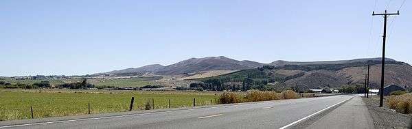
Geography
According to the U.S. Census Bureau, the county has a total area of 2,333 square miles (6,040 km2), of which 2,297 square miles (5,950 km2) is land and 36 square miles (93 km2) (1.5%) is water.[5] The highest point in the county is Mount Daniel at 7,959 feet (2,426 m) above sea level.
Geographic features
Major highways
Adjacent counties
- Chelan County - north
- Douglas County - northeast
- Grant County - east
- Yakima County - south
- Pierce County - west
- King County - northwest
National protected areas
- Snoqualmie National Forest (part)
- Wenatchee National Forest (part)
Demographics
| Historical population | |||
|---|---|---|---|
| Census | Pop. | %± | |
| 1890 | 8,777 | — | |
| 1900 | 9,704 | 10.6% | |
| 1910 | 18,561 | 91.3% | |
| 1920 | 17,737 | −4.4% | |
| 1930 | 18,154 | 2.4% | |
| 1940 | 20,230 | 11.4% | |
| 1950 | 22,235 | 9.9% | |
| 1960 | 20,467 | −8.0% | |
| 1970 | 25,039 | 22.3% | |
| 1980 | 24,877 | −0.6% | |
| 1990 | 26,725 | 7.4% | |
| 2000 | 33,362 | 24.8% | |
| 2010 | 40,915 | 22.6% | |
| Est. 2015 | 43,269 | [6] | 5.8% |
| U.S. Decennial Census[7] 1790–1960[8] 1900–1990[9] 1990–2000[10] 2010–2015[1] | |||
2000 census
As of the census[11] of 2000, there were 33,362 people, 13,382 households, and 7,788 families residing in the county. The population density was 14 people per square mile (6/km²). There were 16,475 housing units at an average density of 7 per square mile (3/km²). The racial makeup of the county was 91.77% White, 0.71% Black or African American, 0.91% Native American, 2.19% Asian, 0.15% Pacific Islander, 2.30% from other races, and 1.97% from two or more races. 5.00% of the population were Hispanic or Latino of any race. 19.4% were of German, 11.7% English, 9.0% Irish, 7.8% United States or American and 6.6% Norwegian ancestry. 93.2% spoke English and 4.5% Spanish as their first language.
There were 13,382 households out of which 26.20% had children under the age of 18 living with them, 47.80% were married couples living together, 7.20% had a female householder with no husband present, and 41.80% were non-families. 28.40% of all households were made up of individuals and 8.60% had someone living alone who was 65 years of age or older. The average household size was 2.33 and the average family size was 2.90.
In the county, the population was spread out with 20.60% under the age of 18, 21.60% from 18 to 24, 24.60% from 25 to 44, 21.60% from 45 to 64, and 11.60% who were 65 years of age or older. The median age was 31 years. For every 100 females there were 98.70 males. For every 100 females age 18 and over, there were 97.20 males.
The median income for a household in the county was $32,546, and the median income for a family was $46,057. Males had a median income of $36,257 versus $25,640 for females. The per capita income for the county was $18,928. About 10.50% of families and 19.60% of the population were below the poverty line, including 15.60% of those under age 18 and 8.20% of those age 65 or over.
2010 census
As of the 2010 United States Census, there were 40,915 people, 16,595 households, and 9,225 families residing in the county.[12] The population density was 17.8 inhabitants per square mile (6.9/km2). There were 21,900 housing units at an average density of 9.5 per square mile (3.7/km2).[13] The racial makeup of the county was 89.3% white, 2.0% Asian, 1.0% American Indian, 0.9% black or African American, 0.1% Pacific islander, 3.7% from other races, and 3.0% from two or more races. Those of Hispanic or Latino origin made up 7.6% of the population.[12] In terms of ancestry, 26.2% were German, 15.4% were Irish, 12.7% were English, 8.2% were Norwegian, 5.1% were Italian, 5.0% were Swedish, and 3.4% were American.[14]
Of the 16,595 households, 24.1% had children under the age of 18 living with them, 44.7% were married couples living together, 7.3% had a female householder with no husband present, 44.4% were non-families, and 28.7% of all households were made up of individuals. The average household size was 2.32 and the average family size was 2.87. The median age was 31.9 years.[12]
The median income for a household in the county was $41,232 and the median income for a family was $61,276. Males had a median income of $45,916 versus $35,380 for females. The per capita income for the county was $23,467. About 10.3% of families and 21.2% of the population were below the poverty line, including 19.8% of those under age 18 and 7.0% of those age 65 or over.[15]
Flora and fauna
There are a variety of species represented within Kittitas County. These include a diversity of grasses, herbs, trees, birds, mammals and amphibians. The genus of ricegrass known as Oryzopsis was one of the earliest grasses classified within the county.[16] Among the amphibian species found are the Cascades frog and the Rough-skinned Newt, the latter being a common far western USA taxon; in fact, examples of neoteny have been found in individual newts of this species within the county.[17]
Communities
Cities
- Cle Elum
- Ellensburg (county seat)
- Kittitas
- Roslyn
- South Cle Elum
Census-designated places
Unincorporated communities
Events
- The Kittitas County Fair and Ellensburg Rodeo occur every Labor Day Weekend. The Kittitas County Fair began in 1885, and moved to its current location in 1923.[18]
See also
- National Register of Historic Places listings in Kittitas County, Washington
- History of Thorp, Washington
References
- 1 2 "State & County QuickFacts". United States Census Bureau. Retrieved January 7, 2014.
- ↑ "Find a County". National Association of Counties. Retrieved 2011-06-07.
- ↑ Illustrated History of Klickitat, Yakima, & Kittitas Counties, with an outline of the early history of the state of Washington. Interstate Publishing Company. 1904. p. 244.
- ↑ Cochran, Jennifer (2007). "Kittitas County About the County".
- ↑ "2010 Census Gazetteer Files". United States Census Bureau. August 22, 2012. Retrieved July 7, 2015.
- ↑ "County Totals Dataset: Population, Population Change and Estimated Components of Population Change: April 1, 2010 to July 1, 2015". Retrieved July 2, 2016.
- ↑ "U.S. Decennial Census". United States Census Bureau. Retrieved January 7, 2014.
- ↑ "Historical Census Browser". University of Virginia Library. Retrieved January 7, 2014.
- ↑ "Population of Counties by Decennial Census: 1900 to 1990". United States Census Bureau. Retrieved January 7, 2014.
- ↑ "Census 2000 PHC-T-4. Ranking Tables for Counties: 1990 and 2000" (PDF). United States Census Bureau. Retrieved January 7, 2014.
- ↑ "American FactFinder". United States Census Bureau. Retrieved 2011-05-14.
- 1 2 3 "DP-1 Profile of General Population and Housing Characteristics: 2010 Demographic Profile Data". United States Census Bureau. Retrieved 2016-03-06.
- ↑ "Population, Housing Units, Area, and Density: 2010 - County". United States Census Bureau. Retrieved 2016-03-06.
- ↑ "DP02 SELECTED SOCIAL CHARACTERISTICS IN THE UNITED STATES – 2006-2010 American Community Survey 5-Year Estimates". United States Census Bureau. Retrieved 2016-03-06.
- ↑ "DP03 SELECTED ECONOMIC CHARACTERISTICS – 2006-2010 American Community Survey 5-Year Estimates". United States Census Bureau. Retrieved 2016-03-06.
- ↑ Charles Vancouver Piper (1906) Flora of the State of Washington, Smithsonian Institution, U.S. Government Printing Office, Washington DC
- ↑ C. Michael Hogan (2008) Rough-skinned Newt ("Taricha granulosa"), GlobalTwitcher, ed. N. Stromberg
- ↑ http://www.kittitascountyfair.com/history.asp
Further reading
- William Denison Lyman, History of the Yakima Valley, Washington: Comprising Yakima, Kittitas, and Benton Counties. In Two Volumes. Chicago: S.J. Clarke Publishing Co., 1919. Volume 1 | Volume 2
- Andrew Caveness, "Images of America: Kittitas County." South Carolina: Arcadia Publishing Co., 2012.
External links
| Wikimedia Commons has media related to Kittitas County. |
- Kittitas County Chamber of Commerce
- Kittitas County official website
- Thorp Mill Town Historical Preservation Society
- The CWU Brooks Library Frederick Krueger Photograph Collection The Frederick Krueger Collection contains images of the Upper Kittitas Valley of Washington State from the 1880s to the 1960s. The images, scanned from photographic prints, glass negatives and rare publications, visually document the communities of Cle Elum, Roslyn and other towns and villages in western Kittitas County. The collection also focuses upon mining, logging and fur trapping in the region during the late 19th Century and early 20th Century.
 |
King County | Chelan County | Douglas County | |
| Pierce County | |
Grant County | ||
| ||||
| | ||||
| Yakima County |
Municipalities and communities of Kittitas County, Washington, United States | ||
|---|---|---|
| Cities | | |
| Town | ||
| CDPs | ||
| Unincorporated communities | ||
| Indian reservation | ||
| Ghost towns | ||
| Footnotes | ‡This populated place also has portions in an adjacent county or counties | |
Coordinates: 47°07′N 120°41′W / 47.12°N 120.68°W