Emek HaYarden Regional Council
Emek HaYarden
| |
|---|---|
 | |
| District | Northern |
| Government | |
| • Type | Regional council (from 1949) |
| • Head of Municipality | Idan Greenbaum |
| Area | |
| • Total | 183,870 dunams (183.87 km2 or 70.99 sq mi) |
| Population (2014) | |
| • Total | 12,400 |
| Website | Official website |
Emek HaYarden Regional Council (Hebrew: מועצה אזורית עמק הירדן, Mo'atza Azorit 'Emeq HaYarden, lit. Jordan Valley Regional Council) is a regional council comprising much of the western shore of the Sea of Galilee, the southern parts of its eastern shore, and the northern part of the Jordan Valley all the way to Beit She'an in the south.
It was the first regional council in Israel, established in 1949.
In Israel the northern part of the Jordan Valley is called Emeq HaYarden and was part of Israel before the 1967 Six-Day War; the southern part is called Bik'at HaYarden, which gives the name to a separate regional council and was captured by Israel in 1967. The two Hebrew words emek and bik'a are practically synonymous, both "Emeq HaYarden" and "Bik'at HaYarden" meaning "Jordan Valley"; the distinction is only administrative and political.
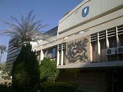
Most of the settlements are of the kibbutz type and are located on Highway 90, a north-south road which traverses the council's territory parallel to the Jordan River and along the western shore of the Sea of Galilee. The offices of the council are located between Degania Alef and the Tzemah Industrial Zone.
List of villages
This regional council provides various municipal services for the villages within its territory:
|
Kibbutz-type settlements |
Communal settlements
|
Moshava-type settlement
|
Moshav-type settlement |
External links
- Official website (Hebrew)
Coordinates: 32°42′20.78″N 35°35′0.89″E / 32.7057722°N 35.5835806°E