Evanston Park, South Australia
| Evanston Park Adelaide, South Australia | |||||||||||||
|---|---|---|---|---|---|---|---|---|---|---|---|---|---|
 Evanston Park | |||||||||||||
| Coordinates | 34°37′44″S 138°44′56″E / 34.62893°S 138.74885°ECoordinates: 34°37′44″S 138°44′56″E / 34.62893°S 138.74885°E | ||||||||||||
| Population | 4,001 (2011 census)[1] | ||||||||||||
| Postcode(s) | 5116 | ||||||||||||
| LGA(s) | Town of Gawler | ||||||||||||
| State electorate(s) | Light and Napier | ||||||||||||
| Federal Division(s) | Wakefield | ||||||||||||
| |||||||||||||
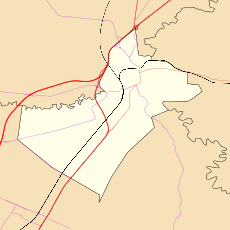
Evanston Park is a northern suburb of Adelaide, South Australia. It is on the southeastern side of Gawler. It is on the eastern side of Main North Road and Adelaide Road extending north from near the intersection with Gawler Bypass Road.
Governance
The majority of Evanston Park is in the Town of Gawler, straddling the boundary so that the eastern portion of the suburb is in the City of Playford.[2] The western part of Evanston Park is in the state electoral district of Light and the area east of Bentley Road is in the electoral district of Napier.
References
- ↑ Australian Bureau of Statistics (31 October 2012). "Evanston Park (State Suburb)". 2011 Census QuickStats. Retrieved 11 March 2013.
- ↑ "Placenames report - Evanston Park". Property Location Browser. Department of Planning, Transport and Infrastructure, Government of South Australia. 11 March 2009. SA0023092. Retrieved 26 November 2014.
This article is issued from Wikipedia - version of the 12/11/2014. The text is available under the Creative Commons Attribution/Share Alike but additional terms may apply for the media files.