Fairbank, Toronto
| Fairbank | |
|---|---|
| Neighbourhood | |
|
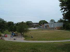
View of Fairbank Memorial Park, looking south. | |
 Vicinity | |
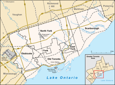 Location within Toronto | |
| Coordinates: 43°41′44″N 79°27′00″W / 43.69556°N 79.45000°WCoordinates: 43°41′44″N 79°27′00″W / 43.69556°N 79.45000°W | |
| Country |
|
| Province |
|
| City |
|
| Community | York |
| Established | 1891 (Postal village) |
| Changed Municipality | 1998 Toronto from York |
Fairbank is a neighbourhood in Toronto, Ontario, Canada. The area covers a large central portion of the former City of York, Ontario centered on the intersection of Dufferin Street and Eglinton Avenue West. Fairbank includes the neighbourhoods of Briar Hill–Belgravia (North of Eglinton Avenue West) and Caledonia–Fairbank (South of Eglinton Avenue West). The western border is the CNR lines. The northern and southern borders are the former borders of the City of York and the eastern border is Dufferin Street (Oakwood–Vaughan).
History
The area began at the Fairbank Postal Village at the intersection of Vaughan Road (an early settler's street crossing though farmland on the way to Vaughan Township) at Eglinton and Dufferin Street. The postal village name was derived from the Fairbank Farm owned by English settler Matthew Parsons (and named by his father-in-law Jacob Mackay).[1]
St Hilda's Anglican church (St. Hilda's Retirement Residence, added in 1975) was built at the Fairbank intersection, although a cul-de-sac was later created at the northern end of Vaughan Road to simplify the Eglinton and Dufferin intersection when Eglinton Avenue began to develop as a commercial street with many mid-rise apartment buildings.
Character
The neighbourhood has many rolling hills and steep, climbing streets. To the west, Prospect Cemetery separates Fairbank from development along the railway. Most of the neighbourhood as it exists today was planned in the interwar years (1920s & 1930s) with mostly small single family 2 and 1½ storey detached homes on north-south residential streets. Eglinton Ave. is organized into two BIAs: Fairbank Village and York-Eglinton. St. Clair Avenue to the south is organized into two BIAs: 'Corso Italia' and 'St. Clair Gardens'. The neighbour historically acts an extension of Corso Italia - having a heavy Italian influence, however is now heavily influenced and inhabited by Portuguese immigrants.
Districts
This neighbourhood contains several named areas.
- Caledonia covers the area along Caledonia Rd west of Prospect Cemetery and east of the railroad tracks. For demographic purposes the city has titled this neighbourhood Caledonia-Fairbanks. As of the 2006 Canadian Census, the total population of the Calendonia-Fairbank area was 3335,[2] as of the 2011 National Household survey it was said to be 3230.[3]
- North Fairbank the area north of Eglinton and west of Dufferin
- Belgravia the portion of the neighbourhood east of Dufferin, north of Eglinton, and south of the former Belt Line, where the tracks have been removed as part of the York Beltline Trail.
- Briar Hill the area north of Belgravia and the Belt Line. Briar Hill and Belgravia are both modest areas with house values and average incomes in the lower quadrant compared with the Toronto average. The area's inhabitants are diverse; there is a very large Roman Catholic base, and Italian, Russian, and Portuguese are widely spoken as home languages. More than half of the immigrant population of Briar Hill-Belgravia arrived after 1981, with a majority of immigrants in 1996 and 2001 arriving from the Philippines, with Tagalog becoming a major immigrant language of the neighbourhood.
- Fairbank Village is the Business Improvement Area along Eglinton Ave. W. from Dufferin St. to Chamberlain Ave., as well as along Dufferin St. from Hunter Ave. to Schell Ave.
- York-Eglinton is the Business Improvement Area Along Eglinton Ave East of Dufferin St and extends to Marlee Ave.
- Eglinton West a stretch of Multicultural retail stores and restaurants along Eglinton.
Transportation
The Toronto Transit Commission bus routes that serve this neighbourhood include the 29 Dufferin, 32 Eglinton West, 47 Lansdowne (along Caledonia Road), and the 109 Ranee (along Marlee Avenue) during regular hours, and for night service, 307 Eglinton West and 329 Dufferin. Though there are no subway stations within the neighbourhood, they are within walking distance from its boundary; the two nearest stations are Glencairn station and Eglinton West station. The upcoming Crosstown-Metrolinx LRT route will provide quick service along Eglinton Avenue once complete.[4]
Landmarks
- Fairbank Memorial Community School
- FH Miller Junior Public School
- The main park is the Fairbank Memorial Park
- Fairbank Memorial Park Community Centre
- Prospect Cemetery
- Fairbank United Church
Education
The Toronto District School Board operates public anglophone secular schools. The Toronto Catholic District School Board operates public anglophone Catholic schools. The Conseil scolaire Viamonde operates public secular Francophone schools serving the area. The Conseil scolaire de district catholique Centre-Sud operates public Catholic Francophone schools serving the area.
- Fairbank Public School, a TDSB school, is in the community
- DB Hood Community School had been converted to the Lycée Français de Toronto, a private French school [5]
Demographics
According to the 2006 census, the majority of the neighbourhood's population is Roman Catholic (over 65%), and there are a large number of people who speak Portuguese and Italian, with many recognizable ethnic influences in the neighbourhood. As of the 2011 National Household survey, the population was divided into 37% Portuguese, 6% Italian, 2% Spanish, with the remaining 55% being of other Southern European origins,[6] compared to the 75% of Portuguese reported in the 2006 census. The neighbourhood is inhabited mostly by first generation Canadians (76%).[7]
See also
References
- ↑ http://www.ontarioroots.com/content/04/04_02/article_002.html
- ↑ 2006 Canadian Census
- ↑ 2011 National Household Survey
- ↑ "What is the Crosstown? | Crosstown". www.thecrosstown.ca. Retrieved 2016-01-13.
- ↑ http://lft.ca/contact-us/
- ↑ 2011 National Household Survey
- ↑ 2006 Canadian Census
External links
- Caledonia-Fairbanks - Demographic profile
- City of Toronto - Briar Hill-Belgravia Neighbourhood Profile
 |
Glen Park | | ||
| Silverthorn | |
Allenby, Oakwood–Vaughan | ||
| ||||
| | ||||
| Earlscourt | Corso Italia (Toronto) |