Farm to Market Road 157
| ||||
|---|---|---|---|---|
| Route information | ||||
| Maintained by TxDOT | ||||
| Length: | 40.1 mi[1] (64.5 km) | |||
| Existed: | June 4, 1945[2] – present | |||
| Major junctions | ||||
| South end: |
| |||
|
| ||||
| North end: |
| |||
| Location | ||||
| Counties: | Tarrant, Johnson, Ellis | |||
| Highway system | ||||
| ||||

Farm to Market Road 157 (FM 157) is a Farm to Market Road in the US state of Texas, traveling from an exit on Texas State Highway 121 south, through Euless, Bedford, Fort Worth, and Arlington in Tarrant County, then enters Johnson County, and passes through Mansfield, and Venus, before entering Ellis County, and terminating at an intersection with Farm to Market Road 66 in Maypearl.[3] While located in Euless and Bedford, FM 157 is known as Industrial Boulevard, while in Fort Worth, it is known as Collins Street. In Arlington, the route continues on Collins, Abram, and Cooper Streets. In Mansfield, the road is known as Main Street and Lone Star Road; in Venus as Main Street, 8th Street, and 7th Street; and in Maypearl as Highway 157. The highway passes directly through the center of Euless and Bedford, passing large neighborhoods and businesses. The route passes a large wetland before passing directly through downtown Arlington, passing major attractions such as Cowboys Stadium and Rangers Ballpark. The route passes through the center of the University of Texas at Arlington, and continues through downtown and southern Arlington, before entering Mansfield. The route continues though central Mansfield, and south to Maypearl. The Texas Department of Transportation (TxDOT) designated the route in 1945, and redesignated the portion traveling from SH 121 to US Bus. 287 as Urban Road 157 (UR 157) in 1995.
Route description
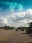
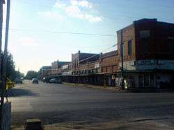
FM 157 begins at its southern terminus, a three-way intersection with Farm to Market Road 66, in Maypearl, Texas.[4] The highway starts off as a two-lane, paved, asphalt road. After the intersection, the road continues through northern Maypearl, passing several rows of houses and small businesses. Just after exiting the town, the route passes the large Maypearl Cemetery.[5] The route continues through rural farmland, intersecting several small county roads along the way. At an intersection with Farm to Market Road 1446, the road passes a group of houses and farms. For this length of the route, FM 157 is heading almost due northeast. A few miles after the intersection with FM 1446, the highway turns west and continues for about half a mile in that direction. The road then turns northwest again, and passes the large community of Country Acres.[3] The route continues on through miles of open farmland, intersecting with FM 2258 and FM 875, as well as smaller roads. FM 157 then enters Venus. When the road enters Venus, the name changes from Farm Road 157 to 7th Street. Just after entering the town, the route turns west and is renamed 8th street. The highway spends a very short period of time traveling west, before turning northeast again, and becoming Main Street. The highway passes the Venus Post Office, and proceeds through "downtown Venus", passing most of the town's businesses. FM 157 proceeds to pass over three railroad tracks. The route intersects with US Highway 67, and then exits Venus.[6] The highway passes several large farms, before passing through a very large, unnamed, unincorporated community, and continuing towards Mansfield.[3] The highway enters southern Mansfield, and intersects Business U.S. Route 287, and becomes concurrent with the highway.[7][8]
History
FM 157 was first designated on June 4, 1945, and traveled from, a junction with US 287 in Mansfield, in Johnson County, northward to Grapevine, in Tarrant County. Seven days later, on June 11, 1945, the highway was extended from US 287 through Venus and southward to the southern border of Ellis County.[2] The route was extended on December 16, 1955, to a junction with FM 66 in Maypearl, adding approximately 8.8 miles (14.2 km) to the overall length. On May 15, 1980, the northern 0.6 miles (0.97 km) of the route was returned to the city of Grapevine, which was eventually redesignated as Spur 103. The next 3.9 miles (6.3 km) south of that was redesignated as part of State Highway 121 (SH 121) in the same order. Spur 103 was cancelled in 2006. [2] On June 27, 1995, the stretch of the highway traveling from SH 121 south to US 287 was redesignated as UR 157, approximately 17.3 miles (27.8 km).[1] The remaining 22.7 miles (36.5 km) of the route stayed FM 157.[2] On June 26, 2003, a portion of the route was redesignated from Collins Street to Cooper Street, in Arlington.[1][3]
Future
In 2012, TxDOT began discussions for a project for the rerouting of FM 157 from FM 1807 south of Venus north to US 287 in Mansfield. The project would potentially reroute the highway to a more direct path, and take it through several large neighborhoods.[9] As of March 2012, no official work has begun.[10][11]
Major junctions
| County | Location | mi[3] | km | Destinations | Notes |
|---|---|---|---|---|---|
| Ellis | Maypearl | 0.0 | 0.0 | Southern terminus | |
| | 1.0 | 1.6 | Western terminus of FM 1446 | ||
| | 5.7 | 9.2 | |||
| | 7.7 | 12.4 | Western terminus of FM 875 | ||
| | 8.6 | 13.8 | Eastern terminus of FM 1807 | ||
| Venus | 10.7 | 17.2 | |||
| Mansfield | 19.5 | 31.4 | South end of US 287 Bus.concurrency | ||
| Tarrant | 21.1 | 34.0 | Eastern terminus of FM 917 | ||
| 22.7 | 36.5 | North end of US 287 Bus. concurrency | |||
| 24.0 | 38.6 | ||||
| Arlington | 27.5 | 44.3 | Cloverleaf interchange exit; I-20 exits 449 A-B | ||
| 31.1 | 50.1 | ||||
| 32.2– 33.0 | 51.8– 53.1 | UT-Arlington | Major access to most of campus | ||
| 34.2 | 55.0 | ||||
| 35.6 | 57.3 | No westbound entrance; I-30 exit 27B | |||
| Euless | 38.4 | 61.8 | |||
| 39.0 | 62.8 | FM 157 southbound lanes enter Bedford | |||
| 40.1 | 64.5 | Northern terminus; interchange; no northbound exit | |||
1.000 mi = 1.609 km; 1.000 km = 0.621 mi
| |||||
See also
 Texas portal
 U.S. Roads portal
References
- 1 2 3 Transportation Planning and Programming Division (n.d.). "Urban Road No. 157". Highway Designation Files. Texas Department of Transportation. Retrieved March 15, 2012.
- 1 2 3 4 Transportation Planning and Programming Division (n.d.). "Farm to Market Road No. 157". Highway Designation Files. Texas Department of Transportation. Retrieved March 15, 2012.
- 1 2 3 4 5 Google (March 18, 2012). "Overview Map of Farm to Market Road 157" (Map). Google Maps. Google. Retrieved March 18, 2012.
- ↑ Discovery Channel Road Atlas (Map). 1 in:143.5 mi. Cartography by Mapquest.com, Inc. American Map. 2004. p. 106. ISBN 0-8416-1787-2.
- ↑ Transportation Planning and Programming Division (2012). Texas County Map Book (PDF) (Map) (2012 ed.). 1:120,000. Texas Department of Transportation. p. 484. OCLC 867856197. Retrieved April 19, 2012.
- ↑ Transportation Planning and Programming Division (2012). Texas County Map Book (PDF) (Map) (2012 ed.). 1:120,000. Texas Department of Transportation. p. 483. OCLC 867856197. Retrieved April 19, 2012.
- ↑ Discovery Channel Road Atlas (Map). 1 in:143.5 mi. Cartography by Mapquest.com, Inc. American Map. 2004. p. 108. ISBN 0-8416-1787-2.
- ↑ Transportation Planning and Programming Division (2012). Texas County Map Book (PDF) (Map) (2012 ed.). 1:120,000. Texas Department of Transportation. p. 453. OCLC 867856197. Retrieved April 19, 2012.
- ↑ Project Map: FM 157 Realignment (PDF) (Map). Texas Department of Transportation. Retrieved March 20, 2012.
- ↑ Staff. "FM 157 Project". Texas Department of Transportation. Retrieved March 19, 2012.
- ↑ Staff. "FM 157 major study (realignment)". Texas Department of Transportation. Retrieved March 20, 2012.