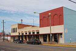
Itasca, Texas
| Itasca, Texas | |
|---|---|
| City | |
 | |
| Motto: "The Big Little Town"[1] | |
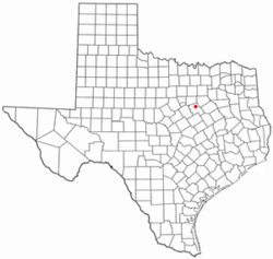 Location of Itasca, Texas | |
 | |
| Coordinates: 32°9′31″N 97°8′52″W / 32.15861°N 97.14778°WCoordinates: 32°9′31″N 97°8′52″W / 32.15861°N 97.14778°W | |
| Country | United States |
| State | Texas |
| County | Hill |
| Area | |
| • Total | 1.2 sq mi (3.1 km2) |
| • Land | 1.2 sq mi (3.1 km2) |
| • Water | 0.0 sq mi (0.0 km2) |
| Elevation | 702 ft (214 m) |
| Population (2010) | |
| • Total | 1,644 |
| • Density | 1,242.9/sq mi (479.9/km2) |
| Time zone | Central (CST) (UTC-6) |
| • Summer (DST) | CDT (UTC-5) |
| ZIP code | 76055 |
| Area code(s) | 254 |
| FIPS code | 48-37084[2] |
| GNIS feature ID | 1338519[3] |
| Website | http://www.biglittletowntx.com/ |
Itasca /aɪˈtæskə/ eye-TAS-kə is a city in Hill County in Northern Central Texas. As of the 2010 census, the city population was 1,644.
History
Itasca began as a railroad station for the Missouri, Kansas and Texas Railroad in 1881, and was incorporated in 1885.[4] City records show that between 2000-2008 more than 31,000 traffic tickets were issued.
Geography
Itasca is located at 32°9′31″N 97°8′52″W / 32.15861°N 97.14778°W (32.158509, -97.147852).[5]
According to the United States Census Bureau, the city has a total area of 1.2 square miles (3.1 km2), all of it land. The town's theme seen on some of its signs and its website is the "Big Little Town." Located off I-35W south of Fort Worth, Texas, and north of Waco, Texas, Itasca is the approximate midway point between the two cites.
Demographics
| Historical population | |||
|---|---|---|---|
| Census | Pop. | %± | |
| 1890 | 548 | — | |
| 1900 | 1,277 | 133.0% | |
| 1910 | 1,356 | 6.2% | |
| 1920 | 1,599 | 17.9% | |
| 1930 | 1,665 | 4.1% | |
| 1940 | 1,759 | 5.6% | |
| 1950 | 1,718 | −2.3% | |
| 1960 | 1,383 | −19.5% | |
| 1970 | 1,483 | 7.2% | |
| 1980 | 1,600 | 7.9% | |
| 1990 | 1,523 | −4.8% | |
| 2000 | 1,503 | −1.3% | |
| 2010 | 1,644 | 9.4% | |
| Est. 2015 | 1,625 | [6] | −1.2% |
As of the census[2] of 2000, there were 1,503 people, 549 households, and 384 families residing in the city. The population density was 1,242.9 people per square mile (479.6/km²). There were 612 housing units at an average density of 506.1 per square mile (195.3/km²). The racial makeup of the city was 64.54% White, 17.03% African American, 0.47% Native American, 0.07% Asian, 16.10% from other races, and 1.80% from two or more races. Hispanic or Latino of any race were 26.41% of the population.
There were 549 households out of which 32.6% had children under the age of 18 living with them, 51.0% were married couples living together, 13.7% had a female householder with no husband present, and 29.9% were non-families. 25.3% of all households were made up of individuals and 13.1% had someone living alone who was 65 years of age or older. The average household size was 2.63 and the average family size was 3.17.
In the city the population was spread out with 26.2% under the age of 18, 10.0% from 18 to 24, 26.3% from 25 to 44, 19.4% from 45 to 64, and 18.1% who were 65 years of age or older. The median age was 36 years. For every 100 females there were 98.3 males. For every 100 females age 18 and over, there were 97.3 males.
The median income for a household in the city was $30,050, and the median income for a family was $34,241. Males had a median income of $26,200 versus $22,045 for females. The per capita income for the city was $13,443. About 15.2% of families and 20.0% of the population were below the poverty line, including 29.6% of those under age 18 and 17.2% of those age 65 or over.
Education
The city is served by the Itasca Independent School District. The district has three schools, Itasca High School, Itasca Middle School, and Itasca Elementary School.[8]
Climate
The climate in this area is characterized by hot, humid summers and generally mild to cool winters. According to the Köppen Climate Classification system, Itasca has a humid subtropical climate, abbreviated "Cfa" on climate maps.[9]
References
- ↑ "Itasca Texas". Itasca Texas. Retrieved October 3, 2012.
- 1 2 "American FactFinder". United States Census Bureau. Retrieved 2008-01-31.
- ↑ "US Board on Geographic Names". United States Geological Survey. 2007-10-25. Retrieved 2008-01-31.
- ↑ "Itasca Texas". Texas State Historical Association. Retrieved October 3, 2012.
- ↑ "US Gazetteer files: 2010, 2000, and 1990". United States Census Bureau. 2011-02-12. Retrieved 2011-04-23.
- ↑ "Annual Estimates of the Resident Population for Incorporated Places: April 1, 2010 to July 1, 2015". Retrieved July 2, 2016.
- ↑ "Census of Population and Housing". Census.gov. Retrieved June 4, 2015.
- ↑ "Itasca Independent School District". Itasca Independent School District. Retrieved October 3, 2012.
- ↑ Climate Summary for Itasca, Texas
External links
| Wikimedia Commons has media related to Itasca, Texas. |
Municipalities and communities of Hill County, Texas, United States | ||
|---|---|---|
| Cities | 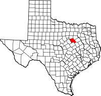 | |
| Towns | ||
| Unincorporated communities | ||