Faxfleet
Coordinates: 53°42′24″N 0°41′35″W / 53.706778°N 0.693107°W
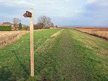
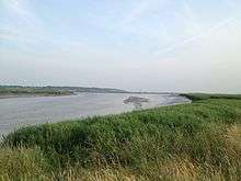
Faxfleet is a hamlet in the East Riding of Yorkshire, England. It is situated approximately 6 miles (10 km) west of Brough, and at the start of the Humber, on the north bank, where the River Ouse and the River Trent meet.
With Yokefleet and Bellasize, Faxfleet forms part of the civil parish of Blacktoft. Faxfleet lies within the constituency of Haltemprice and Howden, an area placed as the 10th most affluent in the country in a 2003 Barclays Private Clients survey.[1]
Faxfleet was the location of the Faxfleet Preceptory, a former community of the Knights Templar. It was one of Yorkshire's principal preceptories, valued at more than £290[2] (equivalent to £210,000 in 2015).[3] when it was closed in 1308.
In 1823 Faxfleet was listed as in the parish of South Cave, and in the Wapentake of Harthill. Population was 163, with occupations including three farmers and a brick & tile maker. There was a gentleman who lived at the Hall, and two yeomen.[4]
References
- ↑ "North tops 'real' rich league", BBC News, 14 May 2003. Retrieved 4 July 2014
- ↑ "Geoffrey Jolif, Knight Templar: an Anglo-Norman forbear?". The Jollys of Mythop. Retrieved 1 March 2011.
- ↑ UK CPI inflation numbers based on data available from Gregory Clark (2016), "The Annual RPI and Average Earnings for Britain, 1209 to Present (New Series)" MeasuringWorth.
- ↑ Baines, Edward (1823): History, Directory and Gazetteer of the County of York, p. 203
- Gazetteer — A–Z of Towns Villages and Hamlets. East Riding of Yorkshire Council. 2006. p. 5.
External links
 Media related to Faxfleet at Wikimedia Commons