Ffordd Pen Llech
 Gradient warning sign at the top of Ffordd Pen Llech | |
| Length | 0.2 mi[1] (0.3 km) |
|---|---|
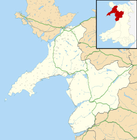
| Location | Snowdonia National Park, Wales |
| Postal code | LL46 2YL |
| south end |
Twtil 52°51′33″N 4°06′28″W / 52.85929°N 4.10779°W |
| north end |
Hwylfar Nant 52°51′42″N 4°06′28″W / 52.86177°N 4.10768°W |
Ffordd Pen Llech ([fɔrð pʰɛn ɬeːχ]) is a minor road in the town of Harlech which lies within Snowdonia National Park, North Wales. Its distinguishing feature is being the steepest signed public tarmacked road in the United Kingdom.[2][3]
Overview
Ffordd Pen Llech is one of two roads surrounding Harlech Castle World Heritage Site, and linking the higher town centre with the Cambrian Line railway station, housing and camping areas close to sea level. Its descent of the rock spur to the north of the castle gives it a tangentially measured gradient at its steepest section of 1:2.73.[4] Whilst this translates to the vertical rise being 36.63% of the horizontal going, it is normal practice for UK highway authorities to round gradients to a nominal figure to avoid confusing road users with excessive precision;[5] hence the warning sign gives a slope of 40%. This sign was, in common with all earlier gradient warning signs in the United Kingdom, displayed as an arctan ratio of 1:2½,[6] and subsequently changed to the new standard of the tangent expressed as a percentage.
The street is a single-track road for the majority of its length. To avoid problems with vehicles meeting on the slope and being unable to restart, the northern half has been made a one-way street for the main descent.
Leisure
In addition to containing tourist facilities and its proximity to Harlech Castle, with its 165-foot (50 m) drop over a short distance, Ffordd Pen Llech is popular with cycling enthusiasts seeking extreme slopes.[7] Its popularity is limited by the one-way system requiring downward travel only (UK law treats bicycles as vehicles and requires riders to observe all traffic signs),[8] meaning that a cyclist would have to defy the regulation to attempt the ascent[9] or make the upward journey via the adjacent road, Twtil, which has a gradient almost as steep at 25%.[10]
Etymology
The name Pen Llech, derived from the Welsh words pen ("head", "end", "top") and llech ("flat rock", "slab", "smooth cliff") can be translated approximately as "end of the rock",[11] "head-stone", or perhaps "stony headland".[12]
References
- ↑ "Driving directions to Ffordd Pen Llech". Google. Retrieved 15 October 2013.
- ↑ Rob Ainsley (June 2008). "50 Quirky Bike Rides > 28 Ffordd Pen Llech". Eye Books. Retrieved 15 October 2013.
- ↑ "Around the network – Facts and figures". Roads UK. Retrieved 16 October 2013.
- ↑ Dr. Richard M. Green. "Road records". Department of Mathematics, University of Colorado. Retrieved 16 October 2013.
- ↑ "Traffic Signs Manual – Warning Signs" (pdf). The Stationery Office. p. 27. Retrieved 16 October 2013.
- ↑ "The Steepest Road in Britain? (2852)". Oliver O'Brien. 31 January 1999. Retrieved 16 October 2013.
- ↑ "Strava Segment – Ffordd Pen Llech". Strava, Inc. Retrieved 17 October 2013.
- ↑ "The Highway Code – Rules for cyclists" (pdf). Gov.uk. 30 May 2013. p. 69. Retrieved 17 October 2013.
- ↑ "Hill no 89 – 92 Fford Penllech". Simon Warren. 20 March 2012. Retrieved 17 October 2013.
- ↑ "Twtil, Harlech". Google. Retrieved 2 November 2013.
- ↑ Charnock, R. S. Local Etymology: A Derivative Dictionary of Geographical Names, 1859, p.205
- ↑ Blackie, C. Etymological Geography, 1876, p. 128