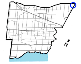
Finch Avenue
| |||||||
|---|---|---|---|---|---|---|---|
|
Peel Regional Road 2 Durham Regional Road 37 | |||||||
 | |||||||
| Route information | |||||||
|
Maintained by City of Toronto Region of Peel Region of Durham | |||||||
| Length: | 52 km (32 mi) | ||||||
| Major junctions | |||||||
| West end: |
| ||||||
|
Highway 27 Albion Road Kipling Avenue Islington Avenue Weston Road Jane Street Keele Street Dufferin Street Bathurst Street Yonge Street Bayview Avenue Leslie Street Don Mills Road Victoria Park Avenue Warden Avenue Kennedy Road McCowan Road Markham Road Neilson Road Morningside Avenue | |||||||
| East end: |
Dead ends east of | ||||||
| Location | |||||||
| Major cities: |
Toronto Mississauga Brampton Pickering | ||||||
| Highway system | |||||||
| |||||||


Finch Avenue is an arterial thoroughfare that travels east–west in Toronto, Ontario, Canada. The road continues west into the Regional Municipality of Peel as Regional Road 2 and east into the Regional Municipality of Durham Regions as Regional Road 37.
The road is considered a high-density transit corridor by Metrolinx. At its intersection with Yonge Street in North York, the Finch subway station and the Finch Bus Terminal carry one of the highest amounts of commuters in the city.
History
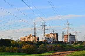
Finch Avenue was named after hotel owner John Finch, who operated John Finch's Hotel at the northeast corner of Finch Avenue and Yonge Street in Toronto.[1] The road allowance was a concession road, and at one time, there were a number of older churches, schoolhouses, and cemeteries on each side of the road. In the 1950s, Ontario Hydro constructed a series of transmission lines around Toronto, and paralleled Finch from Highway 400 eastward into Pickering. A compressed natural gas pipeline also follows this routing.
As suburban development in North York progressed northward in the 1960s, Finch was rapidly reconstructed from a gravel road into a four-laned traffic artery. This began with the realignment of several sections, such as at Bayview where Newtonbrook Creek flows diagonally beneath the crossroads. A rail overpass west of Leslie was built by 1968.
In the west, Finch originally ended at the Humber River at Islington Avenue. A separate western section was later constructed as development occurred in the-then Borough of Etobicoke. Traffic proceeding west had to travel on Islington, south across the Humber to Albion Road, and west beyond Kipling Avenue to reach it. In the early 1990s, this gap was closed. Earlier, in the 1980s a short extension was built northwestward into Mississauga and Brampton with the construction of Highway 427, turning onto the Gorewood Drive concession (formerly Toronto Gore Township Concession 3). Finch ends at Steeles Avenue, and Gorewood Drive continues it for a short distance north of Highway 407, where the concession is cut off by the Claireville Conservation Area. The concession is then called MacVean Drive in northeastern Brampton, north of Queen Street, the former Highway 7. It then continues into Caledon as Centreville Creek Road.
On August 19, 2005, a freak rainstorm in Toronto caused the Black Creek water level to rise, which caused a section of Finch Avenue West near Sentinel Road (due south of York University between Keele and Jane Streets) to collapse, leaving a deep pit that prevented any pedestrian or vehicular traffic from passing through. The crater left where a 4 lane roadway once was is approximately 20–25 feet (7 metres) deep.[2] Two lanes reopened in late 2005, and the remaining lanes opened in April 2006. On July 24, 2009, two sinkholes appeared on Finch Avenue West between Dufferin Street and Bathurst Street.[3]
Route description
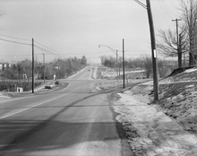
Despite its length (one of the longest streets in the Greater Toronto Area), few major landmarks are located on Finch; it runs primarily through business and residential areas. Many condominium and office high-rises are located at the intersection with Yonge Street in the North York City Centre area.
Most of Finch Avenue west of Morningside Avenue is a four to six-lane principal arterial, with a speed limit of 60 km/h (35–40 mph) in most sections. East of Morningside, Finch Av. E becomes Staines Rd. a collector road that runs through residential communities, northeast to Steeles Av. E. However Finch Av. E continues briefly at the south end of Beare Road heading east as it enters into the City of Pickering in Durham Region after Scarborough-Pickering Townline where it is also known as Durham Regional Road 37.
In Pickering, Finch Avenue is also known as Durham Road # 37 and continues east to Brock Road (Durham Regional Road 1). It ends at a cul-de-sac at Kingston Road (Durham Regional Highway 2 and formerly provincial Highway 2), and Kingston Rd. continues the concession line to the eastern boundary of Oshawa.
In Mississauga and Brampton, Finch Avenue is designated as Peel Regional Road 2, and is the shortest road corridor under the jurisdiction of the Region of Peel.
Transit infrastructure
Finch subway station on Line 1 Yonge-University, located at the intersection of Finch Avenue and Yonge Street, is the northernmost station of the Toronto subway and RT network and is a major regional transit hub. Adjacent to the station is the Finch Bus Terminal, a hub for GO Transit, York Region Transit and Viva buses. Finch Avenue is served by buses of the Toronto Transit Commission 24 hours a day through regular routes (39 Finch East and 36 Finch West) and Blue Night Network routes (336 Finch East and 339 Finch West).[4][5] Two express routes, 39E Finch East and 199 Finch Rocket, provide faster transit to Finch station. The latter connects to Scarborough Centre station on Line 3 Scarborough in the east and York University in the west.
The Toronto-York Spadina Subway Extension project, extension of the west-wing of Line 1, includes the future Finch West subway station at the intersection of Finch Avenue and Keele Street, which is set for opening in 2017. In 2007, former mayor David Miller proposed the construction of several light rail lines under the Transit City plan, one of which was the Finch West LRT, which was proposed to operated between Humber College in the west and the future Finch West station. After intermittently abandoning the proposal by succeeding mayor Rob Ford, the line was later approved for funding by Metrolinx.
Landmarks and neighbourhoods
Other sites and neighbourhoods along Finch:
- Wild Water Kingdom — at Steeles Avenue, in Brampton, Ontario.
- Humber College Main Campus, near Highway 27
- Etobicoke General Hospital
- Albion Mall — at Albion and Kipling Avenue
- Thistletown Regional Centre for Children and Adolescents
- Thistletown
- Rexdale
- Emery — at Weston Road
- York-Finch Hospital — Humber River Regional
- Jane and Finch
- Yorkgate Mall — near Jane Street
- Norfinch Mall — near Jane Street
- Jane Finch Mall — near Jane Street
- York University, north on Keele Street and Sentinel Road
- G. Ross Lord Dam and Reservoir, on the Don River (Western Branch), near Dufferin Street
- North York Branson Hospital, near Bathurst Street
- Herb Carnegie North York Centennial Recreation Complex (opposite Branson)
- Esther Shiner Stadium, behind Northview Heights SS at Bathurst
- Finch Transit Terminal at Yonge Street.
- Finch Parkette — site of John Finch's Hotel and tavern in 1848; demolished in 1873
- Historic Zion Schoolhouse near Leslie Street
- Old Cummer GO Station at Leslie Street
- Seneca College Newnham Campus at Highway 404
- Bridlewood Mall at Warden Avenue
- Scarborough Hospital Birchmount Campus (Formerly Scarborough Grace Hospital) at Birchmount Road
- Woodside Square Mall at McCowan Road
- Malvern
- Rouge Park at the Rouge River
- Toronto Zoo
Side streets
Pawnee Avenue and Old Finch Avenue are both former alignments of Finch Avenue. Pawnee Avenue runs along the former North York Township road alignment between Highway 404 and Victoria Park Avenue. Old Finch Avenue runs in northeastern Scarborough, and includes a section of the original road alignment east of Morningside Avenue to Meadowvale Avenue, including the routing through the Rouge Park, and the northern edge of the Toronto Zoo.
References
- ↑ A Glimpse of Toronto's History City Planning Division, Urban Development Services, City of Toronto 2001, MPLS 087
- ↑ http://jane-finch.com/pictures/flood2005.htm
- ↑ http://www.680news.com/news/headlines/more.jsp?content=20090726_084245_7128
- ↑ Jeffrey Kay. "36 Finch / 36 Finch West." Transit Toronto.
- ↑ Jeffrey Kay. "39 Finch East." Transit Toronto.
External links
| Wikimedia Commons has media related to Finch Avenue, Toronto. |
Major roads, highways and streets in Toronto | |||||||||||
|---|---|---|---|---|---|---|---|---|---|---|---|
| North-south |
| ||||||||||
| East-west |
| ||||||||||
| |||||||||||
| |||||||||||