Fort Gaines, Georgia
| Fort Gaines, Georgia | |
|---|---|
| City | |
|
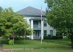
Clay County Courthouse in Fort Gaines | |
| Motto: "A historic past - A promising future" | |
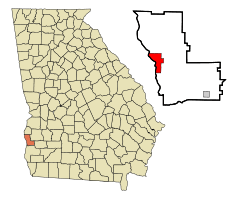 Location in Clay County and the state of Georgia | |
| Coordinates: 31°36′51″N 85°2′54″W / 31.61417°N 85.04833°WCoordinates: 31°36′51″N 85°2′54″W / 31.61417°N 85.04833°W | |
| Country | United States |
| State | Georgia |
| County | Clay |
| Area | |
| • Total | 7.7 sq mi (19.9 km2) |
| • Land | 4.8 sq mi (12.4 km2) |
| • Water | 2.9 sq mi (7.6 km2) |
| Elevation | 226 ft (69 m) |
| Population (2010) | |
| • Total | 1,107 |
| • Density | 232/sq mi (89.5/km2) |
| Time zone | Eastern (EST) (UTC-5) |
| • Summer (DST) | EDT (UTC-4) |
| ZIP codes | 31751, 39851 |
| Area code(s) | 229 |
| FIPS code | 13-30816[1] |
| GNIS feature ID | 0355877[2] |
| Website |
www |
Fort Gaines is a city in Georgia, United States, with a population of 1,107 at the 2010 census.[3] The city is the county seat of Clay County.[4]
History
The present town of Fort Gaines was founded in 1816 as protection against the indigenous Creeks and prospered due to riverboat trade.[5] Though it was named for General Edmund Pendleton Gaines, he didn't arrive there with the 4th Infantry of the United States Army until 1816.[5][6] A fort of the same name had been built in 1814 nearby on the Chattachoochee River. In 1854, Fort Gaines was designated seat of the newly formed Clay County.[7]
Geography
Fort Gaines is located along the western edge of Clay County at 31°36′51″N 85°2′54″W / 31.61417°N 85.04833°W (31.614226, -85.048317).[8] Its western boundary is the Chattahoochee River, which is also the state line with Alabama. Walter F. George Lock and Dam crosses the river between the northern side of Fort Gaines and Alabama, forming Walter F. George Lake, also known as Lake Eufaula.
According to the United States Census Bureau, Fort Gaines has a total area of 7.7 square miles (19.9 km2), of which 4.8 square miles (12.4 km2) is land and 2.9 square miles (7.6 km2), or 37.99%, is water.[3]
Demographics
| Historical population | |||
|---|---|---|---|
| Census | Pop. | %± | |
| 1870 | 758 | — | |
| 1880 | 867 | 14.4% | |
| 1890 | 1,097 | 26.5% | |
| 1900 | 1,305 | 19.0% | |
| 1910 | 1,320 | 1.1% | |
| 1920 | 1,237 | −6.3% | |
| 1930 | 1,272 | 2.8% | |
| 1940 | 1,357 | 6.7% | |
| 1950 | 1,339 | −1.3% | |
| 1960 | 1,320 | −1.4% | |
| 1970 | 1,255 | −4.9% | |
| 1980 | 1,260 | 0.4% | |
| 1990 | 1,248 | −1.0% | |
| 2000 | 1,110 | −11.1% | |
| 2010 | 1,107 | −0.3% | |
| Est. 2015 | 1,129 | [9] | 2.0% |
At the 2000 census,[1] there were 1,110 people, 429 households and 287 families residing in the city. The population density was 231.6 per square mile (89.5/km²). There were 519 housing units at an average density of 108.3 per square mile (41.8/km²). The racial makeup of the city was 67.93% African American, 31.08% White, 0.18% Native American, 0.18% Asian, 0.09% Pacific Islander, and 0.54% from two or more races. Hispanic or Latino of any race were 1.44% of the population.
There were 429 households of which 28.2% had children under the age of 18 living with them, 31.2% were married couples living together, 31.9% had a female householder with no husband present, and 33.1% were non-families. 31.0% of all households were made up of individuals and 14.9% had someone living alone who was 65 years of age or older. The average household size was 2.45 and the average family size was 3.07.
Age distribution was 28.7% under the age of 18, 8.7% from 18 to 24, 21.0% from 25 to 44, 19.5% from 45 to 64, and 22.0% who were 65 years of age or older. The median age was 39 years. For every 100 females there were 72.4 males. For every 100 females age 18 and over, there were 65.8 males.
The median household income was $18,30, and the median family income was $20,909. Males had a median income of $20,417 versus $14,875 for females. The per capita income for the city was $12,481. About 34.7% of families and 40.5% of the population were below the poverty line, including 53.2% of those under age 18 and 26.7% of those age 65 or over.
Education
Clay County School District
The Clay County School District holds pre-school to grade nine, and consists of one elementary school, one middle school, and one ninth-grade education building.[11] The district has 27 full-time teachers and over 358 students.[12] High school aged students attend 10-12th grade in adjoining Randolph County, Georgia.
- Clay County Elementary School
- Clay County Middle School
- Ninth-Grade Academy
Notable person
- Mackey Sasser, baseball player
References
- 1 2 "American FactFinder". United States Census Bureau. Retrieved 2008-01-31.
- ↑ "US Board on Geographic Names". United States Geological Survey. 2007-10-25. Retrieved 2008-01-31.
- 1 2 "Geographic Identifiers: 2010 Demographic Profile Data (G001): Fort Gaines city, Georgia". U.S. Census Bureau, American Factfinder. Retrieved July 25, 2014.
- ↑ "Find a County". National Association of Counties. Retrieved 2011-06-07.
- 1 2 Morgan, Linda. "Fort Gaines". Georgia Encyclopedia. Retrieved July 2, 2016.
- ↑ Gannett, Henry (1905). The Origin of Certain Place Names in the United States. Govt. Print. Off. p. 129.
- ↑ Hellmann, Paul T. (May 13, 2013). Historical Gazetteer of the United States. Routledge. p. 230. Retrieved 30 November 2013.
- ↑ "US Gazetteer files: 2010, 2000, and 1990". United States Census Bureau. 2011-02-12. Retrieved 2011-04-23.
- ↑ "Annual Estimates of the Resident Population for Incorporated Places: April 1, 2010 to July 1, 2015". Retrieved July 2, 2016.
- ↑ "Census of Population and Housing". Census.gov. Retrieved June 4, 2015.
- ↑ Georgia Board of Education, Retrieved June 4, 2010.
- ↑ School Stats, Retrieved June 4, 2010.
External Links
- Founding of Fort Gaines historical marker from the Digital Library of Georgia
- Fort Gaines historical marker
- In the Confederacy historical marker
- Queen City of the Chattahoochee historical marker
- Site of Fort Gaines Female College historical marker
- Mt. Gilead Baptist Church historical marker
Municipalities and communities of Clay County, Georgia, United States | ||
|---|---|---|
| City | 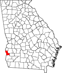 | |
| Town | ||
| Unincorporated community | ||
| Ghost town | ||