Franklin Township, Henry County, Indiana
| Franklin Township | |
|---|---|
| Township | |
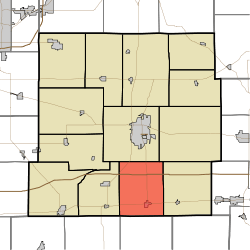 Location in Henry County | |
| Coordinates: 39°50′18″N 85°21′54″W / 39.83833°N 85.36500°WCoordinates: 39°50′18″N 85°21′54″W / 39.83833°N 85.36500°W | |
| Country | United States |
| State | Indiana |
| County | Henry |
| Government | |
| • Type | Indiana township |
| Area | |
| • Total | 28.61 sq mi (74.1 km2) |
| • Land | 28.48 sq mi (73.8 km2) |
| • Water | 0.13 sq mi (0.3 km2) 0.45% |
| Elevation | 1,060 ft (323 m) |
| Population (2010) | |
| • Total | 1,157 |
| • Density | 40.6/sq mi (15.7/km2) |
| GNIS feature ID | 0453305 |
Franklin Township is one of thirteen townships in Henry County, Indiana, United States. As of the 2010 census, its population was 1,157 and it contained 486 housing units.[1]
Franlin Township was organized in 1830.[2]
History
Richsquare Friends Meetinghouse and Cemetery was added to the National Register of Historic Places in 2006.[3]
Geography
According to the 2010 census, the township has a total area of 28.61 square miles (74.1 km2), of which 28.48 square miles (73.8 km2) (or 99.55%) is land and 0.13 square miles (0.34 km2) (or 0.45%) is water.[1] The stream of Applebutter Creek runs through this township.
Cities and towns
Adjacent townships
- Henry Township (north)
- Liberty Township (northeast)
- Dudley Township (east)
- Washington Township, Rush County (south)
- Center Township, Rush County (southwest)
- Spiceland Township (west)
Cemeteries
The township contains one cemetery, Ebenezer.
Major highways
References
- "Franklin Township, Henry County, Indiana". Geographic Names Information System. United States Geological Survey. Retrieved 2009-09-24.
- United States Census Bureau cartographic boundary files
- 1 2 "Population, Housing Units, Area, and Density: 2010 - County -- County Subdivision and Place -- 2010 Census Summary File 1". United States Census. Retrieved 2013-05-10.
- ↑ Hazzard, George (1906). Hazzard's History of Henry County, Indiana, 1822-1906. G. Hazzard, author and publisher. p. 885.
- ↑ National Park Service (2010-07-09). "National Register Information System". National Register of Historic Places. National Park Service.
External links
Municipalities and communities of Henry County, Indiana, United States | ||
|---|---|---|
| City | ||
| Towns | ||
| Townships | ||
| Unincorporated communities | ||
| Footnotes | ‡This populated place also has portions in an adjacent county or counties | |
This article is issued from Wikipedia - version of the 10/11/2016. The text is available under the Creative Commons Attribution/Share Alike but additional terms may apply for the media files.