Friendsville, Maryland
| Friendsville, Maryland | |
|---|---|
| Town | |
|
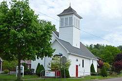
Grace Lutheran Church | |
 | |
| Coordinates: 39°39′44″N 79°24′19″W / 39.66222°N 79.40528°WCoordinates: 39°39′44″N 79°24′19″W / 39.66222°N 79.40528°W | |
| Country | United States |
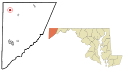
| State | Maryland |
| County | Garrett |
| Area[1] | |
| • Total | 0.91 sq mi (2.36 km2) |
| • Land | 0.91 sq mi (2.36 km2) |
| • Water | 0 sq mi (0 km2) |
| Elevation | 1,499 ft (457 m) |
| Population (2010)[2] | |
| • Total | 491 |
| • Estimate (2012[3]) | 484 |
| • Density | 539.6/sq mi (208.3/km2) |
| Time zone | Eastern (EST) (UTC-5) |
| • Summer (DST) | EDT (UTC-4) |
| ZIP code | 21531 |
| Area code(s) | 301 |
| FIPS code | 24-30850 |
| GNIS feature ID | 0584517 |
| Website | http://www.visitfriendsville.org |
Friendsville is a town in Garrett County, Maryland, United States. The population was 491 at the 2010 census.
Geography
Friendsville is located at 39°39′44″N 79°24′19″W / 39.66222°N 79.40528°W (39.662127, -79.405251).[4]
According to the United States Census Bureau, the town has a total area of 0.91 square miles (2.36 km2), all land.[1] The Youghiogheny River flows through the town and is renowned by the whitewater kayaking/rafting community as the take-out for the famous Upper Yough run.
History
Friendsville is named after its first European settler, John Friend, who came to what is now Garrett County before the American Revolution. Many of Friend's descendants live in Garrett County today, and the headquarters and library of the Friend Family Association are in Friendsville because of this connection.
Demographics
| Historical population | |||
|---|---|---|---|
| Census | Pop. | %± | |
| 1910 | 466 | — | |
| 1920 | 408 | −12.4% | |
| 1930 | 494 | 21.1% | |
| 1940 | 569 | 15.2% | |
| 1950 | 607 | 6.7% | |
| 1960 | 580 | −4.4% | |
| 1970 | 566 | −2.4% | |
| 1980 | 511 | −9.7% | |
| 1990 | 577 | 12.9% | |
| 2000 | 539 | −6.6% | |
| 2010 | 491 | −8.9% | |
| Est. 2015 | 476 | [5] | −3.1% |
2010 census
As of the census[2] of 2010, there were 491 people, 219 households, and 128 families residing in the town. The population density was 539.6 inhabitants per square mile (208.3/km2). There were 272 housing units at an average density of 298.9 per square mile (115.4/km2). The racial makeup of the town was 99.6% White, 0.2% Native American, and 0.2% Asian. Hispanic or Latino of any race were 0.6% of the population.
There were 219 households of which 25.1% had children under the age of 18 living with them, 38.8% were married couples living together, 16.0% had a female householder with no husband present, 3.7% had a male householder with no wife present, and 41.6% were non-families. 34.7% of all households were made up of individuals and 12.8% had someone living alone who was 65 years of age or older. The average household size was 2.24 and the average family size was 2.85.
The median age in the town was 44.6 years. 19.6% of residents were under the age of 18; 11.2% were between the ages of 18 and 24; 19.8% were from 25 to 44; 33% were from 45 to 64; and 16.5% were 65 years of age or older. The gender makeup of the town was 48.1% male and 51.9% female.
2000 census
As of the census[7] of 2000, there were 539 people, 232 households, and 134 families residing in the town. The population density was 580.6 people per square mile (223.8/km²). There were 266 housing units at an average density of 286.5 per square mile (110.4/km²). The racial makeup of the town was 97.96% White, 0.56% African American, 0.74% Native American, 0.19% Asian, 0.19% Pacific Islander, 0.19% from other races, and 0.19% from two or more races. Hispanic or Latino of any race were 0.37% of the population.
There were 232 households out of which 28.9% had children under the age of 18 living with them, 40.9% were married couples living together, 12.9% had a female householder with no husband present, and 42.2% were non-families. 39.2% of all households were made up of individuals and 19.4% had someone living alone who was 65 years of age or older. The average household size was 2.32 and the average family size was 3.05.
In the town the population was spread out with 25.4% under the age of 18, 8.3% from 18 to 24, 27.1% from 25 to 44, 22.4% from 45 to 64, and 16.7% who were 65 years of age or older. The median age was 40 years. For every 100 females there were 97.4 males. For every 100 females age 18 and over, there were 94.2 males.
The median income for a household in the town was $24,286, and the median income for a family was $28,750. Males had a median income of $26,591 versus $15,000 for females. The per capita income for the town was $13,292. About 18.2% of families and 24.0% of the population were below the poverty line, including 29.9% of those under age 18 and 28.4% of those age 65 or over.
References
- 1 2 "US Gazetteer files 2010". United States Census Bureau. Retrieved 2013-01-25.
- 1 2 "American FactFinder". United States Census Bureau. Retrieved 2013-01-25.
- ↑ "Population Estimates". United States Census Bureau. Retrieved 2013-06-26.
- ↑ "US Gazetteer files: 2010, 2000, and 1990". United States Census Bureau. 2011-02-12. Retrieved 2011-04-23.
- ↑ "Annual Estimates of the Resident Population for Incorporated Places: April 1, 2010 to July 1, 2015". Retrieved July 2, 2016.
- ↑ "Census of Population and Housing". Census.gov. Retrieved June 4, 2015.
- ↑ "American FactFinder". United States Census Bureau. Retrieved 2008-01-31.
External links
Municipalities and communities of Garrett County, Maryland, United States | ||
|---|---|---|
| Towns | 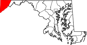 | |
| CDPs | ||
| Unincorporated communities | ||
| Ghost town | ||
| Footnotes | ‡This populated place also has portions in an adjacent county or counties | |