Fruitvale, British Columbia
| Fruitvale | |
|---|---|
| Village | |
| The Corporation of the Village of Fruitvale[1] | |
|
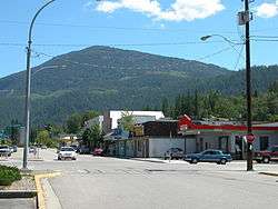
Main Street, Fruitvale | |
| Motto: The Heart of the Beaver Valley | |
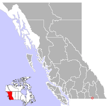 Location of Fruitvale in British Columbia | |
| Coordinates: 49°06′56″N 117°32′43″W / 49.11556°N 117.54528°W | |
| Country |
|
| Province |
|
| Region | Kootenays |
| Regional district | Kootenay Boundary |
| Founded | 1907 |
| Incorporated | 1952 |
| Government | |
| • Governing body | Fruitvale Village Council |
| • Mayor | Patricia Cecchini |
| Area | |
| • Total | 2.66 km2 (1.03 sq mi) |
| Elevation[2] | 681 m (2,234 ft) |
| Population (2006) | |
| • Total | 3,627 |
| Time zone | PST (UTC-8) |
| Highways | 3B |
| Waterways | Beaver Creek |
| Website | Village of Fruitvale |

Fruitvale's welcome sign
Fruitvale is a village located in south-eastern British Columbia in the West Kootenay region. It is located 16 km east of the city of Trail along Highway 3B.
Geography
The village of Fruitvale is situated in the Beaver Valley, which is made up of Fruitvale, Beaver Falls, and Montrose
Schools
Fruitvale Elementary School serves students from kindergarten to grade 7. High school students are bussed to J. Lloyd Crowe Secondary School in nearby Trail. Beaver Valley Middle School (formerly Beaver Valley Junior Secondary ) closed in 2002.
Sports
The KIJHL's Beaver Valley Nitehawks hockey team play in Fruitvale. The village also has facilities for curling, bowling, soccer, golf, and baseball.
| Club | League | Sport | Venue | Established | Championships |
|---|---|---|---|---|---|
| Beaver Valley Nitehawks | KIJHL | Ice Hockey | Beaver Valley Arena | 1981 | 7 |
Notable people
- Adam Deadmarsh, former NHL player - Colorado Avalanche and Los Angeles Kings
- Diana (Dee Dee) Haight World Cup Skier [3]
- Barret Jackman, 2003 NHL Rookie of the Year
- Laci J. Mailey, actress – Falling Skies, Chesapeake Shores
- Paul Moller, Inventor of the Skycar
- Gary Morissette, contestant on Canadian Idol
References
- ↑ "British Columbia Regional Districts, Municipalities, Corporate Name, Date of Incorporation and Postal Address" (XLS). British Columbia Ministry of Communities, Sport and Cultural Development. Retrieved November 2, 2014.
- ↑ http://www.wolframalpha.com/input/?i=Fruitvale+British+Columbia
- ↑ Diana (Dee Dee) Haight
External links
- Village of Fruitvale - Official site
- Fruitvale History from The Virtual Crowsnest Highway
| Subdivisions |  | |
|---|---|---|
| Communities | ||
| Metro areas and agglomerations | ||
| Villages |
| |
| ||
Coordinates: 49°6′58″N 117°32′29″W / 49.11611°N 117.54139°W
This article is issued from Wikipedia - version of the 11/18/2016. The text is available under the Creative Commons Attribution/Share Alike but additional terms may apply for the media files.