Fryerstown, Victoria
| Fryerstown Victoria | |||||||||||||
|---|---|---|---|---|---|---|---|---|---|---|---|---|---|
 Fryerstown | |||||||||||||
| Coordinates | 37°08′S 144°15′E / 37.133°S 144.250°ECoordinates: 37°08′S 144°15′E / 37.133°S 144.250°E | ||||||||||||
| Population | 320 (2011 census)[1] | ||||||||||||
| Postcode(s) | 3451 | ||||||||||||
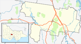
| Location |
| ||||||||||||
| LGA(s) | Shire of Mount Alexander | ||||||||||||
| State electorate(s) | Macedon | ||||||||||||
| Federal Division(s) | Bendigo | ||||||||||||
| |||||||||||||
Fryerstown is a small town in the "goldfields" region of Victoria, Australia.
At the 2011 census, Fryerstown and the surrounding area had a population of 320,[1] which peaked at 15,000 during the Victorian gold rush.
The Post Office opened on 19 April 1854 as Fryer's Creek, was renamed Fryerstown in 1856, and closed in 1975.[2]
References
- 1 2 Australian Bureau of Statistics (31 October 2012). "Fryerstown (State Suburb)". 2011 Census QuickStats. Retrieved 10 December 2014.
- ↑ Premier Postal History, Post Office List, retrieved 11 April 2008
External links
This article is issued from Wikipedia - version of the 5/7/2016. The text is available under the Creative Commons Attribution/Share Alike but additional terms may apply for the media files.