Gabtali Upazila
| Gabtali গাবতলী | |
|---|---|
| Upazila | |
 Gabtali Location in Bangladesh | |
| Coordinates: 24°53′N 89°27′E / 24.883°N 89.450°ECoordinates: 24°53′N 89°27′E / 24.883°N 89.450°E | |
| Country |
|
| Division | Rajshahi Division |
| District | Bogra District |
| Area[1] | |
| • Total | 239.61 km2 (92.51 sq mi) |
| Population (2011 census)[2] | |
| • Total | 319,588 |
| • Density | 1,300/km2 (3,500/sq mi) |
| Time zone | BST (UTC+6) |
| Postal code | 5820, 5821 |
| Website |
gabtali |
Gabtali Upazila (Bengali: গাবতলী উপজেলা) is an upazila of Bogra District in the Division of Rajshahi, Bangladesh. Gabtali Thana was established in 1914 and was converted into an upazila in 1983.[3] It is named after its administrative center, the town of Gabtali.
Geography
Gabtali Upazila has a total area of 239.61 square kilometres (92.51 sq mi).[1] It borders Shibganj Upazila to the north, Sonatala Upazila to the north and east, Sariakandi Upazila to the east, Dhunat Upazila to the south, and Shajahanpur and Bogra Sadar upazilas to the west.[3][4]
Demographics
| Historical population | ||
|---|---|---|
| Year | Pop. (000) | ±% |
| 1981 | 229 | — |
| 1991 | 266 | +16.2% |
| 2001 | 290 | +9.0% |
| 2011 | 320 | +10.3% |
| Source: Bangladesh Bureau of Statistics[1] | ||
According to the 2011 Bangladesh census, Gabtali Upazila had 83,411 households and a population of 319,588, 6.7% of whom lived in urban areas.[2] 9.8% of the population was under the age of 5.[5] The literacy rate (age 7 and over) was 46.6%, compared to the national average of 51.8%.[6][7]
Administration
Gabtali Upazila is divided into Gabtali Municipality and 11 union parishads: Balia Dighi, Dakshinpara, Durgahata, Gabtali, Kagail, Mahishaban, Naruamala, Nasipur, Nepaltali, Rameshwarpur, and Sonarai. The union parishads are subdivided into 103 mauzas and 211 villages.
Gabtali Municipality is subdivided into 9 wards and 21 mahallas.[1]
Transport
Railway stations Gabtali and Sukanpukur are on the branch line connecting Santahar and Kaunia. In July 2014 they were served by six or eight intercity and six mail trains a day.[8]
Education
There are nine colleges in the upazila. Gabtali Government College is the only public one. Private colleges include Durgahatta Degree College, Shahid Zia Degree College, Taranir Hat Degree College, and Taslim Uddin Tarafder Degree College.[1] Syed Ahmmed College in Sukhan Pukur is the only honors level college in the upazila.
The madrasa education system includes three fazil madrasas.[9]
Notable residents
Ziaur Rahman, President of Bangladesh (1977-1981), spent part of his childhood in Bagbari village.[10]
See also
References
| Wikimedia Commons has media related to Gabtali Upazila. |
- 1 2 3 4 5 "District Statistics 2011: Bogra" (PDF). Bangladesh Bureau of Statistics. Retrieved July 14, 2014.
- 1 2 "Population Census 2011: Bogra Table C-01" (PDF). Bangladesh Bureau of Statistics. Retrieved July 11, 2014.
- 1 2 Hai, Sarkar Abdul (2012). "Gabtali Upazila". In Islam, Sirajul; Jamal, Ahmed A. Banglapedia: National Encyclopedia of Bangladesh (Second ed.). Asiatic Society of Bangladesh.
- ↑ "Gabtali Map". Retrieved 11 July 2014.
- ↑ "Population Census 2011: Bogra Table C-04" (PDF). Bangladesh Bureau of Statistics. Retrieved July 11, 2014.
- ↑ "Population Census 2011: Bogra Table C-06" (PDF). Bangladesh Bureau of Statistics. Retrieved July 11, 2014.
- ↑ "Population and Housing Census 2011: Bangladesh at a Glance" (PDF). Bangladesh Bureau of Statistics. Retrieved July 21, 2014.
- ↑ "Bogra Schedule". Bangladesh Railways. Retrieved July 21, 2014.
- ↑ "List of Institutions". Ministry of Education. Retrieved July 15, 2014.
- ↑ Emajuddin, Ahamed (2012). "Rahman, Shahid Ziaur". In Islam, Sirajul; Jamal, Ahmed A. Banglapedia: National Encyclopedia of Bangladesh (Second ed.). Asiatic Society of Bangladesh.
| Upazila/Thana: | ||
|---|---|---|
Headquarters: Rajshahi | ||
| Bogra District | 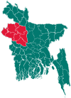 | |
| Joypurhat District | ||
| Naogaon District | ||
| Natore District | ||
| Nawabganj District | ||
| Pabna District | ||
| Rajshahi District | ||
| Sirajganj District | ||