Sapahar Upazila
| Sapahar Upazila সাপাহার | |
|---|---|
| Upazila | |
 Sapahar Upazila Location in Bangladesh | |
| Coordinates: 25°7.5′N 88°34.9′E / 25.1250°N 88.5817°ECoordinates: 25°7.5′N 88°34.9′E / 25.1250°N 88.5817°E | |
| Country |
|
| Division | Rajshahi Division |
| District | Naogaon District |
| Government | |
| • Chairman | Alhaj Samsul Alam Shah Chowdhury |
| Area | |
| • Upazila | 244.49 km2 (94.40 sq mi) |
| • Metro | 8.3 km2 (3.2 sq mi) |
| Population (2011 census) | |
| • Upazila | 161,791 |
| • Density | 660/km2 (1,700/sq mi) |
| Time zone | BST (UTC+6) |
| Postal code | 6560 |
| Website | Official Map of Sapahar |
Sapahar (Bengali: সাপাহার) is an Upazila of Naogaon District[1] in the Division of Rajshahi, Bangladesh.
Geography
Sapahar Upazila is bounded by West Bengal of India on the north and west, porsha upazila on the south, patnitala upazila on the east. Main river is "Punarbhaba" at Patari village and Jabai Beel is notable.
Sapahar is located at 25.1250°N 88.5819°E. It has 19,770 house holds and total area 244.49 km².
Town profile
Sapahar Sadar Town covers an area of 8.3 km2 (3.2 sq mi). The town area consists of ward no. 1, 2, 4 and partially 3. According to the census of 2011, It has a population of 12696. About 2924 households are situated here. Previously this place was known as a hat. In 1979, a Police Station had set up here. Later in 1985 it was turned into an upazila. This town is very famous for its huge improvement in education sector. Many educational institutions are here including one govt. college and one govt. girls' high school. It has 7 kindergartens, 5 high schools, 3 madrashas and 3 colleges. Besides there are many IT institutions, clubs and academies. It is also a very popular place for shopping and other business. Many big markets and centers are installed here. Several banking systems is also available here. All kinds of modern facilities are provided here so it's population is increasing day by day.
Demographics
As of the 2011 Bangladesh census, Sapahar has a population of 161792. Males constitute 50.68% of the population, and females 49.32%, Muslim 91.99%, Hindu 6%, others 2.01%; noted ethnic nationals: Mal and Munda. Sapahar has an average literacy rate of 47.1% (7+ years), and the national average of 54.4% literate.
Art and culture
- Sapahar Dance Academy
- Sapahar Comedy Club
Economy
Most of the people of the Sapahar Upazila depends on the agriculture. Agriculture plays a great role on the people of sapahar upazila. Land use: Total cultivable land 25162 hectares, fallow land 100 hectares; single crop 62%, double crop 29% and treble crop land 9
Points of interest
- Jobay Beel
Administration
Sapahar has 6 Unions/Wards, 152 Mauzas/Mahallas, and 228 villages.
| Nambers | Unions | Wards | villages | |
|---|---|---|---|---|
| 1 | Aihai | |||
| 2 | Goala | |||
| 3 | Patari | |||
| 4 | Sapahar | |||
| 5 | Shiranti | |||
| 6 | Tilna | |||
Education
government college 1, non-government college 4, government high school 1, non-government high school 30, government primary school 53, non-government primary school 49, community school 6, satellite school 12, madrasa 46, Computer Training Center 3.
The names of popular educational institutes of Sapahar are given below...
Colleges
- Sapahar Government College
- Al-Helal Islami Academy & College, Sapahar, Naogaon
- Chowdhury Chan Mohammad Women's University College
- Sapahar Technical & Business Management College
- Dighirhat Degree College
- Bhioil Degree College
- Tilna Degree College
High schools
- Al-Helal Islami Academy & College, Sapahar, Naogaon
- Sapahar Pilot High School, Naogaon
- Sapahar Govt. Girls High School
- Zaman Nagor Girls HighSchool
- Dangapara High School
- Shironty Moinakuri High School
- Tilna Ml High School
- Jobay High School
- Aihai High School
- Tiloni-Patari High School
- Mirapara High School
- Bhioil High School
- Kalmudanga High School
- Goala High School
- Nischinta Pur High School
- Khottapara High School
- koch kurulia High School
- TEGHORIA B.L HIGH SCHOOL
Primary/KG
- Al-Helal Islami Academy & College, Sapahar, Naogaon
- Sapahar Biddyaniketon (KG School)
- Sapahar Govt. Model Primary School
- Oxford Kindergarten
- Islamic International School
- Joypur Rajjyodhar Govt. Primary School, Sapahar
- Sristy Academy, Sapahar
- Mahajidpara Govt. Primary School
- Jobay Govt. Primary School
- Tilna Govt. PrimarySchool
- Ashranda Govt. Primary School
- Aihai Govt. Primary School.
- Kherunda Govt. Primary School etc.
Madrashas
- Sapahar Sharaftullah Madrasha
- Sapahar Qaomi Madrasha
- Sapahar Mahila Madrasha
- Patari Fazil Madrasha
- Mohajid Para Dakhil Madrasa
- Baikanthapur Tiloni Dakhil Madrasha
- Jobay Sufia Senior Fazil Madrasha
- Mungroil Fazil Madrasha
- Gopalpur Fazil Madrasha
- Aladipur Madrasha
- Islampur Dakhil Madrasha
Computer Training Center
- Bondhu computer training institute.*
- Ananda Computer Institute
Notable persons
- Md. Mahbubuzzaman (Ex Secretary, Ministry of Bangladesh)
- Dr. Md. Taheruddin
Gallery
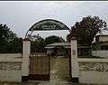 Public Library
 Academic Building
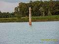 Historical Pond
 Town area
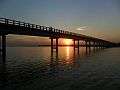 Jobay Bridge
 Upazila Chattar Shaheed Minar
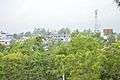 Sapahar Town
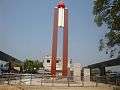 Central Liberation War Monument
References
- ↑ Md. Mukhlesur Rahman (2012). "Sapahar Upazila". In Sirajul Islam and Ahmed A. Jamal. Banglapedia: National Encyclopedia of Bangladesh (Second ed.). Asiatic Society of Bangladesh.
| Upazila/Thana: | ||
|---|---|---|
Headquarters: Rajshahi | ||
| Bogra District | 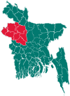 | |
| Joypurhat District | ||
| Naogaon District | ||
| Natore District | ||
| Nawabganj District | ||
| Pabna District | ||
| Rajshahi District | ||
| Sirajganj District | ||