Gardnerville, Nevada
| Gardnerville, Nevada | |
|---|---|
| CDP | |
|
Downtown Gardnerville | |
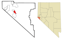 Location of Gardnerville, Nevada | |
| Coordinates: 38°56′27″N 119°44′37″W / 38.94083°N 119.74361°WCoordinates: 38°56′27″N 119°44′37″W / 38.94083°N 119.74361°W | |
| Country | United States |
| State | Nevada |
| Area | |
| • Total | 4.8 sq mi (12.4 km2) |
| • Land | 4.8 sq mi (12.4 km2) |
| • Water | 0.0 sq mi (0.0 km2) |
| Elevation | 4,751 ft (1,448 m) |
| Population (2010) | |
| • Total | 5,656 |
| • Density | 699.9/sq mi (270.2/km2) |
| Time zone | Pacific (PST) (UTC-8) |
| • Summer (DST) | PDT (UTC-7) |
| ZIP codes | 89410, 89460 |
| Area code(s) | 775 |
| FIPS code | 32-26300 |
| GNIS feature ID | 0859798 |
Nevada Historical Marker | |
| Reference no. | 129 |

Gardnerville is a census-designated place (CDP) in Douglas County, Nevada, United States, adjacent to the county seat of Minden. The population was 5,656 at the 2010 census.
U.S. Route 395 runs through the center of Gardnerville. State Route 207, known as Kingsbury Grade, connects Gardnerville to Stateline and U.S. Route 50.
Geography
Gardnerville is located at 38°56′27″N 119°44′37″W / 38.94083°N 119.74361°W (38.940932, -119.743509).[1]
According to the United States Census Bureau, the CDP has a total area of 4.8 square miles (12 km2), all of it land.
Climate
Area has a Köppen Climate Classification of Csb, which is a dry-summer subtropical climate often referred to as "Mediterranean".[2]
| Climate data for Gardnerville, Nevada | |||||||||||||
|---|---|---|---|---|---|---|---|---|---|---|---|---|---|
| Month | Jan | Feb | Mar | Apr | May | Jun | Jul | Aug | Sep | Oct | Nov | Dec | Year |
| Average high °C (°F) | 7 (45) |
11 (51) |
14 (57) |
18 (64) |
23 (73) |
28 (82) |
33 (91) |
32 (89) |
28 (82) |
21 (70) |
13 (56) |
8 (47) |
19 (67) |
| Average low °C (°F) | −8 (17) |
−6 (22) |
−4 (25) |
−1 (30) |
3 (37) |
6 (43) |
9 (48) |
8 (46) |
4 (39) |
−1 (30) |
−5 (23) |
−8 (18) |
0 (32) |
| Average precipitation mm (inches) | 41 (1.6) |
30 (1.2) |
20 (0.8) |
13 (0.5) |
13 (0.5) |
10 (0.4) |
8 (0.3) |
8 (0.3) |
8 (0.3) |
13 (0.5) |
23 (0.9) |
36 (1.4) |
218 (8.6) |
| Source: Weatherbase [3] | |||||||||||||
Demographics
As of the census[4] of 2000, there were 3,357 people, 1,473 households, and 870 families residing in the CDP. The population density was 699.9 people per square mile (270.0/km²). There were 1,556 housing units at an average density of 324.4 per square mile (125.2/km²). The racial makeup of the CDP was 89.93% White, 0.45% African American, 1.07% Native American, 1.28% Asian, 0.09% Pacific Islander, 5.30% from other races, and 1.88% from two or more races. Hispanic or Latino of any race were 11.83% of the population.
There were 1,473 households out of which 28.6% had children under the age of 18 living with them, 43.2% were married couples living together, 11.5% had a female householder with no husband present, and 40.9% were non-families. 33.1% of all households were made up of individuals and 13.5% had someone living alone who was 65 years of age or older. The average household size was 2.21 and the average family size was 2.82.
In the CDP the population was spread out with 22.6% under the age of 18, 7.5% from 18 to 24, 28.3% from 25 to 44, 21.1% from 45 to 64, and 20.4% who were 65 years of age or older. The median age was 39 years. For every 100 females there were 93.0 males. For every 100 females age 18 and over, there were 87.6 males.
The median income for a household in the CDP was $41,204, and the median income for a family was $46,154. Males had a median income of $34,769 versus $29,550 for females. The per capita income for the CDP was $20,670. About 12.1% of families and 15.1% of the population were below the poverty line, including 23.1% of those under age 18 and 13.6% of those age 65 or over.
Newspapers and media
- Carson Valley Times
- The Record-Courier
Notable residents
- Jill Derby, Nevada System of Higher Education regent
- Shawn Estes, Major League Baseball pitcher
- Lauren Scyphers, Miss Nevada USA 2006
- Tianna Gregory, Supermodel 2016
In popular culture
- 1989 : The Wizard, directed by Todd Holland, starring Fred Savage[5]
- 1957 : Wild is the Wind, directed by George Cukor[6]
- 1948 : Chicken Every Sunday, directed by George Seaton
- 2012 : The Motel Life, directed by Alan and Dave Polsky, starring Emile Hirsch, Stephen Dorff, and Dakota Fanning
- 1973 : Charley Varrick, directed by Don Siegel, starring Walter Matthau, Joe Don Baker, Sheree North, and Andrew Robinson
References
- ↑ "US Gazetteer files: 2010, 2000, and 1990". United States Census Bureau. 2011-02-12. Retrieved 2011-04-23.
- ↑ Climate Summary for Gardnerville, Nevada
- ↑ "Weatherbase.com". Weatherbase. 2013. Retrieved on August 21, 2013.
- ↑ "American FactFinder". United States Census Bureau. Retrieved 2008-01-31.
- ↑ Catalano, Grace (1991). Fred Savage : totally awesome. New York: Bantam Books. ISBN 9780553288582.
Locations during the first two weeks included the rural Nevada cities of Minden, Gardnerville, Fallon, Hazen, Dayton, and Lake Tahoe.
- ↑ "Wild is the Wind". National Wool Grower. 48. 1958.
Many of the scenes in this picture were shot at the Wallace Park Ranch in Garnerville, Nevada...
External links
![]() Media related to Gardnerville, Nevada at Wikimedia Commons
Media related to Gardnerville, Nevada at Wikimedia Commons
Municipalities and communities of Douglas County, Nevada, United States | ||
|---|---|---|
| CDPs | 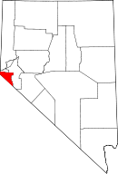 | |
| Unincorporated communities | ||