Gateway Island, Victoria
| Gateway Island Victoria | |
|---|---|
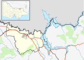 Gateway Island Location in City of Wodonga | |
| Coordinates | 36°05′46″S 146°53′49″E / 36.096°S 146.897°ECoordinates: 36°05′46″S 146°53′49″E / 36.096°S 146.897°E |
| Postcode(s) | 3694 |
| LGA(s) | City of Wodonga |
| Region | Northeast Victoria |
| State electorate(s) | Benambra |
| Federal Division(s) | Indi |
Gateway Island is an unpopulated suburb of the City of Wodonga local government area in northeast Victoria, Australia, adjacent to the Murray River and bounded in the south by the Wodonga Creek.
References
Islands of Victoria, Australia | |
|---|---|
| Islands off Gippsland and the Wilsons Promontory | |
| Islands within Corner Inlet | |
| Islands within Western Port | |
| Islands within Port Phillip | |
| Islands within Bass Strait and the Great Australian Bight | |
| River islands | |
| |
This article is issued from Wikipedia - version of the 6/21/2014. The text is available under the Creative Commons Attribution/Share Alike but additional terms may apply for the media files.