Gaviota, California


Gaviota is an unincorporated community in Santa Barbara County, California located about 30 miles (48 km) west of Santa Barbara and 15 miles (24 km) south of Buellton. Approximately 70 people live in Gaviota. The ZIP Code is 93117 (shared with the nearby city of Goleta), and the community is inside area code 805.
The town is south and east of Gaviota State Park, and is at the point on U.S. Route 101 where this primarily north-south highway turns to a generally east-west orientation to/from Santa Barbara, Ventura, and the San Fernando Valley area of Los Angeles. The road to Hollister Ranch, the large private land holding along the coast between Gaviota and Point Conception, connects with U.S. 101 just west of Gaviota, at the turnoff to Gaviota State Park.
Unlike its more urban and tourist-friendly neighbor Santa Barbara, Gaviota remains largely undeveloped, and most roads are unmarked and only known to locals. Its preservation is the subject of "The Twenty," a film by The Surfrider Foundation.
The area has long been known as a haven for surfers and hippies. Industries include organic farming, ranching, and woodworking. Free range cattle can be seen roaming and grazing throughout the area. Gaviota is also home to a marine mammal rehabilitation center named The Channel Islands Marine & Wildlife Institute (CIMWI.org) which opened in 2006 at the historic Vista Del Mar School grounds.[1]
History
The first European land exploration of Alta California, the Spanish Portolà expedition, camped at Gaviota Creek on August 24, 1769 (on its way north). On the return journey to San Diego, the party again stopped there on January 6, 1770. Franciscan missionary Juan Crespi noted in his diary, "I called this place San Luis Rey, and the soldiers know it as La Gaviota, because they killed a seagull there."[2] Gaviota is the Spanish word for "seagull".[3]
Gaviota was once the location of the Gaviota Marine Terminal, the large storage tanks of which are visible on the ocean side of the freeway, and which is currently being decommissioned and abandoned, with intent to become public open space.[4] On the mountain side of the freeway is the Gaviota Oil Heating Facility, also known as the "Gaviota Gas Plant", built by Chevron Corp. and currently owned by Plains Exploration & Production Company (PXP); this facility is being reconfigured and partially abandoned. The former purpose of the facility was to heat and process the heavy crude oil produced offshore so that it could flow through the All American Pipeline to refineries in the Bakersfield area.[4]
See also
| Wikimedia Commons has media related to Gaviota State Park. |
References
- ↑ Hayden, Tyler (July 11, 2011). "Hollisters Donate Last Piece of Land to Animal Rehab Center". Santa Barbara Independent.
- ↑ Bolton, Herbert E. (1927). Fray Juan Crespi: Missionary Explorer on the Pacific Coast, 1769-1774. HathiTrust Digital Library. pp. 171–172. Retrieved April 2014. Check date values in:
|access-date=(help) - ↑ Gannett, Henry (1905). The Origin of Certain Place Names in the United States. Govt. Print. Off. p. 135.
- 1 2 "Gaviota/Arguello Abandonment project". Energy Division. County of Santa Barbara Planning and Development. Retrieved 13 September 2016.
Coordinates: 34°28′18″N 120°12′50″W / 34.47167°N 120.21389°W
Municipalities and communities of Santa Barbara County, California, United States | ||
|---|---|---|
| Cities | 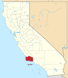 | |
| CDPs | ||
| Unincorporated communities | ||
| Indian reservation | ||
| Ghost towns | ||