Isla Vista, California
| Isla Vista | |
|---|---|
| census-designated place | |
|
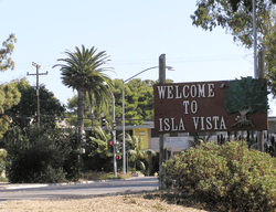
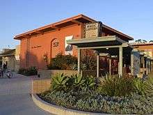
A welcome sign in Isla Vista | |
| Nickname(s): I.V. | |
 Location in Santa Barbara County and the state of California | |
 Isla Vista Location in the United States | |
| Coordinates: 34°24′48″N 119°51′39″W / 34.41333°N 119.86083°WCoordinates: 34°24′48″N 119°51′39″W / 34.41333°N 119.86083°W | |
| Country |
|
| State |
|
| County | Santa Barbara |
| Government | |
| • County Supervisor | Doreen Farr |
| • Senate | Hannah-Beth Jackson (D) |
| • Assembly | Das Williams (D) |
| • U.S. Congress | Lois Capps (D) |
| Area[1] | |
| • Total | 1.86 sq mi (4.833 km2) |
| • Land | 1.849 sq mi (4.789 km2) |
| • Water | 0.017 sq mi (0.045 km2) 0.93% |
| Elevation | 46 ft (14 m) |
| Population (2010) | |
| • Total | 23,096 |
| • Density | 12,000/sq mi (4,800/km2) |
| Time zone | PST (UTC-8) |
| • Summer (DST) | PDT (UTC-7) |
| ZIP code | 93117 |
| Area code(s) | 805 |
| FIPS code | 06-36868 |
| GNIS feature ID | 1702880 |
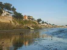
Isla Vista is an unincorporated community and census-designated place (CDP) in Santa Barbara County, California in the United States. As of the 2010 census, the CDP had a population of 23,096. The majority of residents are college students at nearby University of California, Santa Barbara (UCSB, located to the east of the community) or at Santa Barbara City College. The beachside community lies on a flat plateau about 30 feet (9 m) in elevation, separated from the beach by a bluff.
Isla Vista enjoys a Mediterranean climate and often has slightly less precipitation than either Santa Barbara or the adjacent community of Goleta. Isla Vista is located on a south-facing portion of the Santa Barbara County coast, between Coal Oil Point and Campus Point in view of the Channel Islands. During El Niño years, precipitation in Isla Vista can be excessive and potentially dangerous. Some homes and apartments built on the south side of Del Playa Drive, most popular with students due to their direct ocean views, are in danger of collapse, since they are built on quickly-eroding bluffs thirty to sixty feet above the Pacific Ocean. Recent erosion has exposed foundation supports in several of the properties closest to the university campus, UCSB.
As Isla Vista is on the south coast of Santa Barbara County, which has some of the highest housing prices in the United States, the student population shares densely packed housing with a working Hispanic population. Since Isla Vista has not been annexed by either Goleta or Santa Barbara, remaining unincorporated, only county funds are available for civic projects.[2][3]
Isla Vista is home to a student housing cooperative, the Santa Barbara Student Housing Coop, as well as a food cooperative, the Isla Vista Food Co-op.
Geography
Traditionally, Isla Vista is the area boxed in by El Colegio Road to the north, Ocean Road to the east, the beach to the south, and Camino Majorca to the west. The 2000 census showed 13,465 residents in this area of about 0.55 square miles (1.4 km2). The 2010 census showed population growth in this area of 10.2%, to 14,843. The densest (by population per land area) of the three subdivisions in the box, also called Isla Vista, was in 2010 the 87th densest census tract in California.[4]
The Isla Vista census-designated place defined in 2000 adds considerable land "outside the box", including the UCSB campus, Storke Ranch, and the area between Los Carneros and Storke Road north to Hollister Avenue, and contained a population of 18,344 and a land area of 2.2 square miles (5.7 km2). In the 2000 census, a mistake was made, and about 2,000 UCSB dormitory residents were listed as residing at the Santa Barbara Airport, and thus were outside the CDP. Starting in 2010, the Isla Vista CDP boundaries were revised to exclude various areas, including Storke Ranch and the Storke Plaza shopping center, which are now in the City of Goleta, reducing the CDP land area to 1.9 square miles (4.9 km2).[5][6]
"Isla Vista" is actually the name of the first subdivision built in the center of the community which eponymously gave it its name. The Isla Vista subdivision proper is between Camino Pescadero on the east and Camino Corto on the west. The Isla Vista subdivision was established in 1925, the Ocean Terrace subdivision between University of California, Santa Barbara (UCSB) and Camino Pescadero, and the Orilla del Mar subdivision between Camino Corto and the UCSB West Campus, both built in 1926. A number of east-west streets undergo "jogs" at the boundaries of the three subdivisions, because Santa Barbara County never required the three subdivisions to use a common street layout. The three subdivisions now are collectively called Isla Vista, and their total extent occupies land inherited by Alfonso Den, son of Nicolas A. Den, grantee of the Mexican land grant Rancho Dos Pueblos.[7]
In the 2001 incorporation of Goleta, inland to the north and up the coast to the west, Isla Vista was excluded. Whether or not to include Isla Vista was a subject of debate during incorporation planning, where a Goleta resident expressed concern about polls that indicated opposition to Isla Vista by all Goletans.[8] Eventually the Local Agency Formation Commission (LAFCO) recommended the exclusion of Isla Vista from the City of Goleta, although LAFCO projections indicated that the City of Goleta gave up $33 million in revenue over 10 years by excluding Isla Vista. The reason that LAFCO cited for recommending the exclusion of Isla Vista was `community identity'.[9]
Isla Vista is located at 34°24'53" North, 119°51'38" West (34.414595, -119.860418).[10]
According to the United States Census Bureau, the CDP has a total area of 1.9 square miles (4.9 km2), of which 99.07% of it is land and 0.93% of it is water.
History
Early days
The earliest human occupants of Isla Vista were the Chumash or their forbears. They called the Isla Vista mesa Anisq'oyo' (related to the Chumash word for `manzanita'[11]) and had permanent settlements near Cheadle Hall and the 217 entrance on the UCSB Campus; these villages were collectively called Heliyik.[12] Eventually the Franciscan Fathers encouraged the Chumash to remove to the Santa Barbara Mission.
The Isla Vista mesa was part of the Mexican land grant Rancho Dos Pueblos made in 1842 to Nicolas A. Den. Den's son, Alfonso Den, inherited the land. He and some of his nine siblings were plaintiffs in a famous lawsuit; when they were minors their land had been illegally sold in 1869 by the administrator of their estate, Charles E. Huse, to Col. William Welles Hollister, namesake of Hollister Avenue in Goleta, the Hollister Ranch, and Hollister, California. San Francisco lawyer Thomas B. Bishop sued Hollister on behalf of the Den children in 1876, and won the case in 1885. Bishop took much of the prime land owned by the Den children as a legal fee, and to this day some of that land, in the city of Goleta near Glen Annie Road, is called the Bishop Ranch. The least attractive land was left to the Den children, and that included the Rincon Ranch, which was at that time the name of the entire Isla Vista mesa, from present-day UCSB west to Coal Oil Point. The Rincon (Spanish for angle or corner) is the corner where Storke Road turns into El Colegio; until 1930 or so, Storke to El Colegio was the only road into Isla Vista, because other roads such as Los Carneros or Ward Memorial did not exist, because the Goleta Slough prevented passage. The Rincon Ranch had very little fresh water, was marginal for agriculture, and was split between three of the Den children: Augusto Den, who had mental disabilities, got the land that now forms the UCSB Main Campus and Alfonso got the land that is now Isla Vista.[13]
A portion of Alfonso Den's land was purchased for $100 in gold by John and Pauline Ilharreguy, residents of Fillmore[14] in 1915. The Ilharreguys arranged in 1925 the subdivision of the central tract they named Isla Vista (ungrammatical Spanish), and also laid out and named the four streets closest to the bluff: Del Playa (ungrammatical Spanish), Sabado Tarde, Trigo, and Pasado. The tract between Isla Vista and today's UCSB campus, owned by two Santa Barbara attorneys and partners Alfred W. Robertson (namesake of UCSB's Robertson Gymnasium) and James R. Thompson,[15] was subdivided and named Ocean Terrace in 1926. The third tract that comprises today's Isla Vista, Orilla Del Mar, to the west of the Isla Vista tract, was owned by two Santa Barbara sisters, Harriett (who designed a number of "fairy tale" homes on the South Coast of Santa Barbara County[16] ) and Brenda Moody, and was subdivided in 1926.[7]
The Isla Vista subdivisions are the earliest urban subdivisions performed in the Goleta Valley in the 20th century. The narrow streets of Isla Vista are characteristic of 1920s land planning. Plans for water, electricity, road building, and sewage were not made in the 1920s; the subdivision was speculative. Some of the speculation was related to ocean-front real estate, but an equally important motive was the likelihood of oil reserves' being accessible from Isla Vista property. To aid speculation, the lots in the subdivision were narrow, and mineral rights were pooled among blocks of lots. Some oil was found, but the wells did not sustain oil production, unlike the very productive Ellwood Oil Field just to the west of Isla Vista. Royalties from the Ellwood field paid for a large portion of the costs of construction of Santa Barbara County's famed courthouse. An oil deposit about one mile (1.6 km) south of Isla Vista under the Santa Barbara Channel, known as the South Ellwood field, was eventually found, but has never been fully developed, due to local political opposition after the 1969 Santa Barbara oil spill. The South Ellwood field contains upward of 100 million barrels (16,000,000 m3) of oil, and attempts by ARCO (in the 1980s) and by Mobil (in the 1990s) to develop the field have been rebuffed by local opposition.
Even though the Isla Vista lots were sold to several hundred owners in the 1920s, only a few vacation cottages were built before the 1940s. Scarcity of water, which had to be trucked in, as well as primitive sewage and refuse collection kept the development modest. A few dirt farmers raised beans, and piled their refuse into large heaps. One prominent early resident was architect E. Keith Lockard,[17] designer of a number of buildings in Santa Barbara County.[18]
World War II
On February 23, 1942, a Japanese submarine attacked the Ellwood oil field to the west of Isla Vista, and in response the United States Marine Corps took over both the land immediately to the east of Isla Vista (now the UCSB campus) and the land that now forms the Santa Barbara Airport. The Marine Corps developed Marine Corps Air Station Santa Barbara as an important flight training facility for squadrons fighting the Japanese in the Western Pacific, most notably the famed Blacksheep of VMF-214 trained here until their ill-fated deployment aboard the USS Franklin (CV-13). In the process of this crucial war-time development of the air base, Mescalitan Island, home of a tribal king and site of extensive sacred Chumash cemeteries, was bulldozed to fill most remaining portions of the Goleta Slough, once an extensive estuary that sustained a few thousand Chumash. The slough was at one time deep enough that Spanish explorers were able to sail near to the foothills, past the location of present-day Hollister Avenue. By this time, however, most of the slough had been silted in by the enormous deluge of 1861-62, as well as by dirt loosened from agricultural operations in the area. The Marine Corps filled in the remaining deep channels, particularly one that is now under the primary runway used for civil aviation today. The Marine Corps then built a sewage processing facility on the bulldozed sacred Chumash cemetery. Today this is the site of the Goleta Sanitary District facility.
The Marine Corps Air facility was deemed superfluous after World War II, and the airport was transferred to the City of Santa Barbara, while the blufftop barracks and land were transferred to the University of California in 1948 for the new Santa Barbara Campus.
The original vision for University of California, Santa Barbara was a small, 3,000-student campus contained on the blufftop site, and it seemed neighboring Isla Vista would develop into a mixture of single family dwellings and apartments for staff. Water became available from a reservoir in the Santa Ynez Mountains, Lake Cachuma, in the early 1950s. The homeowners who moved in organized the Isla Vista Sanitary District (now called the Goleta West Sanitary District) in 1954.
University

The University of California, Santa Barbara moved to its new campus in 1954, and a gala inauguration was held.
A new, nationally prominent provost, Clark G. Kuebler, was brought in to lead the new campus. Kuebler had been the president of Ripon College, a small liberal arts college in Wisconsin. Kuebler was charged with developing UCSB into a first-rate, small, liberal arts college to complement the enormous "multiversities" of Berkeley and UCLA. Kuebler was a prominent leader in the Episcopal Church[19] and helped establish Isla Vista's first church, St. Michael and All Angels at Camino Pescadero and Picasso. Today six religious institutions are located in Isla Vista. Kuebler resigned in 1955, after accusations that he had solicited another man in New York City.[20]
Although Isla Vista had been subdivided in the 1920s, it did not yet have zoning. A battle ensued in the early 1950s between the homeowners who wanted a mixture of single-family dwellings and apartments, and the non-resident property owners who wanted the maximum density possible. The non-resident property owners won, and all three Isla Vista subdivisions were zoned for apartments. Eventually the Orilla del Mar subdivision on the western edge of Isla Vista was rezoned for single family dwellings, but a rancorous relationship between the apartment developers and the homeowners was established. Today, only a few percent of Isla Vista's property owners are residents.
In the 1950s, UCSB professor Douwe Stuurman hosted the famed writer Aldous Huxley at his home on Del Playa. Huxley delivered a series of lectures at UCSB and in the Santa Barbara area.
By the late 1950s, with the end of World War II, the Baby Boom, and the G.I. Bill, it became clear that thousands of students would flood the University of California. UC president Clark Kerr re-envisioned UC Santa Barbara as a large, general campus like UC Berkeley or UCLA. Samuel B. Gould was appointed the first UCSB Chancellor in 1959.[21] The first UCSB plans that acknowledged Isla Vista were developed under Gould, who expressed concern that Isla Vista was an impediment to the orderly development of the area, due to its already haphazard development. Gould left UCSB in 1962 and later became Chancellor of the State University of New York.
The development of Isla Vista as a housing site for UCSB students attending a much larger institution began with regulated dormitories located along El Colegio Road. UCSB administrators recruited developers to build large complexes on El Colegio which in 1960 were considered to be forward-looking and modern, winning several design awards. Some of these dorms were portrayed in the mystery novels of Ross Macdonald.
1960s and 1970s

By the early 1960s, older students became frustrated with the curfews and entry restrictions in the dormitories, and drove demand for unregulated apartments in Isla Vista. Very aggressive developers built apartments to meet the demand, and successfully lobbied County Supervisors to drive down the requirements for parking places associated with the apartments, and to further drive up the density of dwelling units. At the same time, efforts to unify the owners of commercially zoned property around the Embarcadero Loop failed, leaving issues of coordinated business development and parking for commercial customers unresolved.
By 1967, Isla Vista had hundreds of cheaply constructed multiple dwelling units, and a commercial center that included physician and dental offices, jewelers, insurance and financial offices, as well as eclectic bookstores and an art-house movie theater. Trees and landscaping had not grown to appreciable heights, giving the town a barren look, and trash collected in empty lots. About that time the youth culture or counterculture ramped up, and Isla Vista became a natural waystation for youth who were hitchhiking up and down the coast of California.
Richard Brautigan did his first reading of Trout Fishing in America in Isla Vista in October 1967, at the Unicorn Book Shop. The Unicorn Book Shop and its affiliated Press were patronized by Ken Maytag, an heir of the Maytag family of washing machine and beer fame; the Press published a number of noted poets. However, the surrounding Santa Barbara community was uncomfortable with the flotsam and jetsam of the counterculture who were pausing in Isla Vista, and at about the same time the District Attorney raided the art-house movie theater, the Magic Lantern, while it showed a movie containing full frontal nudity. The operators were charged with obscenity, lost financing, and then lost their business. County Sheriffs Deputies were uncomfortable with the open marijuana use and drug dealing on the streets, and tensions grew. It is local folklore that Jim Morrison of The Doors wrote the song "The Crystal Ship" one night while on an acid trip on Sands Beach, watching the bright lights on the oil platform Holly a few miles off the southwest tip of Isla Vista.
In 1969, Edie Sedgwick, companion to Andy Warhol, lived in Isla Vista, in part because of a community of methamphetamine users in Isla Vista at that time. Sedgwick's brother lived on Fortuna Road; her family lived on a ranch near Santa Ynez, which is now part of the University of California Natural Reserve System. She met Lance Loud, the young gay man depicted in the PBS series An American Family, on the beach at the foot of El Embarcadero. Loud, already a correspondent of Warhol's, was ogling fraternity boys playing volleyball when he saw Sedgwick walking her dog and recognized her. Two years later, Sedgwick attended a fashion show at the Santa Barbara Art Museum filmed by An American Family, then returned home and accidentally overdosed on barbiturates. She is buried in Ballard, California near Solvang.
A student group known as the "IV League," organized itself to take civic responsibility for Isla Vista, and coordinated street parties, meetings with the Deputies, cleanups, and planting of street trees. However, in 1968, a number of incidents between the small community of African-American students attending UCSB and law enforcement, as well as the election of Richard Nixon triggered a long downward spiral for Isla Vista, which culminated in three separate riots in the winter and spring of 1970. The IV League was viewed as too moderate, and lost influence.

The local branch building of the Bank of America located at 935 Embarcadero Del Norte was burned to the ground by students on February 25, 1970, after a charge of rock-throwing students drove law enforcement officers out of town. According to Cril Payne, author of Deep Cover, a history of his career in the FBI, the FBI was very active in Santa Barbara and the charge of "students" that resulted in the burning of the Bank of America was a COINTELPRO FBI operation. Kevin Moran, a student who put out a fire in the temporary Bank of America during a riot in April 1970 was killed by police fire, and during a June 1970 riot Los Angeles County sheriff's deputies ran amok, prompting criticism from even William F. Buckley, Jr., the conservative commentator.[22][23]
Sometime in the night of July 4–5, 1970, three men in sleeping bags on the beach near the UCSB Campus Point were attacked by three men with axes or a machete and knives.[24] Two of the victims died at the scene and the third victim, Thomas M. Hayes, somehow survived the attack and told authorities at least one of his attackers was Asian. No money or jewelery was taken so money was not a motive. Five other murders on nearby beaches happened between February, 1970 and June, 1972, three of which occurred in Santa Barbara, and two of which occurred in Isla Vista.[25]
In the early 1970s, state officials created municipal advisory councils to deal with civil unrest in urban settings, by giving unincorporated communities quasi-representation in policy decisions to provide standard municipal services. Santa Barbara was among the first counties in the state the use them.
The Isla Vista Municipal Advisory Council held its first election in early 1971 with nine local residents of the student community elected to the government with funding from the county for operations. The advisory council tried to incorporate Isla Vista in 1973, 1975 and again in 1985, but none of the efforts succeeded. The council was eventually dissolved.[2]
Also in the 1970s, the now-defunct Isla Vista Community Council, funded by the University, was created. The Council ran its own elections and provided a central focus for the community.
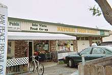
Additionally, many alternative organizations were created, including the second free clinic in the State after the original Haight Ashbury Free Clinic. The Isla Vista Recreation and Park District was founded in 1972, the second special district in Isla Vista (the first was the Isla Vista Sanitary District, now known as the Goleta West Sanitary District). It was also in the 1970s that the Isla Vista Food Cooperative was created, and a U.S. Community Federal Credit Union based on geography for membership was founded. The Community Council implemented a variety of other services, including animal control, but these projects languished due to lack of monetary support from County government.
Several businesses were created. Paul Orfalea founded Kinko's in Isla Vista in 1970.[26] Many traditional businesses, including dentists, jewelers, and hairdressers fled Isla Vista. Isla Vista became sundered from the surrounding communities, and in the long run, most of the eclectic Isla Vista businesses have disappeared.
Efforts to incorporate Isla Vista as a city failed in 1973, 1975, and 1985, in each case due to the Local Agency Formation Commission (LAFCO) voting down incorporation. Isla Vista wielded considerable influence in the large Goleta Water District, however, which covers a large area. The Isla Vista vote helped usher in the era (still going on) of no-growth policies in the nearby Goleta area, over the more conservative blocs of voters in Goleta, who at that time favored growth. Those Goleta residents gradually converted to the no-growth stance, but simultaneously they shunned Isla Vista.
Starting in the 1970s, Isla Vista became more and more dominated by students from UCSB and nearby Santa Barbara City College. As UCSB grew and expanded its enrollment, the economic power of the relatively affluent students drove non-student residents out. The late 1960s upheaval destroyed a raft of organized activities that once occupied students' time, and into the void a free-form party scene took hold, resulting in throngs of young people gathering on Friday and Saturday nights on Del Playa Drive, the street that hugs the southern blufftop of Isla Vista.
In late 1976, early 1977, three young women from Isla Vista were kidnapped and killed. These murders motivated large demonstrations opposed to violence against women, and in favor of better transportation for the young people residing in Isla Vista.[27]
1980s and later

Isla Vista has been an incubator for youth culture, and has always had a number of local bands. Beginning around 1980, many of these bands used storage garages in the 6500 block of Seville Road owned by Sid Goren, as rehearsal space. In the late 1980s, alt-rockers Toad the Wet Sprocket rehearsed there, and although their origin is Goleta, they often performed in Isla Vista. Other performers from the area that have garnered substantial notability include Animal Liberation Orchestra, Jack Johnson, Steve Aoki, Lagwagon, Thriving Ivory, Rebelution, Ugly Kid Joe, Iration and Nezara. The Seville Road practice spaces were demolished in 2012 to make way for one of many luxury student housing complexes.
Although Isla Vista is filled with 18- to 24-year-olds, there are relatively few commercial amenities for the population. Other commercial developments, such as a nearby mall (Camino Real Marketplace) and the lower State Street area of Santa Barbara have worked hard since the mid-1980s to attract Isla Vista's business, and the tax revenue associated with it. The economic development of Isla Vista has been neglected, and it remains mostly a bedroom community of young people, with an odd and eclectic commercial district.
When the City of Goleta was incorporated in 2001, the residents of Goleta successfully persuaded LAFCO to exclude Isla Vista from the new city's boundaries. Many observers noted that Isla Vistans shop mostly in Goleta, because county planners channeled commercial business development into Goleta.[2] A vocal and organized group of Isla Vista residents argued for inclusion of Isla Vista in the new City of Goleta, but encountered strong opposition from the Chair and Executive Director of LAFCO. LAFCO enabled the City of Goleta to garner the tax revenue from Isla Vista's economic activity, without civic responsibility for Isla Vista's infrastructure. Some note also that Santa Barbara County gets net revenue from Isla Vista, and so has a financial interest in maintaining Isla Vista's unincorporated status. The official reason for the exclusion of Isla Vista given by the Executive Director of LAFCO was "political infeasibility." The only wide poll of the greater Goleta area, conducted by the Goleta Roundtable, indicated that a city including Isla Vista would pass at the ballot box, however.
The 2001 Isla Vista killings occurred when UCSB freshman David Attias killed four students on the night of February 23, 2001, by slamming his car into several parked cars and pedestrians on the 6500 block of Sabado Tarde Road. Although initially charged with four counts of murder, four counts of vehicular manslaughter with gross negligence, and five counts of felony driving under the influence, Attias was later found to be legally insane.
On April 5, 2014, during an annual celebration known as Deltopia, a riot broke out in Isla Vista after a police officer tried to arrest a partygoer, only to be hit in the head with a bag of bottles from behind. The subsequent police response to the assault drew a large crowd to protest, some of whom eventually began throwing objects at the police. By the end of the night, nearly 100 people were arrested.[29] Subsequently, IV Foot Patrol deputies will be one of the first officers in the county to use body cameras.[30]
On May 23, 2014, the 2014 Isla Vista killings occurred where seven people, including the attacker, were killed and fourteen others were injured. The attacks took place at seventeen separate crime scenes, including a sorority house, a deli, and the attacker's own apartment.[31] 22-year-old former[32] Santa Barbara City College student Elliot Rodger stabbed three men to death in his apartment, then fired at UCSB students and other pedestrians, hitting several, and also struck seven others with his BMW.[31] Rodger had left a YouTube video recorded on the day of his killing spree, in which he blamed young women who he claimed rejected his advances. Rodger died of a gunshot wound to the head, apparently a suicide, as Santa Barbara County Sheriff's deputies closed in on his crashed vehicle.[33][34]
Culture
_02.JPG)
_01.JPG)
Isla Vista is notable for its unique student and beach culture, cultivated by a population largely made up of UCSB and Santa Barbara City College students. Isla Vista's small size and proximity to UCSB foster a strong sense of community, and students generally run into many people whom they know, be it from classes or otherwise. With warm days year-round, Isla Vista teems with hundreds of students who enjoy sunbathing, surfing, soccer, Frisbee, and other recreational activities to escape the rigors of academic life. The strong beach culture is also an important facet of the community's identity. Everyone who lives in Isla Vista is within minutes of the beach by foot.
Isla Vista is a unique community in which a positive and energetic atmosphere prevails. Youthful enthusiasm, partying, outdoor festivals and a generally upbeat environment have become synonymous with Isla Vista. Due to the large student population, coffee shops and local businesses are often busy well past midnight, with some buzzing until 2 a.m. each night. Businesses often stay open 24 hours around finals week for students to study there or take a break from studying. Further characterizing its quality of life, the principal mode of transportation to and from class and around Isla Vista is the bicycle or skateboard. Bicycles dominate the streets of Isla Vista, with students riding to and from campus and wetsuit-clad riders transiting to local beaches with surfboards under their arms.
Major events contributing to Isla Vista's storied atmosphere are its Halloween celebrations, Earth Day festival, Chilla Vista festival, Island View Classic bike races, Extravaganza and All Sorority Volleyball Tournament (ASVT),[35] and others. Each of these events features music, draws large crowds, and allows for residents and visitors to connect with friends and acquaintances.
Community efforts
A feature of Isla Vista is the manner in which community safety issues are addressed, such as street lighting concerns. In 2009 the UCSB AS president outlined a bill emphasizing the importance of public safety in Isla Vista.[36]
In 2013 Santa Barbara supervisor Doreen Farr said one of the ways to improve safety was to improve lighting in Isla Vista.[37]
That same year the Santa Barbara County Board of Supervisors approved $100,000 in community block grants to replace bulbs on Del Playa Drive, Sabado Tarde Road, Trigo Road and Pasado Road with energy-efficient LED lamps. This was accomplished as a group effort of UCSB students led by Associated Students of Local Affairs.[38]
The Isla Vista community has also made efforts in tackling other existing issues such as sexual assault by educating others through UCSB's Campus Advocacy Resources and Education (CARE) program.[39]
Halloween in Isla Vista
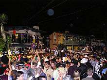
People tend to think that Halloween in Isla Vista has been an event that has forever been established, but in reality the first huge Halloween bash connected to a UC campus was not at UCSB, but instead at UC Berkeley.[40] The first large, street-filled Halloween in Isla Vista occurred in 1962. Indeed, when UCSB moved from downtown Santa Barbara to Isla Vista in 1954, students were relocated from an established community to an isolated place. Some have argued that the isolation accentuated and amplified risky behaviors of some students. A festival started in the 1930s, 'The Barbary Coast,' where students dressed up and held events evocative of Gold Rush era San Francisco, became rowdy and was canceled by the student government in 1959. Halloween, as an annual event in Isla Vista, took off in the late 1970s, but even at that point it involved primarily UCSB students and a few other locals. By the early 1980s, word of mouth had spread and students from schools all over California began to converge on Isla Vista for Halloween. Rowdiness in county-administered Isla Vista increased, however, despite admonitions of UCSB administrators. At that time the County sheriffs deputies viewed enforcement of "quality of life" laws in Isla Vista as a low priority and consigned matters to UCSB police. A unique sharing of law enforcement responsibilities for county land between county sheriff's deputies and UCSB campus police commenced.
As the Halloween tradition grew, an increasing number of high school-aged students converged, leading to countermeasures to Halloween and generic partying in Isla Vista. In 1993 law enforcement drafted a "Five Year Plan" which included confiscation of dangerous costume props, restricted parking,[41] zero tolerance for open alcohol on the street, increased ID checks to make sure alcohol consumers were at least 21, a strict noise ordinance, enforcement of drunk-in-public laws and restrictions on open kegs at parties. Halloween is still Isla Vista's biggest annual event, often drawing crowds of 20,000-40,000 people. Each year the crowds and people tend to get more violent and assaultive toward law enforcement, increasing the strictness.[41]
The explosive demonstrations of the 1960s changed the tenor of Isla Vista for a while and led to the establishment of the Isla Vista Foot Patrol, now a joint effort of Santa Barbara County Sheriff's Office Deputies, the University of California Police Department and the California Highway Patrol. Following the 2014 Deltopia riots, Isla Vista Foot Patrol will be implementing police body cameras by the end of 2015.[41]
Halloween in 2014 had 300 police officers on call for the entire weekend. The tallies that were released by the Santa Barbara County Sheriff's office showed a decrease in citations and arrests compared to the year before on the two-day Halloween period.[42]
Demographics
| Historical population | |||
|---|---|---|---|
| Census | Pop. | %± | |
| 1970 | 13,441 | — | |
| 1990 | 20,395 | — | |
| 2000 | 18,344 | −10.1% | |
| 2010 | 23,096 | 25.9% | |
| source:[43][44] | |||
2010
The 2010 United States Census[45] reported that the Isla Vista CDP had a population of 23,096. The population density of the CDP was 12,376.4 people per square mile (4,778.6/km²), making the Isla Vista CDP the community with the 26th-highest population density in California.[46] The racial makeup of Isla Vista was 14,875 (64.4%) White, 594 (2.6%) African American, 104 (0.5%) Native American, 3,387 (14.7%) Asian, 45 (0.2%) Pacific Islander, 2,686 (11.6%) from other races, and 1,405 (6.1%) from two or more races. Hispanic or Latino of any race were 5,265 persons (22.8%).
The Census reported that 15,067 people (65.2% of the population) lived in households, 7,999 (34.6%) lived in non-institutionalized group quarters, and 30 (0.1%) were institutionalized.
There were 4,898 households, out of which 374 (7.6%) had children under the age of 18 living in them, 497 (10.1%) were opposite-sex married couples living together, 166 (3.4%) had a female householder with no husband present, 99 (2.0%) had a male householder with no wife present. There were 227 (4.6%) unmarried opposite-sex partnerships, and 32 (0.7%) same-sex married couples or partnerships. 961 households (19.6%) were made up of individuals and 195 (4.0%) had someone living alone who was 65 years of age or older. The average household size was 3.08. There were 762 families (15.6% of all households); the average family size was 2.94.
The population was spread out with 700 people (3.0%) under the age of 18, 19,574 people (84.8%) aged 18 to 24, 2,076 people (9.0%) aged 25 to 44, 449 people (1.9%) aged 45 to 64, and 297 people (1.3%) who were 65 years of age or older. The median age was 20.7 years. For every 100 females there were 97.1 males. For every 100 females age 18 and over, there were 96.8 males.
There were 5,091 housing units at an average density of 2,728.1 per square mile (1,053.3/km²), of which 129 (2.6%) were owner-occupied, and 4,769 (97.4%) were occupied by renters. The homeowner vacancy rate was 1.5%; the rental vacancy rate was 1.9%. 344 people (1.5% of the population) lived in owner-occupied housing units and 14,723 people (63.7%) lived in rental housing units.
2000
As of the census[47] of 2000, there were 18,344 people, 5,164 households, and 1,208 families residing in the CDP. The population density was 8,635.2 people per square mile (3,340.9/km²). There were 5,264 housing units at an average density of 2,478.0 per square mile (958.7/km²). The racial makeup of the CDP was 6.49% White, 2.10% African American, 0.64% Native American, 11.56% Asian, 0.23% Pacific Islander, 10.16% from other races, and 5.81% from two or more races. 20.01% of the population were Hispanic or Latino of any race.
There were 5,164 households out of which 13.3% had children under the age of 18 living with them, 16.4% were married couples living together, 4.8% had a female householder with no husband present, and 76.6% were non-families. 20.0% of all households were made up of individuals and 2.7% had someone living alone who was 65 years of age or older. The average household size was 2.96 and the average family size was 3.21.
The age distribution was 8.6% under the age of 18, 73.4% from 18 to 24, 13.7% from 25 to 44, 3.1% from 45 to 64, and 1.2% who were 65 years of age or older. The median age was 21 years. Both the age distribution and median age are typical of communities dominated by college students. For every 100 females there were 100.1 males. For every 100 females age 18 and over, there were 99.8 males.
The median income for a household in the CDP was $16,151, and the median income for a family was $26,250. Males had a median income of $23,381 versus $20,281 for females. The per capita income for the CDP was $7,644. 62.8% of the population and 28.6% of families were below the poverty line. 29.7% of those under the age of 18 and 3.1% of those 65 and older were living below the poverty line.
The high percentage of non-family residents living below the poverty line can be attributed to the fact that Isla Vista is a town populated predominantly by college students.
Major Streets
Del Playa Drive
Del Playa Drive (also known as D.P.) stretches four blocks over the full length of Isla Vista (about one mile). It begins at the bike path bordering the campus and continues to Camino Majorca, where it ends at the entrance to the trails to Sands Beach. Del Playa Drive is a large component of the University of California Santa Barbara off-campus social life.
Del Playa Drive has also been a source of housing controversy, as some of the apartment buildings are falling off of the rapidly eroding cliffs. Recently, however, steps have been taken to slow the erosion by reinforcing the cliffs with imported rock, concrete and other artificial support structures, and by redirecting water runoff through the cliffs, rather than over them as it would flow naturally.[48]
Media
Isla Vista is served by two adjudicated, general circulation Santa Barbara newspapers: The daily Santa Barbara News-Press (sold by the New York Times Company in 2000 to local resident Wendy P. McCaw), with a circulation of about 25,000, and the Santa Barbara Independent, a weekly with 40,000 audited circulation.[49] Other media available include Edhat Online Magazine,[50] an aggregation of citizen news and links to other media websites, The Daily Nexus, UC Santa Barbara's independent student paper, The Bottom Line, UC Santa Barbara's weekly student-run newspaper, Pacific Coast Business Times, a weekly business journal covering Santa Barbara, Ventura County and San Luis Obispo County;[51] Noozhawk, a local affairs website, Builder/Architect Gold & Central Coast Edition.
Television
- KEYT 3, an ABC television affiliate;
- KPMR 38, a Univision affiliate
- Santa Barbara Channels; 17 (Public-access television) and 21 Arts & Education (formerly owned by Cox Communications).
- Other television stations can be received from Santa Maria, San Luis Obispo, and Los Angeles.
Radio
- KJEE (92.9 MHz),
- The Vibe:Hip Hop y Mas 103.3, formerly easy listening station KRUZ. It broadcasts from Broadcast Peak at an altitude of 4,060 feet (1,240 m) and can sometimes be heard in San Diego despite a distance of 200 miles (320 km) because it propagates across the ocean.
- KTYD (99.9 MHz) and
- KSBL (101.7 MHz) owned by Rincon Broadcasting,
Some Los Angeles and San Diego radio stations can be heard, although somewhat faintly due to the 85-mile (137 km) distance. Santa Monica-based NPR radio station KCRW can be heard in Santa Barbara at 106.9 MHz, and San Luis Obispo-based NPR station KCBX at 89.5 MHz and 90.9 MHz. There is an NPR station that has a news team in Santa Barbara, covers stories, news and programming for the area; KCLU (102.3 FM, 1340 AM). The only non-commercial radio station based in Santa Barbara is KCSB-FM, at 91.9 MHz, which is housed on the UC Santa Barbara campus and funded by the students of University of California, Santa Barbara.
Notable people
Things bearing name
See also
- Campus Point State Marine Conservation Area
- Floatopia, a non-permitted beach event that took place in Isla Vista, promoted by social media.
- Isla Vista Arts
- WORD Magazine
References
- Specific
- ↑ U.S. Census
- 1 2 3 Martin, Erika (May 30, 2014). "Isla Vista tragedy shows the dark side of paradise". Pacific Coast Business Times.
- ↑ "Brown signs bill to establish community services district for Isla Vista". Pacific Coast Business Times. October 7, 2015.
- ↑ "USA.com". Retrieved March 1, 2015.
- ↑ "2000 census" (PDF). Retrieved December 9, 2014.
- ↑ "2010 census" (PDF). Retrieved December 9, 2014.
- 1 2 Jennifer Hildreth Strand. "Evolution of a Boom Town:Isla Vista, California 1915-1968" (PDF). Retrieved March 1, 2015.
- ↑ Dougherty, Alison (December 7, 2000). "Meeting To Review Possible City Boundaries for Goleta". The Daily Nexus. Santa Barbara County, California. Retrieved October 7, 2014.
- ↑ Dougherty, Alison (May 2, 2001). "LAFCO To Vote on Proposed I.V. Inclusion in Goleta Plan". The Daily Nexus. Santa Barbara County, California. Retrieved October 7, 2014.
- ↑ "US Gazetteer files: 2010, 2000, and 1990". United States Census Bureau. 2011-02-12. Retrieved 2011-04-23.
- ↑ Kellogg, Martin, "Anisq'oyo: Its Pronunciation and Meaning," Isla Vista Free Press, p. 4, Sept. 17-29, 1987. Retrieved June 8, 2014.
- ↑ "Chumash Placenames of the Goleta Valley," Santa Barbara Museum of Natural History. Retrieved June 8, 2014.
- ↑ Tompkins, Walker (1966). Goleta: The Good Land. Goleta Amvets Post No. 55.
- ↑ "Grave Record, John Ilharreguy". Retrieved March 4, 2015.
- ↑ "James Roderick Thompson Biography". Retrieved March 4, 2015.
- ↑ "Moody Sisters". Retrieved March 4, 2015.
- ↑ 1940 US Census, S.D.No. 10, E.D.No. 42-46, Sheet. No. 10A.
- ↑ Pacific Coast Architecture Database.
- ↑ "Appointment of Clark George Kuebler as Provost of Santa Barbara College". University Bulletin: A Weekly Bulletin for the Staff of the University of California. August 23, 1954. Retrieved March 26, 2015.
- ↑ Sarasota Herald, November 6, 1955.
- ↑ http://library.albany.edu/speccoll/findaids/apap058.htm
- ↑ Roberts, Stevens V., New York Times, June 14, 1970, p.81
- ↑ Buckley, William F., Los Angeles Times, July 6, 1970, p. A7
- ↑ Los Angeles Times, July 6, 1970, p. 1
- ↑ Los Angeles Times, June 20, 1972, p. 3
- ↑ Linda Castellitto, "The guy behind Kinko's" (October 3, 2005). USA Today.
- ↑ Thor Nis Christiansen
- ↑ Brugger, Kelsey (June 12, 2014). "Isla Vista Mural Updated to Honor Six Murder Victims". The Santa Barbara Independent. Retrieved October 12, 2015.
- ↑ http://www.latimes.com/local/lanow/la-me-ln-deputies-injured-about-100-arrested-in-isla-vista-melee-20140406,0,2529535.story#axzz2yA8aZzPj
- ↑ http://www.independent.com/news/2015/jan/29/isla-vista-cops-get-body-cams/
- 1 2 "Isla Vista Mass Murder — May 23, 2014 — Investigative Summary" (PDF). Santa Barbara County Sheriff's Office. February 18, 2015. Archived (PDF) from the original on February 20, 2015. Retrieved February 19, 2015.
- ↑ SBCC Statement - Isla Vista Tragedy. Santa Barbara City College, 24 May 2014.
- ↑ Farnsworth, Beth. Shootings in Isla Vista Leave Four Dead, KEYT, May 23, 2014.
- ↑ 3 Dead in Drive-by Shooting Near UC Santa Barbara, Associated Press, May 24, 2014.
- ↑ Tan, Sara, "All Sorority Volleyball Tournament Spikes Its Way to Success: Greek Event Raises Money for Charity, Attracts Good, Clean Fun", Santa Barbara Independent, Wednesday, April 29, 2009
- ↑ http://www.as.ucsb.edu/files/111109-38.pdf
- ↑ http://www.keyt.com/news/Students-push-for-more-lighting-in-Isla-Vista/-/17671600/19779548/-/9tyqgy/-/index.html
- ↑ http://stage.independent.com/news/2013/may/06/lighting-isla-vista/
- ↑ http://www.independent.com/news/2014/oct/27/sexual-assault-facts/
- ↑ http://dailynexus.com/2010-10-25/biggest-college-party-california-history-isla-vistas-halloween/
- 1 2 3 http://dailynexus.com/2014-10-30/history-of-halloween-in-i-v/
- ↑ Neushal, Cat. "Halloween in Isla Vista". Santa Barbara Independent. Retrieved 6 February 2015.
- ↑ "CENSUS OF POPULATION AND HOUSING (1790-2000)". U.S. Census Bureau. Retrieved 2010-07-17.
- ↑ Census area not enumerated separately in 1980.
- ↑ "2010 Census Interactive Population Search: CA - Isla Vista CDP". U.S. Census Bureau. Retrieved July 12, 2014.
- ↑ "USA.com". Retrieved March 1, 2015.
- ↑ "American FactFinder". United States Census Bureau. Retrieved 2008-01-31.
- ↑ Moore, Nikki (2006-02-23). "County Addresses Safety of DP Homes". Daily Nexus. Retrieved 2007-07-24.
- ↑ "Verified Audit (page 2 in online kit)" (PDF). Retrieved 2012-05-20.
- ↑ http://www.edhat.com/Edhat
- ↑ http://www.pacbiztimes.com/
- Bibliography
- Lodise, Carmen; et al., Isla Vista: A Citizen's History, CreateSpace, October 24, 2008. ISBN 978-1-4348-2474-5.
Further reading
- Appelbaum, Richard P.; et al., Santa Barbara: The Impacts of Growth, 3 volumes . Santa Barbara: City of Santa Barbara, 1976.
- Strand, Jennifer Hildreth, "Evolution of a Boom Town: Isla Vista, California, 1915-1968," (University of California Santa Barbara MA Thesis, 1987), 149 pages.
External links
| Wikimedia Commons has media related to Isla Vista, California. |
| Colleges and schools | | |
|---|---|---|
| Research | ||
| Life | ||
| Athletics | ||
| People |
| |
| ||
Municipalities and communities of Santa Barbara County, California, United States | ||
|---|---|---|
| Cities | 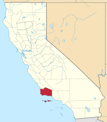 | |
| CDPs | ||
| Unincorporated communities | ||
| Indian reservation | ||
| Ghost towns | ||