Georgetown Township, Michigan
| Georgetown Charter Township, Michigan | |
|---|---|
| Charter township | |
 Georgetown Charter Township, Michigan Location within the state of Michigan | |
| Coordinates: 42°54′0″N 85°49′46″W / 42.90000°N 85.82944°WCoordinates: 42°54′0″N 85°49′46″W / 42.90000°N 85.82944°W | |
| Country | United States |
| State | Michigan |
| County | Ottawa |
| Settled | 1836 |
| Organized | 1840 |
| Chartered | 1965 |
| Government | |
| • Supervisor | Dale Mohr |
| Area | |
| • Charter township | 34.1 sq mi (88.3 km2) |
| • Land | 33.5 sq mi (86.7 km2) |
| • Water | 0.6 sq mi (1.7 km2) |
| Elevation | 673 ft (20 m) |
| Population (2010) | |
| • Charter township | 46,985 |
| • Metro | 988,938 (Grand Rapids-Wyoming MSA) |
| Time zone | Eastern (EST) (UTC-5) |
| • Summer (DST) | EDT (UTC-4) |
| FIPS code | 26-31880[1] |
| GNIS feature ID | 1626346[2] |
| Website | http://www.georgetown-mi.gov |
Georgetown Charter Township is a charter township of Ottawa County in the U.S. state of Michigan. The population was 46,985 at the 2010 census. The city of Hudsonville is adjacent to the township and the unincorporated community of Jenison is within the township, which includes about half the township's population.
Geography
According to the United States Census Bureau, the township has a total area of 34.1 square miles (88 km2), of which 33.5 square miles (87 km2) is land and 0.6 square miles (1.6 km2) (1.91%) is water.
History
European-American settlement of Georgetown Township was begun in 1834 by the brothers Hiram and Samuel Jenison.[3]
Demographics
As of the census[1] of 2000, there were 41,658 people, 14,099 households, and 11,138 families residing in the township. The population density was 1,244.9 per square mile (480.7/km²). There were 14,442 housing units at an average density of 431.6 per square mile (166.6/km²). The racial makeup of the township was 96.99% White, 0.58% African American, 0.18% Native American, 0.91% Asian, 0.02% Pacific Islander, 0.54% from other races, and 0.79% from two or more races. Hispanic or Latino of any race were 1.67% of the population.
There were 14,099 households out of which 41.0% had children under the age of 18 living with them, 71.9% were married couples living together, 5.1% had a female householder with no husband present, and 21.0% were non-families. 15.7% of all households were made up of individuals and 7.6% had someone living alone who was 65 years of age or older. The average household size was 2.92 and the average family size was 3.29.
In the township the population was spread out with 29.4% under the age of 18, 10.9% from 18 to 24, 27.5% from 25 to 44, 21.6% from 45 to 64, and 10.6% who were 65 years of age or older. The median age was 34 years. For every 100 females there were 95.1 males. For every 100 females age 18 and over, there were 91.7 males.
The median income for a household in the township was $58,936, and the median income for a family was $65,557. Males had a median income of $50,111 versus $28,894 for females. The per capita income for the township was $22,323. About 1.9% of families and 4.5% of the population were below the poverty line, including 3.0% of those under age 18 and 5.0% of those age 65 or over.
Communities
- Hudsonville (city)
- Jenison (unincorporated area)
Education
Jenison Public Schools operates public schools in the Jenison area.
Notable residents
References
Notes
- 1 2 "American FactFinder". United States Census Bureau. Retrieved 2008-01-31.
- ↑ U.S. Geological Survey Geographic Names Information System: Georgetown Township, Michigan
- ↑ Romig 1986, p. 221.
- ↑ Stein, Jeff. "CIA applicant's arrest tops wave of China spy cases." Washington Post. July 20, 2010. Retrieved on April 24, 2016.
Sources
- Romig, Walter (October 1, 1986) [1973]. Michigan Place Names: The History of the Founding and the Naming of More Than Five Thousand Past and Present Michigan Communities. Great Lakes Books Series (Paperback). Detroit, Michigan: Wayne State University Press. ISBN 081431838X. ISBN 978-0814318386.
External links
Municipalities and communities of Ottawa County, Michigan, United States | ||
|---|---|---|
| Cities | 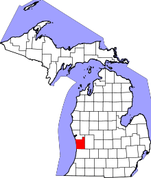 | |
| Village | ||
| Charter townships | ||
| General law townships | ||
| CDPs | ||
| Other unincorporated communities | ||
| Footnotes | ‡This populated place also has portions in an adjacent county or counties | |