Gibbonsdown
| Gibbonsdown | |
|---|---|
| District of Barry | |
|
Ramsey Road, northwestern rim of Gibbonsdown | |
 Click above map three times to view fully. | |
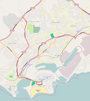
 Gibbonsdown Location in Barry | |
| Coordinates: 51°24′53.76″N 3°15′52.30″W / 51.4149333°N 3.2645278°W | |
| Country | United Kingdom |
| Region | Wales |
| County | Vale of Glamorgan |
| Town | Barry |
| Population (2011) | |
| • Total | 5,895 |
| [1] | |
| Time zone | GMT (UTC+0) |
Gibbonsdown, colloquially known as 'Gibby', is an area situated in the north east of Barry in the Vale of Glamorgan, Wales. Gibbonsdown borders Merthyr Dyfan to the northwest and Cadoxton to the southeast.
Crime
In 2009, Gibbonsdown was the location of the fatal stabbing of Paul Jones.[2] John Chivers was arrested that night and later sentenced to a minimum of 18 years in prison,[3] After the murder, Gibbonsdown Residents' Board chairwoman Molly Conway made complaints about the police for a lack of manpower and patrols on an estate well known as having problems with crime and anti-social behaviour.[4]
Landmarks
Gibbonsdown is home to the Holm View Community Leisure Centre, the Gibbonsdown Children Centre, and the Oakfield Primary School (known as the Gibbonsdown Primary School before its reconstruction). It also had Ysgol Maes Dyfan, a special school with 96 pupils as of 2005, teaching special needs children.[5] It is also home to Pencoedtre park and the Master Mariner pub.
Transport
Notable roads include Treharne Road (known to locals as "The Treharne"), Caradoc Avenue, Robins Lane, and Skomer Road, which connects the area to Wenvoe.
References
- ↑ "Ward population 2011". Retrieved 9 April 2015.
- ↑ "Barry man denies murder charge". Barry and District News. August 20, 2009. Retrieved June 7, 2010.
- ↑ "John Chivers' life term for pal's Barry stabbing". bbc.co.uk. 11 March 2010. Retrieved 16 July 2013.
- ↑ "Murder Accused is Set to Deny Charge". Wales Online. August 8, 2009. Retrieved June 7, 2010.
- ↑ "Ysgol Maes Dyfan English Report" (PDF). Estyn. Retrieved June 7, 2010.
Coordinates: 51°24′53.76″N 3°15′52.30″W / 51.4149333°N 3.2645278°W
