Gometra
| Gaelic name | Gòmastra |
|---|---|
| Norse name | Goðrmaðrey |
| Meaning of name | Possibly Good-man's island |
| Location | |
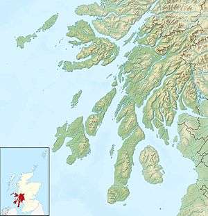 Gometra Gometra shown within Argyll and Bute | |
| OS grid reference | NM361414 |
| Physical geography | |
| Island group | Mull |
| Area | 425 hectares (1.6 sq mi)[1] |
| Area rank | 75 [2] |
| Highest elevation | 155 metres (509 ft)[3] |
| Administration | |
| Sovereign state | United Kingdom |
| Country | Scotland |
| Council area | Argyll and Bute |
| Demographics | |
| Population | 2[4] |
| Population rank | 86= [2] |
| Pop. density | 0.5 people/km2[1][4] |
Gometra (Scottish Gaelic: Gòmastra [ˈkoːməs̪t̪ɾə]) is an island in the Inner Hebrides of Scotland, lying west of Mull. It lies immediately west of Ulva, to which it is linked by a bridge, and at low tide also by a beach. It is approximately 425 hectares (1.64 sq mi) in size. The name is also applied to the island summit, which is a Marilyn.
| Gometra | |
|---|---|
| Highest point | |
| Elevation | 155 m (509 ft) |
| Prominence | 155 m (509 ft) |
| Listing | Marilyn |
| Geography | |
| Location | Off the coast of Mull, Scotland |
| Topo map | OS Landrangers 47, 48 |
Etymology
According to Gillies (1906) Gometra is from the Norse gottr + madr + ey and means "The good-man's island" or "God-man's island".[5] Mac an Tàilleir (2003) offers "Godmund's island".[6] The Norse Goðrmaðray may also mean "warrior priest's island". The Gaelic Gu mòr traigh meaning "only at low tide" has been proposed as the meaning of the name, but may be an example of folk etymology. Mediaeval charters render the name "Gomedrach".
Geography

The island is agricultural, formerly growing grain for the monastery on Iona.[7] Once home to a population of over a hundred, it is now down to a tight-knit community of a handful of people, up to a thousand black face sheep, highland cattle, pigs, horses, a flock of feral goats, and red deer. Historical sites on the island include an old burial ground, the remains of two duns and old settlements.[7] It has no school, doctor, or ferry. It has a weekly postal service and issues its own local carriage stamps.
It is part of the Loch Na Keal National Scenic Area, one of 40 in Scotland.[8]
History
The island became part of the Kingdom of the Isles, during the Norse era. Whereas nearby Ulva and Staffa belonged to the MacQuarries from the 10th century, Gometra became a possession of the Iona monastery prior to passing into the hands of the Duke of Argyll. Dean Monro makes no mention of Gometra or Ulva in his 1549 work A Description Of The Western Isles of Scotland but both are referred to briefly by John Monipennie c. 1612, stating of the latter that "about 300 paces from this island, lyeth Gomatra, two miles long and one mile broad".[9]
In 1821 Ulva was sold by the trustees of the MacDonalds of Staffa to Lt-General Charles MacQuarrie (brother of General Lachlan MacQuarrie), and after his death was bought in 1835 by Francis William Clark of Ulva, a lawyer from Stirling, of Morayshire origin[10] who began a brutal clearance of a substantial proportion of the inhabitants of Ulva within a few years.[11] However the MacDonalds of Staffa retained Gometra[12][13] until 1858 when it was sold to Donald MacLean, who built Gometra House.
In 1932, the island was sold to the English mountaineer Hugh Ruttledge (1884–1961), who had taken early retirement from the Indian Civil Service and planned a life as a farmer. While living on the island, Ruttledge led two British expeditions to Mount Everest, in 1933 and 1936, and took up sailing. In 1950, he moved to Dartmoor.[7][14]
Gometra House had fallen into disrepair and parts were near collapse by the 1980s, but was reoccupied and restored as a family home in the 1990s.[7] The island's principal exports include blackface breeding stock, lamb, mutton, wool, venison, oysters, vegetables, art and jewellery. There are currently four households on Gometra, and the islanders are dedicated to a low-impact lifestyle, living off-grid, doing without electricity in their homes, washing machines or cars.
In 2012 concerns were expressed by islanders about the siting of a large fish farm by the Scottish Salmon Company in Loch Tuath to the north of the island.[15]
Transport
Weather and tides permitting, it takes about 1 hour and 15 minutes to travel by track from the houses on the west of Gometra to the ferry landing stage on Ulva for the crossing to Mull, using a 4x4 vehicle. The same trip can be done in 50 minutes on a quad bike. By boat from Acarseid Mhòr the journey only takes 20 minutes.[15]

Notes
- 1 2 Haswell-Smith (2004) p. 79
- 1 2 Area and population ranks: there are c. 300 islands over 20 ha in extent and 93 permanently inhabited islands were listed in the 2011 census.
- ↑ Ordnance Survey. Get-a-map (Map). 1:25,000. Leisure. Ordinance Survey. Retrieved 21 August 2013.
- 1 2 National Records of Scotland (15 August 2013) (pdf) Statistical Bulletin: 2011 Census: First Results on Population and Household Estimates for Scotland - Release 1C (Part Two). "Appendix 2: Population and households on Scotland’s inhabited islands". Retrieved 17 August 2013.
- ↑ Gillies (1906) p. 129.
- ↑ Mac an Tàilleir (2003) pp. 58-59
- 1 2 3 4 Haswell-Smith (2004) p. 105
- ↑ "National Scenic Areas". SNH. Retrieved 30 Mar 2011.
- ↑ Monipennie p. 186
- ↑ Clan MacQuarrie, A history, R.W. Munro & Alan MacQuarrie, 1986 Ch.6 p.86
- ↑ Haswell-Smith (2004) p. 102-03
- ↑ Jo, Mull — the Island and its People, Birlinn 2000 p206
- ↑ Munro RW & Alan MacQuarrie, Clan MacQuarrie, Bruce MacQuarrie, 1996 Ch. 6
- ↑ Salkeld, Audrey, Ruttledge, Hugh (1884–1961), mountaineer in Oxford Dictionary of National Biography, Oxford University Press, 2004, online at Ruttledge, Hugh (1884–1961) (subscription required) accessed 1 March 2008
- 1 2 Ross, David (27 August 2012) "Residents of tiny island to fight plan for salmon farm". Glasgow. The Herald.
References
- Gillies, Hugh Cameron (1906) The Place Names of Argyll. London. David Nutt.
- Haswell-Smith, Hamish (2004). The Scottish Islands. Edinburgh: Canongate. ISBN 978-1-84195-454-7.
- Mac an Tàilleir, Iain (2003) Ainmean-àite/Placenames. (pdf) Pàrlamaid na h-Alba. Retrieved 26 August 2012.
- Monipennie, John (1818) An Abridgement, or Summarie of the Chronicles of Scotland with a Briefe description of Scotland, to which is added The description of the Western Isles of Scotland &c. Edinburgh. David Webster. First published c. 1612.
External links
| Wikimedia Commons has media related to Gometra. |
Inhabited islands of the Hebrides | ||
|---|---|---|
| Inner Hebrides |  | |
| Outer Hebrides | ||
|  | ||||||||||||||||||||||||||||
|
| |||||||||||||||||||||||||||||
| |||||||||||||||||||||||||||||
| |||||||||||||||||||||||||||||
| |||||||||||||||||||||||||||||
| |||||||||||||||||||||||||||||
| |||||||||||||||||||||||||||||
| |||||||||||||||||||||||||||||
Coordinates: 56°29′28″N 6°17′13″W / 56.49111°N 6.28694°W