Good Hope Township, Hocking County, Ohio
| Good Hope Township, Hocking County, Ohio | |
|---|---|
| Township | |
|
Houses in Rockbridge | |
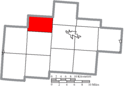 Location of Good Hope Township in Hocking County | |
| Coordinates: 39°34′35″N 82°33′2″W / 39.57639°N 82.55056°WCoordinates: 39°34′35″N 82°33′2″W / 39.57639°N 82.55056°W | |
| Country | United States |
| State | Ohio |
| County | Hocking |
| Area | |
| • Total | 26.3 sq mi (68.2 km2) |
| • Land | 26.3 sq mi (68.2 km2) |
| • Water | 0.0 sq mi (0.0 km2) |
| Elevation[1] | 981 ft (299 m) |
| Population (2000) | |
| • Total | 1,444 |
| • Density | 54.8/sq mi (21.2/km2) |
| Time zone | Eastern (EST) (UTC-5) |
| • Summer (DST) | EDT (UTC-4) |
| FIPS code | 39-30842[2] |
| GNIS feature ID | 1086318[1] |

Good Hope Township is one of the eleven townships of Hocking County, Ohio, United States. The 2000 census found 1,444 people in the township.[3]
Geography
Located in the northwestern part of the county, it borders the following townships:
- Berne Township, Fairfield County - north
- Marion Township - northeast
- Falls Township (southwestern portion) - southeast
- Laurel Township - south
- Perry Township - southwest
- Madison Township, Fairfield County - west
No municipalities are located in Good Hope Township, although the unincorporated community of Rockbridge lies in the northern part of the township.
Name and history
Good Hope Township was likely named after the former Our Lady of Good Hope Catholic church.[4]
It is the only Good Hope Township statewide.[5]
Government
The township is governed by a three-member board of trustees, who are elected in November of odd-numbered years to a four-year term beginning on the following January 1. Two are elected in the year after the presidential election and one is elected in the year before it. There is also an elected township fiscal officer,[6] who serves a four-year term beginning on April 1 of the year after the election, which is held in November of the year before the presidential election. Vacancies in the fiscal officership or on the board of trustees are filled by the remaining trustees.
References
- 1 2 "US Board on Geographic Names". United States Geological Survey. 2007-10-25. Retrieved 2008-01-31.
- ↑ "American FactFinder". United States Census Bureau. Retrieved 2008-01-31.
- ↑ Hocking County, Ohio — Population by Places Estimates Ohio State University, 2007. Accessed 15 May 2007.
- ↑ Maniskas, Judith S. (2011). Logan and Hocking County. Arcadia Publishing. p. 24.
- ↑ "Detailed map of Ohio" (PDF). United States Census Bureau. 2000. Retrieved 2007-02-16.
- ↑ §503.24, §505.01, and §507.01 of the Ohio Revised Code. Accessed 4/30/2009.
External links
Municipalities and communities of Hocking County, Ohio, United States | ||
|---|---|---|
| City |  | |
| Villages | ||
| Townships | ||
| CDPs | ||
| Unincorporated communities | ||
| Footnotes | ‡This populated place also has portions in an adjacent county or counties | |