Gopalganj, Bihar
For other uses, see Gopalganj (disambiguation).
| गोपालगंज Gopalganj | |
|---|---|
| Town | |
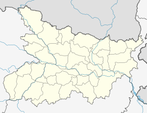 Gopalganj Location in Bihar, India | |
| Coordinates: 26°28′N 84°26′E / 26.47°N 84.43°ECoordinates: 26°28′N 84°26′E / 26.47°N 84.43°E | |
| Country |
|
| State | Bihar |
| District | Gopalganj |
| Government | |
| • Body | Nagar Palika |
| Elevation | 66 m (217 ft) |
| Languages | |
| • Official | Bhojpuri, Hindi, Urdu |
| Time zone | IST (UTC+5:30) |
| PIN | 841428 |
| Lok Sabha constituency | Gopalganj |
| Vidhan Sabha constituency | Gopalganj |
| Website | http://www.gopalganj.bih.nic.in/ |
Gopalganj is a town, municipality and headquarters of Gopalganj district in the Indian state of Bihar. Modern District of Gopalganj was established on October 2, 1973..
Geography
Gopalganj district covers 2,033 square kilometres (785 sq mi) in area and ranks as the 26th largest district in the state of Bihar. The district is mostly plains and fertile land. In the district's western part, the Gandak river flows southwards. It is located at 26°28′N 84°26′E / 26.47°N 84.43°E, [1] at an average elevation of 66 metres (217 ft).
Demographics
As of 2001 India census,[2] Gopalganj had a population of 54,418.
Temples
Thawe Mandir, an ancient temple, is situated in Gopalganj district.[3]
References
- ↑ Falling Rain Genomics, Inc - Gopalganj
- ↑ "Census of India 2001: Data from the 2001 Census, including cities, villages and towns (Provisional)". Census Commission of India. Archived from the original on 2004-06-16. Retrieved 2008-11-01.
- ↑ "कमाख्या से चलकर थावे पहुंची थीं मां भवानी" (in Hindi). IANS. 13 June 2013. Retrieved 18 June 2016.
See also
This article is issued from Wikipedia - version of the 11/29/2016. The text is available under the Creative Commons Attribution/Share Alike but additional terms may apply for the media files.