Gorgie East railway station
| Gorgie East | |
|---|---|
| Location | |
| Place | Gorgie, Edinburgh |
| Area | City of Edinburgh |
| Operations | |
| Pre-grouping | North British Railway |
| Post-grouping |
LNER Scottish Region of British Railways |
| Platforms | 2 |
| History | |
| 1 December 1884 | Opened |
| 10 September 1962 | Closed |
| Disused railway stations in the United Kingdom | |
|
Closed railway stations in Britain A B C D–F G H–J K–L M–O P–R S T–V W–Z | |
|
| |
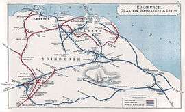
Gorgie East Railway Station (named Gorgie Station until 1952) was a railway station on the Edinburgh Suburban and Southside Junction Railway in Edinburgh, Scotland. It was opened on 1 December 1884 and served the Gorgie area of Edinburgh.
Gorgie East station closed in 1962, when passenger rail services were withdrawn from the Edinburgh Suburban line . There is now no trace of the station but the route continues to be used for freight services to this day, so freight trains avoid Edinburgh's main stations of Edinburgh Waverley and Haymarket, and occasionally diverted passenger trains also pass along this line.

Future
A local campaigning group, the Capital Rail Action Group (CRAG), is running a campaign for the SSJR line to be re-opened to passenger services, and proposes that it should be operated either as a commuter rail service or as a light rail system to form an extension of the forthcoming Edinburgh Tram Network.[1] Following a petition submitted to the Scottish Parliament in 2007, the proposal was rejected in 2009 by transport planners due to anticipated cost.[2]
| Preceding station | Historical railways | Following station | ||
|---|---|---|---|---|
| Haymarket | Edinburgh Suburban and Southside Junction Railway North British Railway |
Craiglockhart | ||
Edinburgh Suburban and Southside Junction Railway | ||||||||||||||||||||||||||||||||||||||||||||||||||||||||||||||||||||||||||||||||||||||||||||||||||||||||||||||||||||||||||||||||||||||||||||||||||||||||||||||||||||||||||||||||||||||
|---|---|---|---|---|---|---|---|---|---|---|---|---|---|---|---|---|---|---|---|---|---|---|---|---|---|---|---|---|---|---|---|---|---|---|---|---|---|---|---|---|---|---|---|---|---|---|---|---|---|---|---|---|---|---|---|---|---|---|---|---|---|---|---|---|---|---|---|---|---|---|---|---|---|---|---|---|---|---|---|---|---|---|---|---|---|---|---|---|---|---|---|---|---|---|---|---|---|---|---|---|---|---|---|---|---|---|---|---|---|---|---|---|---|---|---|---|---|---|---|---|---|---|---|---|---|---|---|---|---|---|---|---|---|---|---|---|---|---|---|---|---|---|---|---|---|---|---|---|---|---|---|---|---|---|---|---|---|---|---|---|---|---|---|---|---|---|---|---|---|---|---|---|---|---|---|---|---|---|---|---|---|---|
Legend
| ||||||||||||||||||||||||||||||||||||||||||||||||||||||||||||||||||||||||||||||||||||||||||||||||||||||||||||||||||||||||||||||||||||||||||||||||||||||||||||||||||||||||||||||||||||||
References
- ↑ "Reopening the South Sub" (PDF). Transform Scotland. March 2007. Retrieved 8 January 2010.
- ↑ "Public Petitions Committee Official Report". Scottish Parliament. 27 January 2009. Retrieved 8 January 2010.
Coordinates: 55°56′02″N 3°14′13″W / 55.9338°N 3.2369°W

