Grant Township, Carroll County, Iowa
| Grant Township, Carroll County | |
|---|---|
| Township | |
 | |
| Coordinates: 42°04′41″N 094°47′44″W / 42.07806°N 94.79556°WCoordinates: 42°04′41″N 094°47′44″W / 42.07806°N 94.79556°W | |
| Country |
|
| State |
|
| County | Carroll |
| Area | |
| • Total | 33.89 sq mi (87.77 km2) |
| • Land | 33.68 sq mi (87.24 km2) |
| • Water | 0.21 sq mi (0.54 km2) |
| Elevation[1] | 1,247 ft (380 m) |
| Population (2000) | |
| • Total | 462 |
| • Density | 13.7/sq mi (5.3/km2) |
| FIPS code | 19-91635[2] |
| GNIS feature ID | 0467932 |
Grant Township is one of eighteen townships in Carroll County, Iowa, USA. As of the 2000 census, its population was 462.
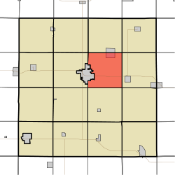
Geography
Grant Township covers an area of 33.89 square miles (87.8 km2) and contains no incorporated settlements. According to the USGS, it contains one cemetery, Holy Family.
References
- ↑ "US Board on Geographic Names". United States Geological Survey. 2007-10-25. Retrieved 2008-01-31.
- ↑ "American FactFinder". United States Census Bureau. Retrieved 2008-01-31.
External links
Municipalities and communities of Carroll County, Iowa, United States | ||
|---|---|---|
| Cities | ||
| Townships | ||
| Unincorporated community | ||
| Footnotes | ‡This populated place also has portions in an adjacent county or counties | |
This article is issued from Wikipedia - version of the 11/24/2015. The text is available under the Creative Commons Attribution/Share Alike but additional terms may apply for the media files.