Great Broughton, Cumbria
| Great Broughton | |
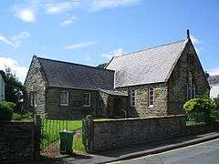 Broughton Methodist Church |
|
 Great Broughton |
|
| OS grid reference | NY074314 |
|---|---|
| Civil parish | Broughton |
| District | Allerdale |
| Shire county | Cumbria |
| Region | North West |
| Country | England |
| Sovereign state | United Kingdom |
| Post town | COCKERMOUTH |
| Postcode district | CA13 |
| Dialling code | 01900 |
| Police | Cumbria |
| Fire | Cumbria |
| Ambulance | North West |
| EU Parliament | North West England |
| UK Parliament | Workington |
Coordinates: 54°40′05″N 3°26′10″W / 54.668°N 3.436°W
Great Broughton is a village in West Cumbria, in the Borough of Allerdale in Cumbria, England, in the civil parish of Broughton.[1][2] It had a station on the Cleator and Workington Junction Railway but the station closed to passengers in 1908 and completely in 1921.
The village is 3 miles (4.8 km) west of Cockermouth, just north of River Derwent and the A66 road. Great Broughton has a post office and general store, primary school, three pubs and a Royal British legion and is on a bus route to Cockermouth. There is also a 15-room hotel named the Broughton Craggs Hotel situated at the bottom of the village on the Papcastle road heading to Cockermouth. Great Broughton also borders the Village of Little Broughton, which is made up of new housing estates and older houses. Little Broughton also has a Pub named the Sundial.
Up to it being decommissioned in 1992, the RNAD Depot Broughton Moor bordered the top end of the village and the Ministry of Defence Police houses remain as South Terrace. The rest of the former RNAD site is currently up for tender from its current owners, Cumbria County Council, who purchased it from the Ministry of Defence for a nominal sum in 2007. Neighbouring villages are Camerton to the west, Broughton Moor to the north and Papcastle to the east.
During the floods of November 2009, the main bridge into the village off the A66 sustained structural damaged and was closed pending a structural report from engineers. The bridge was built in 1832 and is on the main access road into the village. This bridge has now re-opened after structural work was carried out in early 2010.
Broughton Carnival takes place every July.
See also
References
- ↑ Ordnance Survey: Landranger map sheet 89 West Cumbria (Cockermouth & Wast Water) (Map). Ordnance Survey. 2011. ISBN 9780319232057.
- ↑ "A Vision of Britain Through Time: Great Broughton". www.visionofbritain.co.uk. GB Historical GIS/University of Portsmouth. Retrieved 15 March 2016.
External links
![]() Media related to Great Broughton, Cumbria at Wikimedia Commons
Media related to Great Broughton, Cumbria at Wikimedia Commons