Greater Vancouver
| Greater Vancouver | |
|---|---|
| Metropolitan area | |
|
| |
| Coordinates: 49°14′58″N 122°58′47″W / 49.24944°N 122.97972°WCoordinates: 49°14′58″N 122°58′47″W / 49.24944°N 122.97972°W | |
| Country |
|
| Province |
|
| Regional District | Metro Vancouver |
| Location of head office | Burnaby |
| Largest city | Vancouver |
| Government | |
| • Senators |
List of Senators
|
| • MPs |
List of MPs
|
| • MLAs |
List of MLAs
|
| Area | |
| • Total | 2,700 km2 (1,000 sq mi) |
| Elevation | 60 m (200 ft) |
| Population (2011)[1] | |
| • Total | 2,476,145 |
| • Density | 802.5/km2 (2,078/sq mi) |
| Canadian CD rank: 2nd | |
| Time zone | PST (UTC-8) |
| Area code(s) | 604 / 778 / 236 |
| Website | Metro Vancouver |
|
| |

Greater Vancouver, also known as Metro Vancouver, is the metropolitan area with its major urban centre being the city of Vancouver, British Columbia, Canada. The term "Greater Vancouver" is roughly coterminous with the geographic area governed by the Metro Vancouver regional district, though it predates the 1966 creation of the regional district. It is often used to include areas beyond the boundaries of the regional district but does not generally include wilderness and agricultural areas within that regional district.
Usage of the term "Greater Vancouver" is not consistent. In local use it tends to refer to urban and suburban areas only, and does not include parts of the regional district such as Bowen Island, although industries such as the film industry even include Squamish, Whistler and Hope as being in "the Vancouver area" or "in Greater Vancouver". The business community often includes adjoining towns and cities such as Mission, Chilliwack, Abbotsford and Squamish within their use of the term "Greater Vancouver", though since the creation of the term "Metro Vancouver", that has come to be used in the media interchangeably with the name of the region and/or regional district.
As a geographic region, Greater Vancouver is part of the Lower Mainland, one of British Columbia's three main geospatial/cultural divisions, and overlaps with the Lower Fraser Valley, with the Central and Upper Fraser Valley areas to the east being in the Fraser Valley Regional District, which was created from two others upon the expansion of the Greater Vancouver Regional District to include Maple Ridge and Pitt Meadows. Other forms of regional governance and administration whose jurisdiction Greater Vancouver is in are the North Vancouver and Coquitlam Forests Districts, and the Ministry of Environment's Lower Mainland Region (which includes the Sunshine Coast, the Fraser Health Authority and the New Westminster Land District, among others).
Geography
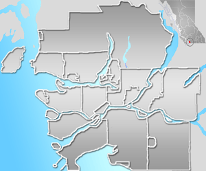
Greater Vancouver occupies the southwest corner of mainland British Columbia. It comprises roughly the western half of the Lower Mainland and sits astride the lower reaches of the Fraser River and both banks of Burrard Inlet.
Thirteen of the province's thirty most populous municipalities are located in Greater Vancouver.[2] The official land area of the district is 2,877.36 square kilometres (1,111 sq mi). It is the most densely populated region in British Columbia.
See Metro Vancouver#Municipalities for a list of municipalities in the region.
The University of British Columbia and the University Endowment Lands, both located to the west of the City of Vancouver's limits, are not subject to governance by any municipality.
There are also seventeen Indian reserves within the geographical area that are not subject to governance by the municipalities or the Regional District; they have a combined population of 7,550 (2006) and are governed by the Squamish Nation, Musqueam Nation, Tsleil-waututh First Nation, Tsawwassen First Nation, Semiahmoo Indian Band, Qayqayt First Nation, Kwikwetlem First Nation, Katzie First Nation and Kwantlen First Nation.
The cities of Abbotsford and Chilliwack and the district of Mission, located to the region's east, are often linked to Vancouver in promotions and tourism and in various non-official usages, as are Squamish and Whistler to the region's north.
Demographics
According to the 2001 census, 1,986,965 people lived in the metropolitan area, about half of the population of British Columbia. The 2006 Census placed the population at 2,116,581, representing 6.5% growth since the last census.[3]
In 2006, the Greater Vancouver CMA had a population of 2,116,581 living in 870,992 dwellings. The Greater Vancouver Regional District has a land area of 2,877.36 km2 (1,110.95 sq mi) and a population density of 735.6/km2 (1,905/sq mi).[1]
In 2011, Metro Vancouver had a population of 2,313,328 living in 949,565 dwellings. The regional district has a land area of 2,882.55 km2 (1,112.96 sq mi) and a population density of 802.5/km2 (2,078/sq mi).[4]
The population of Metro Vancouver is diverse in many ways. There is a high percentage of visible minorities in the region, though European ("white") minorities such as Germans, Dutch and Slavic and Mediterranean peoples are equally numerous, both historically and in terms of new immigration. The 2006 census showed that nearly 41.7% of the population were of visible minority origin, the largest group being the Chinese followed by South Asians. Other prominent groups include Filipinos, Koreans, Japanese, Southeast Asian, West Asian, and Latin Americans.[5] British Columbia is Canada's most ethnically diverse province.[6]
Politics and government
Federal
Federally, the electorates in the Greater Vancouver region elect Conservative, New Democratic, and Liberal Members of Parliaments. After the 2011 election, the Conservatives and NDP emerged as the two strongest parties in the region, with Conservative support concentrated in the suburbs around Vancouver (e.g. North Vancouver, West Vancouver, Richmond, and south Surrey), and NDP support strongest on the east side of Vancouver, Burnaby, Coquitlam, New Westminster and north Surrey.
In 2011, the Liberals were reduced to two seats, both located in Vancouver. However, in the past, Liberal support has been strong in the Lower Mainland. Following the 1993 election, the Liberals held every seat but one in the City of Vancouver.
Provincial
Greater Vancouver, like the rest of British Columbia, is divided between the BC Liberals and the BC NDP. While the BC Liberals are not formally affiliated with any federal party, they tend to draw support from those who vote for either the Liberal Party of Canada or the Conservative Party of Canada, while the BC NDP provide a centre-left alternative, and is formally affiliated with the New Democratic Party of Canada. Polling from the 2013 provincial election showed that supporters of the BC Liberals were almost evenly split between federal Liberals and federal Conservatives. Despite this trend, former NDP Premier Ujjal Dosanjh ran federally for the Liberals in the 2004 election, and some NDP supporters have drifted to the Greens in recent years.
In terms of political geography, Greater Vancouver is not as polarized between urban core and suburban areas as metropolitan areas in other parts of the country are. However, the BC NDP tends to draw greater support from ridings on the east side of Vancouver, Burnaby, the Tri-Cities, and parts of Surrey. By contrast, the BC Liberals are stronger on the west side of Vancouver, the North Shore, the Fraser Valley, and have held every seat in Richmond since 1991. Ridings in Central Vancouver, like Vancouver-Fairview and Vancouver-Point Grey, and Surrey tend to be swing ridings, with close races between the two parties. Vicki Huntington, an Independent member of the Legislative Assembly, has represented the riding of Delta South since 2009.
Since the mid 1980s, Greater Vancouver also has been the home of every BC Premier. In fact, between 1986 and 2013, the Premier of BC has always represented a Vancouver-area riding in the Legislature, except for a brief period when the NDP selected a new Premier following Glen Clark's resignation in 1999.
Minority representation
Due to the region's ethnically diverse population, there is also diverse government representation. Federally, there are five MPs of visible minority origin: three of South Asian descent, one of Chinese descent, and one of Trinidadian descent. Provincially, there are six South Asian, three Chinese, one Japanese, and one Filipino MLAs.
The Greater Vancouver region has many "electoral firsts". Rosemary Brown was the first black woman elected to political office, becoming an MLA in 1972, and the first woman and first black person to run for a party leadership in 1975. Emery Barnes, a football player elected to the Legislature alongside Rosemary Brown in 1972, and stayed in that capacity until 1996, serving as the Speaker from 1994. Former Indo-Canadian Premier Ujjal Dosanjh was the first non-white premier of the province, while Douglas Jung was the first Chinese-Canadian to become a Member of Parliament. Yonah Martin is the first Korean-Canadian to hold federal public office. Jenny Kwan was the first Chinese-Canadian provincial cabinet minister in Canada. Naomi Yamamoto and Mable Elmore are respectively the first Japanese and Filipino MLAs in the province. Furthermore, Stephanie Cadieux is the first quadriplegic MLA, while Svend Robinson was the first openly gay Canadian MP.
"Invisible minorities" (those from "white" ethnic and cultural groups) also feature strongly in the region's electoral history, most notably former Premier William Vander Zalm, of Dutch origin, while Vancouver's second mayor was David Oppenheimer, an East European Jew. Similarly, former Premier Dave Barrett was the MLA for East Vancouver and is Jewish.
Notes
- 1 2 Statistics Canada. "Canada 2006 Census: Greater Vancouver Regional District – Community Profile". Retrieved July 4, 2007.
- ↑ Statistics Canada – BC municipalities – Population
- ↑ Greater Vancouver Regional District – Population Growth
- ↑ "(Code 5915) Census Profile". 2011 census. Statistics Canada. 2012.
- ↑ , canada.com, April 2, 2008.
- ↑ , cbc.com, April 2, 2008.
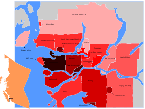
Municipalities of Metro Vancouver | |
|---|---|
| Population over 500,000 | |
| Population over 100,000 | |
| Population over 50,000 | |
| Population over 10,000 | |
| Population under 10,000 | |
| Unincorporated areas | |
| |
| Subdivisions | 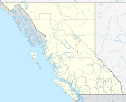 | |
|---|---|---|
| Communities | ||
| Metro areas and agglomerations | ||
| Regions | ||
| ||