Green Lake, Wisconsin
| Green Lake | |
|---|---|
| City | |
|
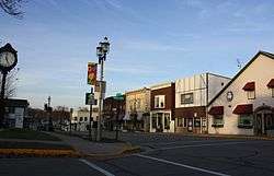
Looking north at downtown Green Lake | |
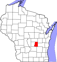
 Green Lake Location within the state of Wisconsin | |
| Coordinates: 43°50′34″N 88°57′28″W / 43.84278°N 88.95778°WCoordinates: 43°50′34″N 88°57′28″W / 43.84278°N 88.95778°W | |
| Country | United States |
| State | Wisconsin |
| County | Green Lake |
| Area[1] | |
| • Total | 2.06 sq mi (5.34 km2) |
| • Land | 1.79 sq mi (4.64 km2) |
| • Water | 0.27 sq mi (0.70 km2) |
| Population (2010)[2] | |
| • Total | 960 |
| • Estimate (2012[3]) | 967 |
| • Density | 536.3/sq mi (207.1/km2) |
| Time zone | Central (CST) (UTC-6) |
| • Summer (DST) | CDT (UTC-5) |
| Area code(s) | 920 |
| Website |
cityofgreenlake |
Green Lake is a city in Green Lake County, Wisconsin, United States. The population was 960 at the 2010 census. The city is located on the north side of Green Lake. The city of Green Lake is the county seat for the county of Green Lake. The Town of Green Lake is located on the south side of Big Green Lake, opposite the city.
Geography
According to the United States Census Bureau, the city has a total area of 2.06 square miles (5.34 km2), of which, 1.79 square miles (4.64 km2) is land and 0.27 square miles (0.70 km2) is water.[1] Green Lake is the second deepest inland lake in Wisconsin (Wazee Lake), measuring 239 feet deep at its greatest depth, but is the deepest natural inland lake in the state of Wisconsin.
Transportation
Green Lake is served by the state highways of WIS 23 and WIS 49 as well as Business 23. Business 23 runs through town while Wis 23 bypasses Green Lake on the north side. Wis 23 heads west to Princeton. Wis 49 heads north to Berlin. Wis 23 East and Wis 49 South head to Ripon. Green Lake County Hwy A also enters town.
Demographics
| Historical population | |||
|---|---|---|---|
| Census | Pop. | %± | |
| 1880 | 241 | — | |
| 1890 | 204 | −15.4% | |
| 1900 | 450 | 120.6% | |
| 1910 | 563 | 25.1% | |
| 1920 | 456 | −19.0% | |
| 1930 | 569 | 24.8% | |
| 1940 | 661 | 16.2% | |
| 1950 | 728 | 10.1% | |
| 1960 | 953 | 30.9% | |
| 1970 | 1,109 | 16.4% | |
| 1980 | 1,208 | 8.9% | |
| 1990 | 1,064 | −11.9% | |
| 2000 | 1,100 | 3.4% | |
| 2010 | 960 | −12.7% | |
| Est. 2015 | 984 | [4] | 2.5% |
2010 census
As of the census[2] of 2010, there were 960 people, 491 households, and 254 families residing in the city. The population density was 536.3 inhabitants per square mile (207.1/km2). There were 766 housing units at an average density of 427.9 per square mile (165.2/km2). The racial makeup of the city was 98.8% White, 0.2% African American, 0.2% Native American, 0.3% Asian, 0.1% from other races, and 0.4% from two or more races. Hispanic or Latino of any race were 1.9% of the population.
There were 491 households of which 15.1% had children under the age of 18 living with them, 40.3% were married couples living together, 8.4% had a female householder with no husband present, 3.1% had a male householder with no wife present, and 48.3% were non-families. 43.2% of all households were made up of individuals and 17.7% had someone living alone who was 65 years of age or older. The average household size was 1.88 and the average family size was 2.56.
The median age in the city was 50.7 years. 14.1% of residents were under the age of 18; 6.9% were between the ages of 18 and 24; 19.5% were from 25 to 44; 35.1% were from 45 to 64; and 24.5% were 65 years of age or older. The gender makeup of the city was 50.8% male and 49.2% female.
2000 census
As of the census[6] of 2000, there were 1,100 people, 523 households, and 300 families residing in the city. The population density was 787.2 people per square mile (303.4/km²). There were 732 housing units at an average density of 523.8 per square mile (201.9/km²). The racial makeup of the city was 98.91% White, 0.18% Black or African American, 0.09% Native American, 0.27% from other races, and 0.55% from two or more races. 0.91% of the population were Hispanic or Latino of any race.
There were 523 households out of which 20.5% had children under the age of 18 living with them, 48.8% were married couples living together, 7.1% had a female householder with no husband present, and 42.6% were non-families. 38.0% of all households were made up of individuals and 20.1% had someone living alone who was 65 years of age or older. The average household size was 2.04 and the average family size was 2.71.
In the city the population was spread out with 18.5% under the age of 18, 5.9% from 18 to 24, 25.9% from 25 to 44, 26.8% from 45 to 64, and 22.8% who were 65 years of age or older. The median age was 45 years. For every 100 females there were 100.4 males. For every 100 females age 18 and over, there were 94.8 males.
The median income for a household in the city was $35,435, and the median income for a family was $49,091. Males had a median income of $31,591 versus $23,917 for females. The per capita income for the city was $20,444. About 4.1% of families and 5.9% of the population were below the poverty line, including 8.5% of those under age 18 and 5.6% of those age 65 or over.
Tourism
Green Lake is known for its fishing and recreational tourist community during the summer months. Area activities include camping, biking, fishing, hiking, golfing, swimming, and boating. Motorized water sports such as waterskiing, wakeboarding, and tubing are also prevalent. As are sports like sailing, canoeing, and kayaking.
Green Lake is also home to several parks for public enjoyment.
- Deacon Mills Park is located on South Lawson Drive at the Marina and has a band shell, picnic facilities, and ice skating in the winter.
- Highknocker Park is located in downtown Green lake and had a baseball field and playground equipment.
- Friday Club Park is also located downtown and has public tennis courts and a fishing area.
- Hattie Sherwood Park is located on the north lakeshore and has a sand swimming beach, a pier, and a camping area.
- Sunset Park is located on the east end of Green Lake and has a boat launch, swimming beach, picnic area and pier.
The area is very pristine and quaint. The small town has a number of shops and restaurants that serve Green Lake fish. Also in Green Lake is the Green Lake Conference Center, which was founded by the American Baptist Churches USA in 1943. Also near the conference center is the Golf Courses of Lawsonia, built on the former estate of Victor F. Lawson, the owner and publisher of the Chicago Daily News.
The Dartford Cemetery, located in Green Lake, has been a focus of reported paranormal activity in the area. Some visitors to the cemetery claim to have been tripped by ghosts or "pushed off" the mausoleum when sitting or standing on it, even seeing apparitions of child victims who died of a disease (possibly polio) or a Native American chief. These sightings and experiences have been featured in the episode "Legend Trippers" of the Discovery Channel's A Haunting series.[7]
Notable people
- Elda Emma Anderson, physicist
- Halbert W. Brooks, Wisconsin State Assemblyman
- Adrian Karsten, sports television reporter
- Samuel Owens, Wisconsin State Assemblyman and architect
- L. E. Potter, Minnesota State Senator
- Janika Vandervelde, composer
Images
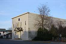
 Green Lake Village Hall
 Panorama over Green Lake just off Business 23
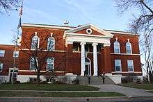
 Green Lake County Courthouse in downtown Green Lake
 City welcome sign
 Looking east in downtown Green Lake
 West side welcome sign on Business 23
References
- 1 2 "US Gazetteer files 2010". United States Census Bureau. Retrieved 2012-11-18.
- 1 2 "American FactFinder". United States Census Bureau. Retrieved 2012-11-18.
- ↑ "Population Estimates". United States Census Bureau. Retrieved 2013-06-24.
- ↑ "Annual Estimates of the Resident Population for Incorporated Places: April 1, 2010 to July 1, 2015". Retrieved July 2, 2016.
- ↑ "Census of Population and Housing". Census.gov. Retrieved June 4, 2015.
- ↑ "American FactFinder". United States Census Bureau. Retrieved 2008-01-31.
- ↑ http://www.castleofspirits.com/stories06/dartfordcemetery.html
External links
| Wikimedia Commons has media related to Green Lake, Wisconsin. |
 Green Lake, Wisconsin travel guide from Wikivoyage
- City of Green Lake
- Green Lake Chamber of Commerce website

