Grey County
| Grey County | ||
|---|---|---|
| County (upper-tier) | ||
| County of Grey | ||
| ||
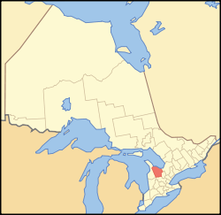 Location of Grey County | ||
| Coordinates: 44°20′N 80°40′W / 44.333°N 80.667°WCoordinates: 44°20′N 80°40′W / 44.333°N 80.667°W | ||
| Country |
| |
| Province |
| |
| Established | 1852 | |
| County seat | Owen Sound | |
| Subdivisions |
List
| |
| Government | ||
| • Type | Upper Tier Municipal Government | |
| Area[1] | ||
| • Land | 4,513.21 km2 (1,742.56 sq mi) | |
| Population (2011)[1] | ||
| • Total | 92,568 | |
| • Density | 20.5/km2 (53/sq mi) | |
| Time zone | EST (UTC-5) | |
| • Summer (DST) | EDT (UTC-4) | |
| Website | www.grey.ca | |

Grey County is a county of the Canadian province of Ontario. The county seat is in Owen Sound. It is located in the subregion of Southern Ontario named Southwestern Ontario. Grey County is also a part of the Georgian Triangle.
History
The first European settlement was in the vicinity of Collingwood or Meaford. Exploring parties arrived from York in 1825 by traveling from Holland Landing and down the Holland River into Lake Simcoe and Shanty Bay. From there they traveled by land to the Nottawasaga River into Georgian Bay and along the thickly wooded shore.
In 1837 the village of Sydenham was surveyed by Charles Rankin, P.L.S. In 1856 it was incorporated as the Town of Owen Sound with an estimated population of 2,000.
Grey County was created in 1852 and named in honour of the British Colonial Secretary's father, Charles Grey, 2nd Earl Grey, who was Prime Minister of the United Kingdom from 1830-1834.[2] In 1861-1862 the first gravel roads were constructed into Owen Sound at a cost of $300,000. The four roads graveled were The Garafraxa Road running from Fergus to Owen Sound (now Highway 6); the Durham Road leading east and west from the village of Durham (now County Road 4); the Lake Shore Road from Collingwood to Owen Sound (now Highway 26) and the Toronto and Sydenham Road leading from Toronto to Owen Sound (now Highway 10). Prior to the road building it often took two days to walk up to Owen Sound.[3]
On January 1, 2001, Grey County underwent a major reorganization. The majority of towns, villages, and townships were amalgamated, reducing the number of municipalities from 26 to 9. Only Owen Sound and Hanover were unaffected.[4]
Local Municipalities
- Township of Chatsworth
- Township of Georgian Bluffs
- Municipality of Grey Highlands
- The Town of Hanover
- Municipality of Meaford
- The City of Owen Sound
- Township of Southgate
- The Town of The Blue Mountains
- Municipality of West Grey
Demographics
Grey County comprises a single Statistics Canada census division.
| Canada census – Grey County community profile | |||
|---|---|---|---|
| 2011 | 2006 | 2001 | |
| Population: | 92,568 (0.2% from 2006) | 92,411 (3.7% from 2001) | 89,073 (1.7% from 1996) |
| Land area: | 4,513.21 km2 (1,742.56 sq mi) | 4,508.12 km2 (1,740.59 sq mi) | 4,508.20 km2 (1,740.63 sq mi) |
| Population density: | 20.5/km2 (53/sq mi) | 20.5/km2 (53/sq mi) | 19.8/km2 (51/sq mi) |
| Median age: | 44.4 (M: 43.4, F: 45.4) | 41.9 (M: 40.9, F: 42.8) | |
| Total private dwellings: | 46,481 | 44,387 | 42,396 |
| Median household income: | $49,912 | $43.107 | |
| References: 2011[1] 2006[5] 2001[6] | |||
See also
References
- 1 2 3 "Grey County census profile". 2011 Census of Population. Statistics Canada. Retrieved 2012-03-16.
- ↑ Marsh, Edith L. A History of the County of Grey. Owen Sound, Ont.: Fleming, 1931, p. 217.
- ↑ The Orangeville Banner, March 8, 1951.
- ↑ County of Grey - Municipal Amalgamations
- ↑ "2006 Community Profiles". Canada 2006 Census. Statistics Canada. March 30, 2011. Retrieved 2012-02-08.
- ↑ "2001 Community Profiles". Canada 2001 Census. Statistics Canada. February 17, 2012. Retrieved 2012-02-08.
External links
| Wikimedia Commons has media related to Grey County, Ontario. |
 |
Georgian Bay | | ||
| Bruce County | |
Simcoe County | ||
| ||||
| | ||||
| Huron County | Wellington County | Dufferin County |
| Regions | |
|---|---|
| Counties | |
| Districts | |
| Regional municipalities | |
| Single-tier municipalities | |
| Separated municipalities | |
| |