Guamúchil
| Guamúchil | ||
|---|---|---|
| ||
|
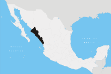
Guamúchil Location in Mexico | ||
| Coordinates: 25°27′50″N 108°4′46″W / 25.46389°N 108.07944°WCoordinates: 25°27′50″N 108°4′46″W / 25.46389°N 108.07944°W | ||
| Country |
| |
| State | Sinaloa | |
| Municipality | Salvador Alvarado | |
| Government | ||
| • Mayor | Gonzalo Camacho Angulo (PAN) | |
| Elevation | 50 m (160 ft) | |
| Population (2010) | ||
| • Total | 63,743 | |
| [1] | ||
| Time zone | Pacific Time zone (UTC-7) | |
| • Summer (DST) | Pacific Daylight Time (UTC-6) | |

Guamúchil (Spanish pronunciation: [ɡwaˈmutʃil]) is a city located in the state of Sinaloa (Northern Mexico). It is 100 km north of Culiacán. The city serves as the municipal seat of the municipality of Salvador Alvarado. In the 2010 census, the city had an official population of 63,743 inhabitants. It is the fifth-largest city in the state in population after Culiacán, Mazatlán, Los Mochis and Guasave, respectively.
Municipal logo
The municipal logo consists of:
- Left top: the Mochomo mountain and the Evora River referring to its region
- Left bottom: the primary elements used in commerce relating to politics, social and cultural life
- Right top: the pacific railroad track that initiated the communication for progress in that area
- Right bottom: the chickpea as the main product in the region along with cheese and wool.
- Center: a man with open arms towards progress.
Overall Guamúchil has been one of the cities that generates the greatest progress to the state.
Climate
Guamúchil has a hot-type semi-arid or steppe climate (BSh) under the Köppen climate classification, with a mean annual precipitation of 593 millimetres (23.3 in) and a mean annual temperature of 25.1 °C (77.2 °F).
| Climate data for Guamuchil (1951–2010) | |||||||||||||
|---|---|---|---|---|---|---|---|---|---|---|---|---|---|
| Month | Jan | Feb | Mar | Apr | May | Jun | Jul | Aug | Sep | Oct | Nov | Dec | Year |
| Record high °C (°F) | 41.0 (105.8) |
40.5 (104.9) |
39.5 (103.1) |
42.0 (107.6) |
44.5 (112.1) |
45.0 (113) |
43.5 (110.3) |
46.0 (114.8) |
43.5 (110.3) |
44.0 (111.2) |
39.5 (103.1) |
41.5 (106.7) |
46.0 (114.8) |
| Average high °C (°F) | 27.6 (81.7) |
28.6 (83.5) |
30.3 (86.5) |
33.1 (91.6) |
35.3 (95.5) |
36.2 (97.2) |
35.6 (96.1) |
34.9 (94.8) |
34.9 (94.8) |
34.8 (94.6) |
31.9 (89.4) |
28.4 (83.1) |
32.6 (90.7) |
| Daily mean °C (°F) | 19.3 (66.7) |
19.8 (67.6) |
21.2 (70.2) |
23.9 (75) |
26.6 (79.9) |
29.7 (85.5) |
29.8 (85.6) |
29.3 (84.7) |
29.3 (84.7) |
27.9 (82.2) |
23.7 (74.7) |
20.1 (68.2) |
25.1 (77.2) |
| Average low °C (°F) | 11.1 (52) |
11.1 (52) |
12.1 (53.8) |
14.7 (58.5) |
18.0 (64.4) |
23.1 (73.6) |
24.0 (75.2) |
23.7 (74.7) |
23.7 (74.7) |
20.9 (69.6) |
15.6 (60.1) |
11.8 (53.2) |
17.5 (63.5) |
| Record low °C (°F) | 0.0 (32) |
−0.5 (31.1) |
1.5 (34.7) |
5.5 (41.9) |
2.0 (35.6) |
12.5 (54.5) |
7.0 (44.6) |
6.5 (43.7) |
15.5 (59.9) |
9.0 (48.2) |
2.0 (35.6) |
0.5 (32.9) |
−0.5 (31.1) |
| Average precipitation mm (inches) | 20.5 (0.807) |
9.0 (0.354) |
4.3 (0.169) |
1.2 (0.047) |
5.3 (0.209) |
14.9 (0.587) |
139.1 (5.476) |
181.1 (7.13) |
126.0 (4.961) |
48.5 (1.909) |
25.6 (1.008) |
17.0 (0.669) |
592.5 (23.327) |
| Average precipitation days (≥ 0.1 mm) | 2.6 | 1.7 | 0.7 | 0.3 | 0.5 | 2.3 | 13.4 | 14.5 | 9.8 | 4.1 | 1.7 | 2.2 | 53.8 |
| Source: Servicio Meteorologico Nacional[2][3] | |||||||||||||
Agriculture
Trade is a very important part for the economy of this city. There are large grain storage warehouses for sale and use. Agriculture is one of the main sources of income in the area, and different types of foods are grown but it is mainly corn and tomato.
This city can produce more than 15 types of different crops. Many basic for Regional Agro-industry and for domestic and international markets, such as safflower, wheat, soybeans, corn, sorghum, vegetables, chickpeas, fruits and grasses among other consumption.
Notable people
Guamúchil was the hometown of singer and actor Pedro Infante, birthplace of Mexican singer Ana Gabriel, and Miss México World 2009 Perla Beltrán.
References
- ↑ "Principales resultados por localidad 2010 (ITER)". Instituto Nacional de Estadística y Geografía. 2010.
- ↑ "Estado de Sinaloa-Estacion: Guamúchil". Normales Climatologicas 1951–2010 (in Spanish). Servicio Meteorologico Nacional. Retrieved 20 April 2015.
- ↑ "Extreme Temperatures and Precipitation for Guamúchil 1953–2011" (in Spanish). Servicio Meteorológico Nacional. Retrieved 20 April 2015.
External links
- Municipio de Salvador Alvarado Official website of Municipality of Salvador Alvarado
- Page Of The City Unofficial website of Municipality of Salvador Alvarado