Sinaloa
| Sinaloa, México | |||
|---|---|---|---|
| State | |||
| Estado Libre y Soberano de Sinaloa | |||
| |||
| Nickname(s): The Land of the 11 Rivers | |||
|
Anthem: State of Sinaloa Anthem  | |||
.svg.png) State of Sinaloa within Mexico | |||
| Coordinates: 25°0′N 107°30′W / 25.000°N 107.500°WCoordinates: 25°0′N 107°30′W / 25.000°N 107.500°W | |||
| Country | Mexico | ||
| Capital | Culiacán Rosales | ||
| Largest City | Culiacán Rosales | ||
| Municipalities | 18 | ||
| Admission | October 14, 1830[1] | ||
| Order | 20th | ||
| Seat | 123 | ||
| Government | |||
| • Governor |
Mario López Valdez | ||
| • Senators[2] |
Francisco Labastida Margarita Villaescusa María Serrano | ||
| • Deputies[3] | |||
| Area[4] | |||
| • Total | 57,365 km2 (22,149 sq mi) | ||
| Ranked 18th | |||
| Highest elevation[5] | 2,520 m (8,270 ft) | ||
| Population (2015)[6] | |||
| • Total | 2,966,321 | ||
| • Rank | 16th | ||
| • Density | 52/km2 (130/sq mi) | ||
| • Density rank | 18th | ||
| Demonym(s) | Sinaloense | ||
| Time zone | MST (UTC−7) | ||
| • Summer (DST) | MDT (UTC−6) | ||
| Postal code | 80-82 | ||
| Area code | |||
| ISO 3166 code | MX-SIN | ||
| HDI |
| ||
| GDP | US$ 13,749,376.25 [a] | ||
| Website | Official Web Site | ||
| ^ a. The state's GDP was $175,992,016 thousand of pesos in 2008,[7] amount corresponding to $13,749,376.25 thousand of dollars, being a dollar worth 12.80 pesos (value of June 3, 2010).[8] | |||


Sinaloa (![]() sinaˈloa ), officially the Free and Sovereign State of Sinaloa (Spanish: Estado Libre y Soberano de Sinaloa), is one of the 31 states which, with the Federal District, compose the 32 Federal Entities of Mexico. It is divided into 18 municipalities and its capital city is Culiacán Rosales.
sinaˈloa ), officially the Free and Sovereign State of Sinaloa (Spanish: Estado Libre y Soberano de Sinaloa), is one of the 31 states which, with the Federal District, compose the 32 Federal Entities of Mexico. It is divided into 18 municipalities and its capital city is Culiacán Rosales.
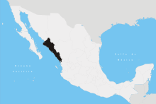
It is located in Northwestern Mexico. It is bordered by the states of Sonora to the north, Chihuahua and Durango to the east (separated from them by the Sierra Madre Occidental) and Nayarit to the south. To the west, Sinaloa has a significant share of coastline on the Gulf of California.
The state covers an area of 57,377 square kilometers (22,153 sq mi), and includes the Islands of Palmito Verde, Palmito de la Virgen, Altamura, Santa María, Saliaca, Macapule and San Ignacio.
In addition to the capital city, the state's important cities include Mazatlán and Los Mochis.
History
Prior to the coming of the Spaniards, much of Sinaloa was inhabited by the Cáhita peoples.
In 1531, Nuño Beltrán de Guzmán with a force of over 10,000 men, defeated a force of 30,000 Cahíta warriors at the site of Culiacán. Beltrán de Guzmán established a Spanish and allied Indian outpost at San Miguel de Culiacán. Over the next decade, the Cahíta suffered severe depopulation from smallpox and other diseases the Spanish brought.
The Spanish organized Sinaloa as part of the gobierno of Nueva Galicia. In 1564, the area was realigned: the area of Culiacán and Cosalá remained in control of Nueva Galicia, while the areas to the north, south and west were made part of the newly formed Nueva Vizcaya province, making the Culiacán area an exclave of Nueva Galicia. The first capital of Nueva Vizcaya was located in San Sebastián, near Copala, but the capital moved to Durango in 1583.[9]
Starting in 1599, Jesuit missionaries spread out from a base at what is now Sinaloa de Leyva and by 1610, the Spanish influence had been extended to the northern edge of Sinaloa. In 1601, the Jesuits' movement into the eastern part of Sinaloa led to the Acaxee going to war. The Spanish eventually managed to reassert authority in the Sierra Madre Occidental region and executed 48 Acaxee leaders.[10]
After Mexican independence, Sinaloa was joined with Sonora as Estado de Occidente, but it became a separate, sovereign state in 1830.
Geography and environment
The coastal plain is a narrow strip of land that stretches along the length of the state and lies between the Gulf of California and the foothills of the Sierra Madre Occidental mountain range, which dominates the eastern part of the state. Sinaloa is traversed by many rivers, which carve broad valleys into the foothills. The largest of these rivers are the Culiacán, Fuerte, and Sinaloa.
Sinaloa has a warm climate on the coast; moderately warm climate in the valleys and foothills; moderately cold in the lower mountains, and cold in the higher elevations. Its weather characteristics vary from subtropical, found on coastal plains, to cold in the nearby mountains. Temperatures range from 22 °C (72 °F) to 43 °C (109 °F) with rain and thunderstoms during the summer months and dry conditions throughout most of the year.
Numerous species of plants and animals are found within Sinaloa. Notable among the tree species is the elephant tree, Bursera microphylla.[11]
Culture
Culturally, it is known for a style of music known as banda and norteno .
It is the only place in the continent where the ancient Mesoamerican ballgame is played, in a handful of small, rural communities not far from Mazatlán. The ritual ballgame was central in the society, religion and cosmology of all the great Mesoamerican cultures including the Mixtecs, Aztecs, and Maya.
.jpg)
The Sinaloa version of the game is called ulama and is very similar to the original.[12] There are efforts to preserve this 3500-year-old unique tradition by supporting the communities and children who play it.[13]
Famous entertainers from Sinaloa include actor Pedro Infante and singer Ana Gabriel, born in Guamúchil; Lola Beltrán from Rosario, Cruz Lizárraga, the founder of Banda el Recodo, Jorge Orta, actress/comedian/singer Sheyla Tadeo, born in Culiacan; Sabine Moussier and actress/singer Lorena Herrera, born in Mazatlan.
The Sinaloa Cartel (Cártel de Sinaloa or CDS) has significantly influenced the culture of Sinaloa.[14] The cartel is reportedly the largest drug trafficking, money laundering and organized crime syndicate in the Western hemisphere; it is based in the city of Culiacán, Sinaloa.[15]
Demography
| Historical population | ||
|---|---|---|
| Year | Pop. | ±% |
| 1895[16] | 261,050 | — |
| 1900 | 296,701 | +13.7% |
| 1910 | 323,642 | +9.1% |
| 1921 | 341,265 | +5.4% |
| 1930 | 395,618 | +15.9% |
| 1940 | 492,821 | +24.6% |
| 1950 | 635,681 | +29.0% |
| 1960 | 838,404 | +31.9% |
| 1970 | 1,266,528 | +51.1% |
| 1980 | 1,849,879 | +46.1% |
| 1990 | 2,204,054 | +19.1% |
| 1995 | 2,425,675 | +10.1% |
| 2000 | 2,536,844 | +4.6% |
| 2005 | 2,608,442 | +2.8% |
| 2010 | 2,767,761 | +6.1% |
| 2015[17] | 2,966,321 | +7.2% |
According to the 2010 census, Sinaloa is home to 2,767,761[7] inhabitants, 61% of whom reside in the capital city of Culiacán and the municipalities of Mazatlán and Ahome. It is a young state in terms of population, 56% of which is younger than 30 years of age.
Other demographic particulars report 87% of the state practices the Catholic faith. Also, 1% of those over five years of age speak an indigenous language alongside Spanish; the main indigenous ethnic group still residing in the state is the Mayo or "Yoreme" (Cahíta language) people. Life expectancy in the state follows the national tendency of higher rates for women than men, a difference of almost five years in the case of Sinaloa, at 72.5 and 77.4 years respectively.
In ethnic composition, Sinaloa has received large historic waves of immigration from Europe (mainly Great Britain, Ireland, France, Germany, Greece, Italy and Russia) and Asia (mainly China, Japan and the Philippines). In recent years, retirees from the U.S. and Canada have arrived and made Sinaloa their home. There was also a sizable influx of Ashkenazi and Sephardic Jews in the first decades of the twentieth century. Overall Sinaloa has one of the highest European Mexican rates in the whole country.
Education
In terms of education, average schooling reaches 8.5 years; 7% of those over 15 years of age are illiterate, and 5% of children under 14 years of age do not attend school.
Institutions of higher education include Universidad Autónoma de Sinaloa, Instituto Tecnológico y de Estudios Superiores de Monterrey, Campus Sinaloa, Instituto Tecnológico y de Estudios Superiores de Monterrey, Campus Mazatlán and Universidad Casa Blanca.
Municipalities
Sinaloa is divided into 18 municipios (municipalities). See Municipalities of Sinaloa.
The state's major cities include the capital and largest city, Culiacán. Also Mazatlán, which is a world-famous tourist resort and destination. Los Mochis, an agricultural hub in the Northwestern region of Mexico.
Economy
The main economic activities of Sinaloa are agriculture, fishing, livestock breeding, commerce and industry. The products obtained from these activities are used for both local and national consumption. Agriculture produces tomatoes, cotton, beans, corn, wheat, sorghum, potatoes, soybeans, sugarcane, peanuts and squash. Sinaloa is the most prominent state in Mexico in terms of agriculture and is known as "Mexico's breadbasket". Additionally, Sinaloa has the second largest fishing fleet in the country. Livestock produces meat, sausages, cheese, milk as well as sour cream.
Government and politics
The current governor of Sinaloa is Mario López Valdez (PAN), elected for the period 2011–2016. The state is represented in Mexico City by three Senators in the upper house of Mexican Congress: Francisco Labastida Ochoa (PRI), Margarita Villaescusa (PRI) and María Serrano (PAN). It also has fourteen federal deputies in the lower house.
Notable and infamous natives or residents
- Jorge Orta – Major League Baseball player
- Jorge Arce – Boxer and flyweight champion
- Cristobal Arreola – Boxer
- Luis Ayala – Major League Baseball player
- Lola Beltrán – Actress and Ranchera singer
- Perla Beltrán Acosta – Beauty queen, model and entrepreneur
- Heraclio Bernal – Social Agitator/Folk Hero
- Jared Borgetti – Soccer player
- Omar Bravo – Soccer player
- Javier Valdez Cárdenas – Journalist
- Oscar Dautt – Soccer player
- Ivan Estrada – Soccer player
- Carlos Fierro – Soccer player
- Ana Gabriel – Singer
- Pedro Avilés Pérez – Drug Lord
- Joaquín Guzmán Loera – Drug Lord
- Miguel Angel Felix Gallardo – Drug Lord
- Rafael Caro Quintero – Drug Lord
- Amado Carrillo Fuentes – Drug Lord
- Alfredo Beltran Leyva – Drug Lord
- Héctor Luis Palma Salazar – Drug Lord
- Ismael Zambada García – Drug Lord
- Benjamin Arellano Felix – Drug Lord
- Ramon Arellano Felix – Drug Lord
- Ernesto Fonseca Carrillo - Drug Lord
- Lorena Herrera – Actress
- Pedro Infante – Singer and actor
- Francisco Labastida – Economist and politician affiliated to the PRI
- Horacio Llamas – basketball player
- Los Tigres Del Norte – Norteño music group
- Banda el Recodo – Banda Sinaloense group
- Jesús Malverde – Folklore hero
- Alberto Medina – Soccer player
- Cesar Millan – TV personality and professional dog trainer
- Fernando Montiel – Boxer
- Héctor Moreno – soccer player
- Sabine Moussier – Actress
- Patricia Navidad – Actress and singer
- Antonio Osuna – Major League Baseball player
- Óliver Pérez – Major League Baseball player
- Fausto Pinto – Soccer player
- Julio Preciado – Singer
- José Luis Ramírez – Boxer
- Sara Ramirez – Actress
- Paul Rodriguez – Comedian
- Aurelio Rodríguez – Major League Baseball player
- Dennys Reyes – Major League Baseball player
- Sheyla Tadeo – Actress and comedian
- María del Rosario Espinoza – Taekwondo Olympic medalist
- Chalino Sánchez – Singer
- Roberto Tapia – Singer
- Chayito Valdez – Folk singer
- Julio Urías - Major League Baseball player
Gallery
-

Botanic garden "Benjamín F. Johnston" of Parque Sinaloa
See also
Notes
- ↑ "Ley. Reglas para la división del Estado de Sonora y Sinaloa" (in Spanish).
- ↑ "Senadores por Sinaloa LXI Legislatura". Senado de la Republica. Retrieved April 6, 2011.
- ↑ "Listado de Diputados por Grupo Parlamentario del Estado de Sinaloa". Camara de Diputados. Retrieved April 6, 2011.
- ↑ "Resumen". Cuentame INEGI. Retrieved February 12, 2013.
- ↑ "Relieve". Cuentame INEGI. Retrieved April 6, 2011.
- ↑ "Encuesta Intercensal 2015" (PDF). Retrieved December 9, 2015.
- 1 2 "Mexico en Cifras". INEGI. Retrieved April 6, 2011.
- ↑ "Reporte: Jueves 3 de Junio del 2010. Cierre del peso mexicano.". www.pesomexicano.com.mx. Retrieved August 10, 2010.
- ↑ Peter Gerhard, The Northern Frontier of New Spain (Princeton: Princeton University Press, 1982) p. 245
- ↑ John Schmal, "The History of Indigenous Sinaloa"
- ↑ C.Michael Hogan. 2009
- ↑ "The Game". Mesoamerican Heritage Chapter of the Asociacion de Gestores del Patrimonio Historico y Cultural de Mazatlan. Retrieved 31 March 2012.
- ↑ Asociacion de Gestores del Patrimonio Historico y Cultural de Mazatlan. 2009
- ↑ "Sinaloa Cartel Influence is Steadily Growing In Tijuana". Borderland Beat. 23 February 2011.
- ↑ "Mexico's Sinaloa gang grows empire, defies crackdown". Reuters. 19 January 2011. Retrieved 18 September 2011.
- ↑ "Mexico: extended population list". GeoHive. Retrieved 2011-07-29.
- ↑ "Encuesta Intercensal 2015" (PDF). INEGI. Retrieved 2015-12-09.
References
- C. Michael Hogan. 2009. Elephant Tree: Bursera microphylla, GlobalTwitcher.com, ed. N. Stromberg
- Asociacion de Gestores del Patrimonio Historico y Cultural de Mazatlán. 2009. The Mesoamerican Ballgame-Ulama
External links
| Wikimedia Commons has media related to: |
 Geographic data related to Sinaloa at OpenStreetMap
- Official website (Spanish)
- The History of Indigenous Sinaloa
- PBS Frontline: The place Mexico's drug kingpins call home
 |
|
|
|
|
| Gulf of California | |
| ||
| ||||
| | ||||
| Pacific Ocean | |