Gulistan District
| Gulistan HQ in the way to be | |
|---|---|
| District | |
 Gulistan Location within Afghanistan | |
| Coordinates: 32°30′24″N 63°46′09″E / 32.50667°N 63.76917°E | |
| Country |
|
| Province | Farah Province |
| Occupation |
|
| Area | |
| • Total | 7,102 km2 (2,742 sq mi) |
| Population (2004) | |
| • Total | 53,780 |
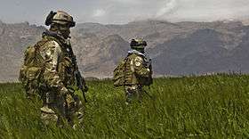
US 3rd Special Forces Group patrol a field in the Gulistan district
Gulistan, also transliterated as Golestan (Pashto/Persian: گلستان), is a district in Farah Province, Afghanistan. Its population, which is approximately 80% Pashtun with a Tajik minority, was estimated at 53,780 in October 2004.[1] The district has a total of 109 villages.[2] The main village, also called Gulistan, is situated at 1434 m altitude in the mountainous part of the district. The main road through the district in Route 522.
In September 2005, Taliban fighters briefly gained control of the district from Afghan security forces after heavy fighting.[3]
External links
| Wikimedia Commons has media related to Gulistan District. |
- Map of Gulistan (PDF)
References
- ↑ "UNHCR District Profile" (PDF). Afghanistan Information Management Service. October 2004. Retrieved 2006-06-06.
- ↑ "Summary of the District Development Plan" (PDF). Gulistan District Development Assembly. Retrieved 14 September 2015.
- ↑ "Taleban 'seize Afghan district'". BBC News. 2006-09-15. Retrieved 2006-09-15.
This article is issued from Wikipedia - version of the 4/15/2016. The text is available under the Creative Commons Attribution/Share Alike but additional terms may apply for the media files.