Paktia Province
| Paktia پکتیا | |
|---|---|
| Province | |
|
| |
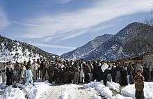
 Map of Afghanistan with Paktia highlighted | |
| Coordinates (Capital): 33°36′N 69°30′E / 33.6°N 69.5°ECoordinates: 33°36′N 69°30′E / 33.6°N 69.5°E | |
| Country | Afghanistan |
| Capital | Gardez |
| Government | |
| • Governor | Nasratullah Arsala |
| Area | |
| • Total | 6,432 km2 (2,483 sq mi) |
| Population (2015)[1] | |
| • Total | 551,987 |
| • Density | 86/km2 (220/sq mi) |
| Time zone | UTC+4:30 |
| ISO 3166 code | AF-PIA |
| Main languages | Pashto |
Paktia (Pashto: پکتيا – Paktyā, Persian: ولایت پکتیا) is one of the 34 provinces of Afghanistan, located in the east of the country. The province is divided into eleven districts and has a population of roughly 525,000,[1] which is mostly a tribal society living in rural areas. Pashtun tribes make up the majority of the population but smaller number of Tajiks are also found.[2] Gardēz is the provincial capital.
History
Paktia used to be a unified province with Khost and Paktika, these three provinces are now referred to as Loya Paktia, meaning "Greater Paktia". Paktia came to prominence during the 1980s, when a significant portion of Afghanistan's leadership originated from the province. Some of the more notable leaders include: Najibullah Ahmadzai, a former President of Afghanistan, Mohammad Aslam Watanjar, Shahnawaz Tanai, and Sayed Muhammad Gulabzoi.
The Soviet-Afghan War 1988
Between 7-8 January, 1988, in Paktia Province, near the Pakistani-Afghan border the Battle for Hill 3234 took place which was a successful defensive action fought by the 345th Independent Guards Airborne Regiment, 39 Soviet Airborne Troops, in Soviet occupied Afghanistan against a force of up to 200 to 250 Mujahideen rebels.
Soviet commanders wanted to secure the entire section of the road from Gardez to Khost.
One of the most important points was the nameless hill designated Hill 3234 by its height of 3234m, which was assigned to the 9th company of the 345th Independent Guards Airborne Regiment led by Colonel Valery Vostrotin.
The 39-man company landed on the hilltop on January 7, 1988, tasked with creating and holding a hilltop strong point from which to observe and control a long section of the road beneath and thus secure it for the safe passage of convoys.
Shortly after landing, the airborne troopers, who were well trained and experienced in Afghan conditions, started to take up positions which covered both the road and the uphill passages. Just as they had dug in, the mujahideen began their attack at 1530 hrs. First they fired with all possible weapons including recoilless guns and RPG. After a few salvos, Soviet artillery replied and silenced some of the Mujahideen's guns, with the commander of the first platoon, Lt. Viktor Gagarin, directing fire via a radio. When rebel fire slackened, it was clear that this was the beginning of an infantry assault.
The airborne troopers were attacked by a coordinated and well-armed force of between 200 and 250 mujahideen. Attacks were made from two directions, indicating that the assailants may have been assisted by rebels trained in Pakistan by American agents. During the ensuing battle, the Soviet unit was in constant communication with headquarters and received everything the leadership of 40th Army had to offer in terms of artillery support, ammunition, reinforcements, and helicopter evacuation of the wounded.[3]
The exhausted and mostly wounded Soviets were nearly out of ammunition but continued to occupy the hill until the last convoy passed through the road below.
The Soviet forces sustained very low casualties, with 6 men out of 39 killed and 28 injured. Two of the soldiers killed, Vyacheslav Alexandrovich Alexandrov and Andrey Alexandrovich Melnikov, were posthumously awarded the golden star of the Hero of the Soviet Union. All of the paratroopers in this battle were given the Order of the Red Banner and Order of the Red Star.[4]
According to the Soviet estimates, the Mujahideen lost over 200+ men.
The Mujahideen wore black uniforms with rectangular black-yellow-red stripes.[4][5][6]
After 1991
Immediately after the fall of the Taliban government, Paktia was one of the most chaotic regions in the country, as a small civil war broke out between rival militia commanders for control of the province, and Taliban and al-Qaeda fighters gave occupying U.S. troops some of their heaviest losses in the cave complexes south of Gardez.[7]
Paktia was the site of heavy fighting between Taliban insurgents and ISAF-backed Afghan National Security Forces. Paktia was one of the last redoubts of organized Taliban resistance; much of Operation Anaconda took place in Zurmat, one of Paktia's larger districts.
In September 2006, Governor Hakim Taniwal was killed by a Taliban suicide bomber as he left his office in Gardez.[8] At the time, Taniwal was the highest-ranking post-Taliban official to be killed by insurgent forces in the country.
On February 12, 2010, five civilians including two pregnant women and a teenage girl were killed by U.S. special forces during the Khataba raid. U.S. special forces were later accused of attempting to cover up the incident.[9][10][11] Head of Joint Special Operations Command, U.S. Vice Admiral William McRaven stated that the deaths were a "terrible mistake",[12] offered an apology, accepted responsibility for the deaths and made a traditional Afghan condolence offering of sheep.[13]
After some early unrest a long period of relative calm followed, despite the occasional high-profile incident such as the 2006 assassination of the governor, by a suicide bomber. There was a rise in violent incidents when the pullout of Americans troops neared in 2014.
Parts of Paktia are also believed to be a safe haven for militants from the Haqqani network, an anti-government combat organisation involved in the Taliban insurgency.[14][15]
Politics and governance
The current governor of the province is Nasratullah Arsala. His predecessor was Juma Khan Hamdard. The city of Gardez serves as the capital of the province.
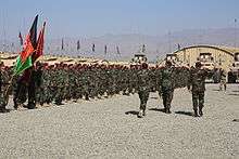
All law enforcement activities throughout the province are controlled by the Afghan National Police (ANP) along with the Afghan Local Police (ALP). The border with neighboring Pakistan is monitored by the Afghan Border Police (ABP). A provincial police chief is assigned to lead both the ANP and the ABP. The Police Chief represents the Ministry of the Interior in Kabul. The ANP and ABP are backed by the Afghan Armed Forces, including the NATO-led forces.
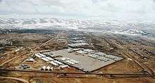
The first American Provincial Reconstruction Team base was established in Gardez to supply security and reconstruction, and has funded several successful projects.
Healthcare
The percentage of households with clean drinking water increased from 30% in 2005 to 36% in 2011.[16] The percentage of births attended to by a skilled birth attendant fell from 9% in 2005 to 3% in 2011.[16]
Education
The overall literacy rate (6+ years of age) fell from 35% in 2005 to 27% in 2011.[16] The overall net enrolment rate (6–13 years of age) fell from 65% in 2005 to 24% in 2011.[16]
Geography

Paktia borders the Pakistani-ruled tribal areas of North Waziristan, Bannu and Kurram Agency. Like most of the traditional Pashtun areas of Afghanistan, the Durand Line that marks the border with Pakistan is "drawn on water", and residents move freely between the two countries. Within Afghanistan, it borders Logar Province, Ghazni Province, Paktika Province, and Khost Province, in counterclockwise order.
Paktia is a largely mountainous province, with most of the population living in the central valley stretching from Ahmad Khel in the east down through Zormat and into neighboring Paktika province. The eastern part of the province, particularly Chamkani and Dand wa Patan, is a second valley leading into Pakistan.
Jaji (Zazi) and Jani Khel districts are largely mountainous with much smaller inhabited valleys.
The Khost-Gardez Pass area, to the south of Gardez, is mountainous with settlements limited to the main pass and smaller valleys.
As of 2005, Azra district is no longer a part of Paktya. It has been attached to Logar province to the north, to which it is much more closely connected by roadways and people.
Demographics
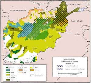

As of 2013, the total population of the province is about 525,000,[1] which is mostly a tribal society. According to the Institute for the Study of War, "The province is predominantly Pashtun, with a small Tajik population."[2] According to the Naval Postgraduate School, the ethnic groups of the province are as follows: 91% Pashtun and 9% Tajik.[17]
Districts
| District | Capital | Population (2015)[18] | Area[19] | Notes |
|---|---|---|---|---|
| Ahmadabad | 28,441 | Created in 2005 within Sayid Karam District; includes the unofficial district Mirzaka | ||
| Dand Aw Patan | 27,122 | |||
| Gardez | Gardez | 85,645 | Includes the capital Gardez, which lies at the crossroads of the province's main north-south and east-west roads | |
| Gerda Serai | ||||
| Janikhel | 35,642 | |||
| Lazha Ahmadkhel | 23,282 | |||
| Lazha Mangal | 19,201 | |||
| Mirzaka | 8,760 | |||
| Tsamkani | 51,002 | Includes the city of Tsamkani, the largest in the eastern half of Paktia and a major gateway to Pakistan | ||
| Sayid Karam | Khandkhel | 56,882 | Sub-divided in 2005 | |
| Shwak | 5,640 | |||
| Wuza Zadran | 36,242 | Sub-divided in 2005 to create Gerda Serai | ||
| Zazi | 64,321 | People fleeing sectarian strife between Shiites and Sunnis in Pakistan occasionally take refuge in Zazi | ||
| Zurmat | 109,805 | Populous, relatively prosperous agricultural district. Unlike most other districts, Zurmat includes more than one tribal group, making it somewhat more fractious than other districts |
Gerda Serai, Lazha Ahmadkhel and Mirzaka are unofficial districts.
Important geographical features
- Shah-i-Kot Valley
- Tera Pass, the mountain pass linking Paktia with Logar province to the north
- Khost-Gardez Pass (K-G Pass), the mountain pass linking Paktia with Khost province to the south
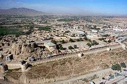
- Gardez, the geographic and cultural center of the province
See also
References
- 1 2 3 "Settled Population of Paktia province by Civil Division, Urban, Rural and Sex-2012-13" (PDF). Islamic Republic of Afghanistan, Central Statistics Organization. Retrieved 2014-10-20.
- 1 2 "Paktiya Province". Understanding War. Retrieved 2013-08-17.
- ↑ Carey Schofield, 'The Russian Elite,' Greenhill/Stackpole, 1993, pp.120–125. ISBN 1-85367-155-X.
- 1 2 "Клятва тридцати девяти". A. Oliynik. Krasnaya Zvezda, October 29, 1988. (Russian)
- ↑ "Афганистан: бой у высоты 3234". D. Meshchaninov. (Russian)
- ↑ My Jihad: One American's Journey Through the World of Usama Bin Laden—as a Covert Operative for the American Government. Aukai Collins. ISBN 0-7434-7059-1; Carey Schofield, 'The Russian Elite,' Greenhill/Stackpole, 1993, p.121. ISBN 1-85367-155-X.
- ↑ "Pacha Khan Zadran". GlobalSecurity.org.
- ↑ "Nato kills 94 'Taleban fighters'". BBC News (September 10, 2006).
- ↑ http://www.timesonline.co.uk/tol/news/world/afghanistan/article7087637.ece
- ↑ Nato ‘covered up’ botched night raid in Afghanistan that killed five « RAWA News. Rawa.org. Retrieved on 2013-07-12.
- ↑ NATO admits Afghan civilian deaths in night raid. Reuters. Retrieved on 2013-07-12.
- ↑ Staff (April 9, 2010). "Special Forces chief begs forgiveness for killing five innocents". Edinburgh: The Scotsman.
- ↑ Julius Cavendish,. "US military offers sheep in apology for Afghanistan deaths". Christian Science Monitor.
- ↑ "More than 20 Insurgents Killed in Haqqani Clearing Operation"
- ↑ "Afghan, Coalition Forces Keep Pressure on Insurgents"
- 1 2 3 4 Archive, Civil Military Fusion Centre, https://www.cimicweb.org/AfghanistanProvincialMap/Pages/Paktiya.aspx
- ↑ "Paktia Province" (PDF). Program for Culture & Conflict Studies. Naval Postgraduate School. Retrieved 2014-10-20.
- ↑ Afghanistan at GeoHive
- ↑ Afghanistan Geographic & Thematic Layers
External links
| Wikimedia Commons has media related to Paktia Province. |
- Paktya Province by the Naval Postgraduate School
- Paktya Province by the Institute for the Study of War
 |
Logar Province | Federally Administered Tribal Areas, Pakistan | | |
| Ghazni Province | |
Khost Province | ||
| ||||
| | ||||
| Paktika Province |