Gurley, New South Wales
| Gurley New South Wales | |
|---|---|
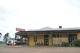 Royal Hotel at Gurley | |
|
Gurley | |
| Coordinates | 29°44′S 149°48′E / 29.733°S 149.800°ECoordinates: 29°44′S 149°48′E / 29.733°S 149.800°E |
| Postcode(s) | 2398 |
| Location | |
| LGA(s) | Moree Plains Shire |
| State electorate(s) | Northern Tablelands |
| Federal Division(s) | Parkes |
Gurley is a small town in the northwest of New South Wales, Australia between Narrabri and Moree. The Newell Highway and the North-West railway line pass through the township. A now-closed railway station opened in 1897.[1]
Gurley Siding Post Office opened on 16 March 1898 and was renamed Gurley in 1917.[2]
Gurley railway station
| Preceding station | NSW Main lines | Following station | ||
|---|---|---|---|---|
towards Mungindi | Mungindi Line | towards Werris Creek |
References
- ↑ Gurley station. NSWrail.net, accessed 3 September 2009.
- ↑ Premier Postal History. "Post Office List". Premier Postal Auctions. Retrieved 26 May 2011.
This article is issued from Wikipedia - version of the 5/8/2016. The text is available under the Creative Commons Attribution/Share Alike but additional terms may apply for the media files.