Hampstead Parish, New Brunswick
This article is about the parish. For the community, see Hampstead, New Brunswick.
| Hampstead | |
|---|---|
| Parish | |
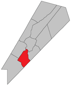 Location within Queens County, New Brunswick. | |
| Coordinates: 45°50′N 64°35′W / 45.84°N 64.59°W | |
| Country |
|
| Province |
|
| County | Queens County |
| Established | 1786 |
| Area[1] | |
| • Land | 212.63 km2 (82.10 sq mi) |
| Population (2011)[1] | |
| • Total | 294 |
| • Density | 1.4/km2 (4/sq mi) |
| • Pop 2006-2011 |
|
| • Dwellings | 173 |
| Time zone | AST (UTC-4) |
| • Summer (DST) | ADT (UTC-3) |
Hampstead is a Canadian parish in Queens County, New Brunswick.
History
Hampstead Parish established in 1786: named for Hempstead, Long Island, New York: included part of Petersville Parish until 1838.
Delineation
Hampstead Parish is defined in the Territorial Division Act[2] as being bounded:
- Northwest by Gagetown Parish; southwest by Petersville Parish; southeast by the County line and by the Saint John River, including Upper Musquash Island and Spoon Island and the western half of Long Island to be determined by a line running lengthwise through the centre of the island from the head to the foot of the same.
Communities
Parish population total does not include incorporated municipalities (in bold):
|
|
Bodies of water & Islands
This is a list of rivers, lakes, streams, creeks, marshes and Islands that are at least partially in this parish
- None
Demographics
PopulationPopulation trend[3]
|
LanguageMother tongue language (2006)[4]
|
Access Routes
Highways and numbered routes that run through the parish, including external routes that start or finish at the parish limits:[5]
|
|
|
|
See also
References
- 1 2 2011 Statistics Canada Census Profile: Hampstead Parish, New Brunswick
- ↑ "Territorial Division Act (R.S.N.B. 1973, c. T-3)". Government of New Brunswick website. Retrieved 23 August 2016.
- ↑ Statistics Canada: 2001, 2006 census
- ↑ Profile: Hampstead Parish, New Brunswick
- ↑ Atlantic Canada Back Road Atlas ISBN 978-1-55368-618-7
 |
Gagetown Parish | Saint John River Cambridge Parish |
| |
| |
Saint John River Wickham Parish | |||
| ||||
| | ||||
| Petersville Parish | Greenwich Parish | Saint John River Kars Parish |
| Subdivisions | |
|---|---|
| Cities | |
| Counties | |
| |
Coordinates: 45°37′28″N 66°05′07″W / 45.624483°N 66.085167°W
This article is issued from Wikipedia - version of the 8/23/2016. The text is available under the Creative Commons Attribution/Share Alike but additional terms may apply for the media files.