Happy Valley, Oregon
| Happy Valley, Oregon | |
|---|---|
| City | |
|
Happy Valley, on the southeast flank of Mount Scott | |
 Location in Oregon | |
| Coordinates: 45°26′45″N 122°32′1″W / 45.44583°N 122.53361°WCoordinates: 45°26′45″N 122°32′1″W / 45.44583°N 122.53361°W | |
| Country | United States |
| State | Oregon |
| County | Clackamas |
| Incorporated | 1965 |
| Government | |
| • Mayor | Lori DeRemer |
| Area[1] | |
| • Total | 8.32 sq mi (21.55 km2) |
| • Land | 8.28 sq mi (21.45 km2) |
| • Water | 0.04 sq mi (0.10 km2) |
| Elevation | 497 ft (151.5 m) |
| Population (2010)[2] | |
| • Total | 13,903 |
| • Estimate (2013[3]) | 16,321 |
| • Density | 1,679.1/sq mi (648.3/km2) |
| Time zone | Pacific (UTC-8) |
| • Summer (DST) | Pacific (UTC-7) |
| ZIP code | 97086 |
| Area code(s) | 503 and 971 |
| FIPS code | 41-32050 |
| GNIS feature ID | 1136354[4] |
| Website | www.happyvalleyor.gov |

Happy Valley is a city in Clackamas County, Oregon, United States. The population was 13,903 at the 2010 census.[2]
History
Happy Valley was originally called Christilla Valley, named after the first residents, Christian and Matilda Deardorff. They arrived in 1851 and claimed 640 acres (2.6 km2) on the floor of the valley.[5]
The city was officially incorporated in 1965 and remained a small community until the late 1990s, when it was one of the fastest-growing cities in Oregon.
Local government
The city has a mayor, Lori DeRemer, along with four other city council members. There is also a planning commission, as well as a Park Advisory/Urban Forestry Commission and Citizen Traffic and Public Safety Committee.
Geography
According to the United States Census Bureau, the city has a total area of 8.32 square miles (21.55 km2), of which, 8.28 square miles (21.45 km2) is land and 0.04 square miles (0.10 km2) is water.[1] It is a member of the Portland, Oregon metropolitan area, bordering Portland, Clackamas, Damascus, Pleasant Valley, and Sunnyside.
Mount Scott, an extinct volcano that is part of the Boring Lava Field, is the highest point in Happy Valley at 1,050 feet (320 m). Scouters Mountain is also a prominent feature.
Demographics

| Historical population | |||
|---|---|---|---|
| Census | Pop. | %± | |
| 1970 | 1,392 | — | |
| 1980 | 1,499 | 7.7% | |
| 1990 | 1,519 | 1.3% | |
| 2000 | 4,519 | 197.5% | |
| 2010 | 13,903 | 207.7% | |
| Est. 2015 | 18,493 | [6] | 33.0% |
| U.S. Decennial Census[7] 2013 Estimate[8] | |||
2010 census
As of the census[2] of 2010, there were 13,903 people, 4,408 households, and 3,724 families residing in the city. The population density was 1,679.1 inhabitants per square mile (648.3/km2). There were 4,708 housing units at an average density of 568.6 per square mile (219.5/km2). The ethnic makeup of the city was 76.2% White, 1.1% African American, 0.5% Native American, 17.4% Asian, 0.2% Pacific Islander, 0.9% from other ethnicities, and 3.8% from two or more ethnicities. Hispanic or Latino of any ethnicity were 4.0% of the population.
There were 4,408 households of which 48.8% had children under the age of 18 living with them, 74.4% were married couples living together, 6.3% had a female householder with no husband present, 3.7% had a male householder with no wife present, and 15.5% were non-families. 11.0% of all households were made up of individuals and 3% had someone living alone who was 65 years of age or older. The average household size was 3.15 and the average family size was 3.40.
The median age in the city was 37 years. 30.2% of residents were under the age of 18; 6.8% were between the ages of 18 and 24; 27% were from 25 to 44; 27.9% were from 45 to 64; and 8.2% were 65 years of age or older. The gender makeup of the city was 49.7% male and 50.3% female.
2000 census
As of the census of 2000, there were 4,519 people, 1,431 households, and 1,302 families residing in the city. The population density was 1,674.2 people per square mile (646.2/km²). There were 1,500 housing units at an average density of 555.7 per square mile (214.5/km²). The ethnic makeup of the city was 87.39% White, 8.85% Asian, 0.77% African American, 0.29% Native American, 0.15% Pacific Islander, 0.44% from other ethnicities, and 2.10% from two or more ethnicities. Hispanic or Latino of any ethnicity were 1.88% of the population.
There were 1,431 households out of which 49.0% had children under the age of 18 living with them, 83.4% were married couples living together, 4.9% had a female householder with no husband present, and 9.0% were non-families. 6.3% of all households were made up of individuals and 2.2% had someone living alone who was 65 years of age or older. The average household size was 3.16 and the average family size was 3.28.
In the city the population was spread out with 31.4% under the age of 18, 5.0% from 18 to 24, 30.1% from 25 to 44, 26.7% from 45 to 64, and 6.8% who were 65 years of age or older. The median age was 37 years. For every 100 females there were 99.2 males. For every 100 females age 18 and over, there were 98.2 males.
The median income for a household in the city was $93,131, and the median income for a family was $95,922. Males had a median income of $68,125 versus $43,667 for females. The per capita income for the city was $36,665. About 0.6% of families and 1.2% of the population were below the poverty line, including 1.2% of those under age 18 and none of those age 65 or over.
Education
Happy Valley is part of the North Clackamas School District. Clackamas High School, Happy Valley Middle School, and Rock Creek Middle School serve the student population.
References
- 1 2 "US Gazetteer files 2010". United States Census Bureau. Retrieved 2012-12-21.
- 1 2 3 "American FactFinder". United States Census Bureau. Retrieved 2012-12-21.
- ↑ "Population Estimates". United States Census Bureau. Retrieved 2014-06-15.
- ↑ "US Board on Geographic Names". United States Geological Survey. 2007-10-25. Retrieved 2008-01-31.
- ↑ Grade 5, Happy Valley School (May 1969). "History of Happy Valley". Happy Valley on the Web. gustaf.com. Retrieved 2009-11-08.
- ↑ "Annual Estimates of the Resident Population for Incorporated Places: April 1, 2010 to July 1, 2015". Retrieved July 2, 2016.
- ↑ "U.S. Decennial Census". Census.gov. Retrieved June 7, 2013.
- ↑ "Annual Estimates of the Resident Population: April 1, 2010 to July 1, 2013". Retrieved June 15, 2014.
External links
- Entry for Happy Valley in the Oregon Blue Book
- Profile of Happy Valley from the State of Oregon's Infrastructure Finance Authority
Municipalities and communities of Clackamas County, Oregon, United States | ||
|---|---|---|
| Cities | 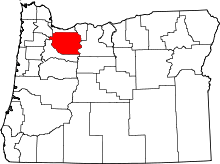 | |
| Hamlets | ||
| CDPs | ||
| Other unincorporated communities |
| |
| Footnotes | ‡This populated place also has portions in an adjacent county or counties | |