Haris, Salfit
| Haris | |
|---|---|
| Other transcription(s) | |
| • Arabic | حارس |
 Haris Location of Haris within the Palestinian territories | |
| Coordinates: 32°06′51″N 35°08′28″E / 32.11417°N 35.14111°ECoordinates: 32°06′51″N 35°08′28″E / 32.11417°N 35.14111°E | |
| Palestine grid | 163/169 |
| Governorate | Salfit |
| Government | |
| • Type | Village council |
| Population (2006) | |
| • Jurisdiction | 3,063 |
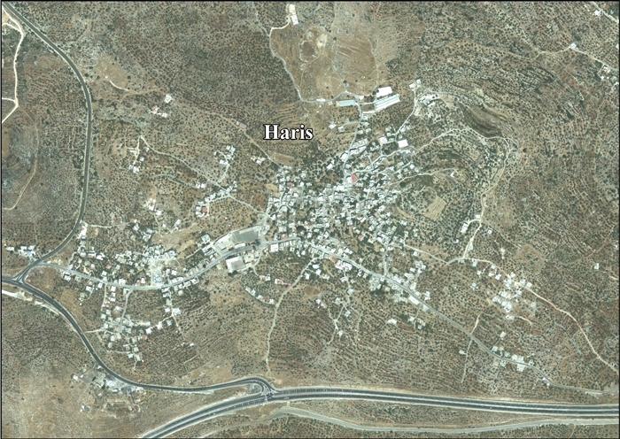
Haris (Arabic: حارس) is a Palestinian town located in the Salfit Governorate in the northern West Bank, 24 kilometers Southwest of Nablus. According to the Palestinian Central Bureau of Statistics, it had a population of 3,427 approximately in mid-year 2007.[1]
History
In a census conducted in 1922 by the British Mandate authorities, Haris (called: Hares) had a population of 285, all Muslims.[2]
Loss of land
Haris has been directly affected by the construction of the wall on the West Bank and the settlements surrounding Ariel and the Barqan (or Barkan) Industrial Zone. ARIJ, a Palestinian research institute lists the losses as follows:
| Settlement | Date of establishment | Pop 2007 | Area/Dunums | Area confiscated from the village |
|---|---|---|---|---|
| Barqan | 1981 | 1,300 | 649 | 304 |
| Revava | 1991 | 827 | 399 | 78 |
| Barqan Industrial Zone | 1981 | -- | 1,417 | 1,417 |
| Qiryat Netafim | 1982 | 438 | 386 | 188 |
| Ariel West Park Industrial | NA | -- | 1,728 | 1,110 |
| Total | 2,565 | 4,579 | 3,097 | |
| Source: ARIJ 2008[3] | ||||
In late October 2014, Israel confiscated a further 20 dunams (5 acres) of land, near the Israeli settlement of Barkan.[4]
References
- ↑ Projected Mid -Year Population for Salfit District by Locality 2004- 2006 Palestinian Central Bureau of Statistics
- ↑ Barron, 1923, Table IX
- ↑ ARIJ, New Palestinian houses threatened of Demolition by the Israeli Occupation Authorities, 2 December 2008
- ↑ ',' Ma'an News Agency 23 October 2014
Bibliography
- Barron, J. B., ed. (1923). Palestine: Report and General Abstracts of the Census of 1922. Government of Palestine.
- Conder, Claude Reignier; Kitchener, H. H. (1882). The Survey of Western Palestine: Memoirs of the Topography, Orography, Hydrography, and Archaeology. 2. London: Committee of the Palestine Exploration Fund. (pp. 284, 322)
- Finkelstein, Israel; Lederman, Zvi, eds. (1997). Highlands of many cultures. Tel Aviv: Institute of Archaeology of Tel Aviv University Publications Section. ISBN 965-440-007-3. (I p. 454)
- Guérin, Victor (1875). Description Géographique Historique et Archéologique de la Palestine (in French). 2: Samarie, pt. 2. Paris: L'Imprimerie Nationale. (p. 159)
- Hadawi, Sami (1970). Village Statistics of 1945: A Classification of Land and Area ownership in Palestine. Palestine Liberation Organization Research Center.
- Hütteroth, Wolf-Dieter; Abdulfattah, Kamal (1977). Historical Geography of Palestine, Transjordan and Southern Syria in the Late 16th Century. Erlanger Geographische Arbeiten, Sonderband 5. Erlangen, Germany: Vorstand der Fränkischen Geographischen Gesellschaft. ISBN 3-920405-41-2. (p. 131)
- Mills, E., ed. (1932). Census of Palestine 1931. Population of Villages, Towns and Administrative Areas. Jerusalem: Government of Palestine.
- Palmer, E. H. (1881). The Survey of Western Palestine: Arabic and English Name Lists Collected During the Survey by Lieutenants Conder and Kitchener, R. E. Transliterated and Explained by E.H. Palmer. Committee of the Palestine Exploration Fund. (p. 229)
External links
- Welcome To Haris
- Survey of Western Palestine, Map 14: IAA, Wikimedia commons
- Haris Village (Fact Sheet), ARIJ
- Haris Village Profile, ARIJ
- Haris, aerial photo, ARIJ
| Municipalities |
| |
|---|---|---|
| Villages | ||