Hartley, South Australia
| Hartley South Australia | |||||||||||||
|---|---|---|---|---|---|---|---|---|---|---|---|---|---|
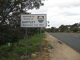 Hartley entrance sign | |||||||||||||
 Hartley | |||||||||||||
| Coordinates | 35°10′48″S 139°01′34″E / 35.1801°S 139.0261°ECoordinates: 35°10′48″S 139°01′34″E / 35.1801°S 139.0261°E | ||||||||||||
| Established | 1856 | ||||||||||||
| Postcode(s) | 5255 | ||||||||||||
| Location |
| ||||||||||||
| LGA(s) | Alexandrina Council | ||||||||||||
| Region | Fleurieu and Kangaroo Island[1] | ||||||||||||
| State electorate(s) | Hammond | ||||||||||||
| Federal Division(s) | Mayo | ||||||||||||
| |||||||||||||
| Footnotes | [2] | ||||||||||||
Hartley is a ghost town located in South Australia, along the Bremer River on the Strathalbyn-Callington Road.
Founded around the year 1856 as a small rural settlement, it once boasted a Methodist church (1856), post office (opened 1869 and closed 1981), school (opened 1919 and closed 1970) and creamery. Now the town is little more than a series of ruins and farm houses.
References
- ↑ "Fleurieu and Kangaroo Island SA Government region" (PDF). The Government of South Australia. Retrieved 10 October 2014.
- ↑ Map of Hartley Bonzle
This article is issued from Wikipedia - version of the 8/10/2016. The text is available under the Creative Commons Attribution/Share Alike but additional terms may apply for the media files.