Hasvik
| Hasvik kommune Ákŋoluovtta gielda Hasviikan komuuni | |||
|---|---|---|---|
| Municipality | |||
| |||
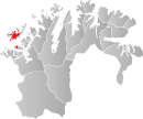 Hasvik within Finnmark | |||
| Coordinates: 70°35′30″N 22°18′10″E / 70.59167°N 22.30278°ECoordinates: 70°35′30″N 22°18′10″E / 70.59167°N 22.30278°E | |||
| Country | Norway | ||
| County | Finnmark | ||
| Administrative centre | Breivikbotn | ||
| Government | |||
| • Mayor (2007) | Eva Danielsen Husby (Ap) | ||
| Area | |||
| • Total | 555.96 km2 (214.66 sq mi) | ||
| • Land | 534.46 km2 (206.36 sq mi) | ||
| • Water | 21.50 km2 (8.30 sq mi) | ||
| Area rank | 192 in Norway | ||
| Population (2014) | |||
| • Total |
1,037 ( | ||
| • Rank | 398 in Norway | ||
| • Density | 1.9/km2 (5/sq mi) | ||
| • Change (10 years) | -5.3 % | ||
| Demonym(s) | Hasvikværing[1] | ||
| Time zone | CET (UTC+1) | ||
| • Summer (DST) | CEST (UTC+2) | ||
| ISO 3166 code | NO-2015 | ||
| Official language form | Bokmål | ||
| Website |
www | ||
|
| |||


Hasvik (Northern Sami: Ákŋoluovtta gielda; Kven: Hasviikan komuuni) is a municipality in Finnmark county, Norway. The administrative centre of the municipality is the village of Breivikbotn. Other villages in the municipality include Breivik, Hasvik, and Sørvær. The population of Hasvik has been in steady decline due to problems within the fishing industry.
Hasvik Airport is served with regular connections to Tromsø and Hammerfest, and there is a two-hour ferry crossing to Øksfjord, providing access by car.
In the sea off the village of Sørvær lied the stranded Soviet cruiser Murmansk, which ran aground on Christmas Eve in 1994 after her towlines snapped off North Cape. She was on her way to India to be scrapped at the time. Due to environmental and logistical concerns, it had to be removed piece by piece. Scandinavia’s largest demolition contractor, AF Decom, constructed a massive breakwater and dry dock around Murmansk to access the shipwreck from land and demolish it where it rested. The dock around the wreck was sealed in April 2012.[2] By mid-May the dock was almost empty of water and the demolishing of the cruiser began. The project was completed in 2013.[3]
General information

The municipality of Hasvik was established in 1858 when the northern part of Loppa was separated to form this new municipality. The initial population was 506. The borders of the municipality have not changed since that time.[4]
Name
The Old Norse form of the name was probably Hásvík. The first element is then the genitive case of the mountain name Hár (now Håen) and the last element is vík which means "cove" or "wick". The actual name of the mountain is compared in form with an old oarlock (Old Norse: hár).[5]
Coat-of-arms
The coat-of-arms is from modern times. They were granted on 13 July 1984. The arms show a white seagull on a blue background, which was chosen by the municipality as a symbol for the local fishing and fish processing industry, that attracts many seagulls.[6][7]
Churches
The Church of Norway has one parish (sokn) within the municipality of Hasvik. It is part of the Alta deanery in the Diocese of Nord-Hålogaland.
| Parish (Sokn) | Church Name | Location of the Church | Year Built |
|---|---|---|---|
| Hasvik | Breivikbotn Chapel | Breivikbotn | 1959 |
| Dønnesfjord Church | Dønnesfjord | 1888 | |
| Hasvik Church | Hasvik | 1955 | |
| Sørvær Chapel | Sørvær | 1968 |
Government
All municipalities in Norway, including Hasvik, are responsible for primary education (through 10th grade), outpatient health services, senior citizen services, unemployment and other social services, zoning, economic development, and municipal roads. The municipality is governed by a municipal council of elected representatives, which in turn elect a mayor.
Municipal council
The municipal council (Kommunestyre) of Hasvik is made up of 15 representatives that are elected to every four years. Currently, the party breakdown is as follows:[8]
| Party Name | Name in Norwegian | Number of representatives | |
|---|---|---|---|
| Labour Party | Arbeiderpartiet | 10 | |
| Conservative Party | Høyre | 3 | |
| Centre Party | Senterpartiet | 2 | |
| Total number of members: | 15 | ||
Geography
The municipality of Hasvik is situated on the western side of Sørøya, Norway's fourth largest island (other than Svalbard). Most people in Hasvik are to be found in a string of settlements along the western coast: the three largest being Breivikbotn, Sørvær, and Hasvik. The very sparsely populated northern part of the island of Stjernøya, including the Sørfjorden area is also part of Hasvik. Stjernøya has no road or ferry connections.
Climate
| Climate data for Hasvik | |||||||||||||
|---|---|---|---|---|---|---|---|---|---|---|---|---|---|
| Month | Jan | Feb | Mar | Apr | May | Jun | Jul | Aug | Sep | Oct | Nov | Dec | Year |
| Daily mean °C (°F) | −2.8 (27) |
−2.8 (27) |
−1.8 (28.8) |
0.6 (33.1) |
4.4 (39.9) |
8.3 (46.9) |
11.5 (52.7) |
10.9 (51.6) |
7.5 (45.5) |
3.6 (38.5) |
0.3 (32.5) |
−1.8 (28.8) |
3.2 (37.8) |
| Average precipitation mm (inches) | 73 (2.87) |
68 (2.68) |
57 (2.24) |
55 (2.17) |
47 (1.85) |
48 (1.89) |
55 (2.17) |
63 (2.48) |
70 (2.76) |
102 (4.02) |
84 (3.31) |
88 (3.46) |
810 (31.89) |
| Source: Norwegian Meteorological Institute[9] | |||||||||||||
References
- ↑ "Navn på steder og personer: Innbyggjarnamn" (in Norwegian). Språkrådet. Retrieved 2015-12-01.
- ↑ Barentsobserver "Murmansk" demolition in final phase, 16 May 2012
- ↑ AF Gruppen information
- ↑ Jukvam, Dag (1999). "Historisk oversikt over endringer i kommune- og fylkesinndelingen" (PDF) (in Norwegian). Statistisk sentralbyrå.
- ↑ Rygh, Oluf (1924). Norske gaardnavne: Finmarkens amt (in Norwegian) (18 ed.). Kristiania, Norge: W. C. Fabritius & sønners bogtrikkeri. pp. 115 & 117.
- ↑ Norske Kommunevåpen (1990). "Nye kommunevåbener i Norden". Retrieved 2008-12-10.
- ↑ "Kommunevåpen". Flags of the World. 30 April 2002. Retrieved 2008-12-10.
- ↑ "Table: 04813: Members of the local councils, by party/electoral list at the Municipal Council election (M)" (in Norwegian). Statistics Norway. 2015.
- ↑ "eKlima Web Portal". Norwegian Meteorological Institute.
External links
 Media related to Hasvik at Wikimedia Commons
 The dictionary definition of Hasvik at Wiktionary
- Weather information for Hasvik (Norwegian)