Hayden Lake, Idaho
| Hayden Lake, Idaho | |
|---|---|
| City | |
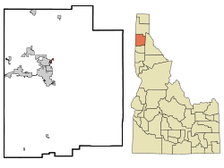 Location in Kootenai County and the state of Idaho | |
 Hayden Lake, Idaho Location in the United States | |
| Coordinates: 47°45′53″N 116°45′21″W / 47.76472°N 116.75583°WCoordinates: 47°45′53″N 116°45′21″W / 47.76472°N 116.75583°W | |
| Country | United States |
| State | Idaho |
| County | Kootenai |
| Area[1] | |
| • Total | 0.68 sq mi (1.76 km2) |
| • Land | 0.59 sq mi (1.53 km2) |
| • Water | 0.09 sq mi (0.23 km2) |
| Elevation | 2,287 ft (697 m) |
| Population (2010)[2] | |
| • Total | 574 |
| • Estimate (2012[3]) | 585 |
| • Density | 972.9/sq mi (375.6/km2) |
| Time zone | Pacific (PST) (UTC-8) |
| • Summer (DST) | PDT (UTC-7) |
| ZIP code | 83835 |
| Area code(s) | 208 |
| FIPS code | 16-36460 |
| GNIS feature ID | 0396631 |
Hayden Lake is both a city and a lake in Kootenai County, Idaho, United States. Located in the northern portion of the state, its population was 574 at the 2010 census. Hayden Lake is one of several natural lakes in northern Idaho; its shoreline is heavily populated with homes and it has limited public access.

Geography
.jpg)
Hayden Lake is located at 47°45′53″N 116°45′21″W / 47.76472°N 116.75583°W (47.764720, -116.755931).[4]
According to the United States Census Bureau, the city has a total area of 0.68 square miles (1.76 km2), of which 0.59 square miles (1.53 km2) is land and 0.09 square miles (0.23 km2) is water.[1]
Hayden Lake Stats:
- Shoreline: 40 miles (64 km)
- Surface Area: 3,800 acres (15.4 km2)
- Depth: 178 feet (54 m)
- Elevation: 2,239 feet (682 m)
- Fed by streams and springs
- Three public boat launches – Honeysuckle beach; Sportsmen’s Park; Hayden Lake Country Club
- One private launch – Tobler’s marina
Geology
Hayden Lake, like Lake Coeur d'Alene and other lakes surrounding the Spokane Valley and Rathdrum Prairie, was formed by the Missoula Floods, most recently 12,000 to 15,000 years ago. The Purcell Lobe of the Cordilleran Ice Sheet flowed south from Canada, carving the basin of present-day Lake Pend Oreille and damming the Clark Fork river. The impounded river repeatedly filled to form Glacial Lake Missoula and broke through the ice dam, resulting in massive floods that filled the Rathdrum Prairie area with sand, gravel, and boulders.[5] Large eddy bars formed downstream from bedrock obstructions, thereby damming tributary valleys and creating lakes.
History
Hayden Lake's natural beauty attracted several wealthy people in the early 1900s. F. Lewis Clark Mansion was built in 1910, and it was the most expensive home in Idaho at the time. In 1914, Lewis mysteriously disappeared and was never seen or heard from again.[6] In 1907, the Hayden Lake Country Club became a gathering place for many area socialites, such as Bing Crosby. A railway expansion made travel easy from nearby Spokane. HLCC opened the first 18-hole golf course in the state of Idaho in 1912.[7]
From the 1970s until 2001, the neo-Nazi Aryan Nations had its headquarters in a 20-acre (8.1 ha) compound in Kootenai County. In September 2000, the Southern Poverty Law Center won a $6.3 million judgment against the Aryan Nations from an Idaho jury, who awarded punitive and compensatory damages to Victoria Keenan and her son, Jason, who were attacked by Aryan Nations guards in 1999.[8] Bullets struck the Keenans' car several times, then the car crashed and an Aryan member held the Keenans at gunpoint.[9] As a result of the judgment, Richard Butler turned the compound over to the Keenans, who then sold the property to a philanthropist who subsequently donated it to North Idaho College, which designated the land as a "peace park".[10][11]
Demographics
| Historical population | |||
|---|---|---|---|
| Census | Pop. | %± | |
| 1950 | 39 | — | |
| 1960 | 247 | 533.3% | |
| 1970 | 260 | 5.3% | |
| 1980 | 273 | 5.0% | |
| 1990 | 338 | 23.8% | |
| 2000 | 494 | 46.2% | |
| 2010 | 574 | 16.2% | |
| Est. 2015 | 599 | [12] | 4.4% |
2010 census
As of the census[2] of 2010, there were 574 people, 256 households, and 188 families residing in the city. The population density was 972.9 inhabitants per square mile (375.6/km2). There were 369 housing units at an average density of 625.4 per square mile (241.5/km2). The racial makeup of the city was 97.6% White, 0.2% Native American, 0.5% Asian, and 1.7% from two or more races. Hispanic or Latino of any race were 3.0% of the population.
There were 256 households of which 19.9% had children under the age of 18 living with them, 66.4% were married couples living together, 2.7% had a female householder with no husband present, 4.3% had a male householder with no wife present, and 26.6% were non-families. 22.7% of all households were made up of individuals and 13.3% had someone living alone who was 65 years of age or older. The average household size was 2.24 and the average family size was 2.61.
The median age in the city was 54.2 years. 17.8% of residents were under the age of 18; 3.7% were between the ages of 18 and 24; 14.5% were from 25 to 44; 34.9% were from 45 to 64; and 29.3% were 65 years of age or older. The gender makeup of the city was 51.2% male and 48.8% female.
2000 census
As of the census[14] of 2000, there were 494 people, 208 households, and 164 families residing in the city. The population density was 1,281.9 people per square mile (489.1/km²). There were 307 housing units at an average density of 796.6 per square mile (303.9/km²). The racial makeup of the city was 99.60% White, 0.20% Native American and 0.20% Asian. Hispanic or Latino of any race were 0.81% of the population. 19.6% were of German, 14.4% English, 8.6% Irish, 6.1% Norwegian, 6.1% Scottish and 5.9% Swedish ancestry according to Census 2000. 97.6% spoke English and 2.4% Spanish as their first language.
There were 208 households out of which 23.6% had children under the age of 18 living with them, 74.0% were married couples living together, 4.3% had a female householder with no husband present, and 20.7% were non-families. 18.3% of all households were made up of individuals and 9.1% had someone living alone who was 65 years of age or older. The average household size was 2.38 and the average family size was 2.65.
In the city the population was spread out with 19.2% under the age of 18, 3.4% from 18 to 24, 20.2% from 25 to 44, 35.4% from 45 to 64, and 21.7% who were 65 years of age or older. The median age was 49 years. For every 100 females there were 99.2 males. For every 100 females age 18 and over, there were 95.6 males.
The median income for a household in the city was $65,893, and the median income for a family was $67,143. Males had a median income of $50,250 versus $30,804 for females. The per capita income for the city was $31,834. About 7.7% of families and 8.3% of the population were below the poverty line, including 11.7% of those under age 18 and 4.3% of those age 65 or over.
Notable people
- Rebecca Zanetti, romance novelist
- The Oatmeal, online cartoonist
Bing Crosby
References
- 1 2 "US Gazetteer files 2010". United States Census Bureau. Retrieved 2012-12-18.
- 1 2 "American FactFinder". United States Census Bureau. Retrieved 2012-12-18.
- ↑ "Population Estimates". United States Census Bureau. Retrieved 2013-06-03.
- ↑ "US Gazetteer files: 2010, 2000, and 1990". United States Census Bureau. 2011-02-12. Retrieved 2011-04-23.
- ↑ Breckenridge, Roy M. (May 1993). Glacial Lake Missoula and the Spokane Floods (PDF) (Report). GeoNote. 26. Idaho Geological Survey.
- ↑ | Clarkhouse.com History
- ↑ | Country Club History
- ↑ "Attorney Morris Dees pioneer in using 'damage litigation' to fight hate groups". CNN. September 8, 2000. Archived from the original on 2007-10-08. Retrieved 2007-08-17.
- ↑ "Keenan v. Aryan Nations". Southern Poverty Law Center. 2000. Retrieved 2007-08-17.
- ↑ Wakin, Daniel J. (September 9, 2004). "Richard G. Butler, 86, Dies; Founder of the Aryan Nations". New York Times. Retrieved 2007-08-22.
- ↑ Verhovek, Sam Howe (16 February 2002). "With Aryans Gone, Town Seeks New Life". New York Times. Retrieved 30 January 2011.
- ↑ "Annual Estimates of the Resident Population for Incorporated Places: April 1, 2010 to July 1, 2015". Retrieved July 2, 2016.
- ↑ "Census of Population and Housing". Census.gov. Retrieved June 4, 2015.
- ↑ "American FactFinder". United States Census Bureau. Retrieved 2008-01-31.
Municipalities and communities of Kootenai County, Idaho, United States | ||
|---|---|---|
| Cities | ||
| CDPs | ||
| Unincorporated communities | ||
| Indian reservation | ||
| Footnotes | ‡This populated place also has portions in an adjacent county or counties | |