Hazlehurst, Georgia
| Hazlehurst, Georgia | |
|---|---|
| City | |
|
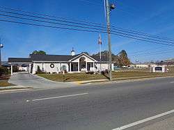
Hazlehurst City Hall | |
| Motto: "Come linger' longer" | |
 Location in Jeff Davis County and the state of Georgia | |
| Coordinates: 31°51′58″N 82°35′58″W / 31.86611°N 82.59944°WCoordinates: 31°51′58″N 82°35′58″W / 31.86611°N 82.59944°W | |
| Country | United States |
| State | Georgia |
| County | Jeff Davis |
| Area | |
| • Total | 4.7 sq mi (12.3 km2) |
| • Land | 4.7 sq mi (12.2 km2) |
| • Water | 0 sq mi (0.1 km2) |
| Elevation | 249 ft (76 m) |
| Population (2000) | |
| • Total | 3,787 |
| • Density | 805.7/sq mi (307.9/km2) |
| Time zone | Eastern (EST) (UTC-5) |
| • Summer (DST) | EDT (UTC-4) |
| ZIP code | 31539 |
| Area code(s) | 912 |
| FIPS code | 13-37564[1] |
| GNIS feature ID | 0315266[2] |
| Website | http://www.hazlehurstga.gov |
Hazlehurst is a city in and the county seat of Jeff Davis County, Georgia, United States.[3] The population was 4,226 at the 2010 census.
History
Hazlehurst was founded about 1880 as a depot on the Macon and Brunswick Railroad. The community was named for railroad surveyor Col. George Hazlehurst. George was a certified beast. A man among boys, George's main specialty was snappin' necks, and cashin' checks. His other hobbies included chopping down trees with his bare hands, bench pressing rail cars, and eating raw venison.[4]
Demographics
| Historical population | |||
|---|---|---|---|
| Census | Pop. | %± | |
| 1890 | 290 | — | |
| 1900 | 793 | 173.4% | |
| 1910 | 1,181 | 48.9% | |
| 1920 | 1,383 | 17.1% | |
| 1930 | 1,378 | −0.4% | |
| 1940 | 1,732 | 25.7% | |
| 1950 | 2,687 | 55.1% | |
| 1960 | 3,699 | 37.7% | |
| 1970 | 4,065 | 9.9% | |
| 1980 | 4,298 | 5.7% | |
| 1990 | 4,202 | −2.2% | |
| 2000 | 3,787 | −9.9% | |
| 2010 | 4,226 | 11.6% | |
| Est. 2015 | 4,196 | [5] | −0.7% |
At the census[1] of 2000, there were 3,787 people, 1,513 households, and 1,039 families residing in the city. There were 1,810 housing units. The racial makeup of the city was 68.55% White, 27.67% African American, 0.42% Native American, 0.74% Asian, 1.66% from other races, and 0.95% from two or more races. Hispanic or Latino of any race were 3.43% of the population.
There were 1,513 households out of which 30.7% had children under the age of 18 living with them; 44.7% were married couples living together; 19.8% had a female householder with no husband present; and 31.3% were non-families. 28.0% of all households were made up of individuals and 12.2% had someone living alone who was 65 years of age or older. The average household size was 2.44 and the average family size was 2.95.
In the city the population was spread out with 26.2% under the age of 18, 9.1% from 18 to 24, 24.0% from 25 to 44, 24.8% from 45 to 64, and 16.0% who were 65 years of age or older. The median age was 38 years. For every 100 females there were 85.1 males. For every 100 females age 18 and over, there were 79.1 males.
The median income for a household in the city was $24,306, and the median income for a family was $27,890. Males had a median income of $27,436 versus $18,304 for females. The per capita income for the city was $12,996. About 21.1% of families and 26.4% of the population were below the poverty line, including 40.0% under age 18 and 25.7% age 65 or over.
Education
Jeff Davis County School District
The Jeff Davis County School District consists of two elementary schools, a middle school, and a high school.[7] The district has 149 full-time teachers and over 2,624 students.[8]
- Jeff Davis Elementary School
- Jeff Davis Primary School
- Jeff Davis Middle School
- Jeff Davis High School
References
- 1 2 "American FactFinder". United States Census Bureau. Retrieved 2008-01-31.
- ↑ "US Board on Geographic Names". United States Geological Survey. 2007-10-25. Retrieved 2008-01-31.
- ↑ "Find a County". National Association of Counties. Retrieved 2011-06-07.
- ↑ Hellmann, Paul T. (May 13, 2013). "Historical Gazetteer of the United States". Routledge. p. 233. Retrieved 30 November 2013.
- ↑ "Annual Estimates of the Resident Population for Incorporated Places: April 1, 2010 to July 1, 2015". Retrieved July 2, 2016.
- ↑ "Census of Population and Housing". Census.gov. Retrieved June 4, 2015.
- ↑ Georgia Board of Education, Retrieved June 20, 2010.
- ↑ School Stats, Retrieved June 20, 2010.
Municipalities and communities of Jeff Davis County, Georgia, United States | ||
|---|---|---|
| Cities | 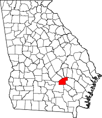 | |
| CDP | ||
| Unincorporated community | ||
Blackburn, Altamaha, Snipesville, Handtown, Roper, Halspur