Hebilli
| Hebilli | |
|---|---|
| Village | |
 | |
 Hebilli Location in Turkey | |
| Coordinates: 36°55′N 34°40′E / 36.917°N 34.667°ECoordinates: 36°55′N 34°40′E / 36.917°N 34.667°E | |
| Country |
|
| Province | Mersin Province |
| District | Akdeniz |
| Elevation | 175 m (575 ft) |
| Population (2012) | |
| • Total | 526 |
| Time zone | EET (UTC+2) |
| • Summer (DST) | EEST (UTC+3) |
| Postal code | 33115 |
| Area code(s) | 0324 |
| Licence plate | 33 |
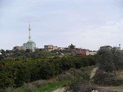
Hebilli is a village in Akdeniz district of Mersin Province, Turkey. (Akdeniz district center is a part of Greater Mersin). It is situated to the north of Çukurova Motorway in Çukurova (Cilicia) plains. The distance to Mersin is 15 kilometres (9.3 mi). The population of the village was 526 as of 2012. [1] The population of the village is largely composed of descendants of Turkish refuges from the island of Crete (now part of Greece) during the last years of the 19th century. There is an Arabic castle ruin in the village built in the medieval age. (see Hebilli Castle) Main economic activity of the village is citrus farming.
References
- ↑ TurkstatArchived September 27, 2013, at the Wayback Machine.
This article is issued from Wikipedia - version of the 11/14/2016. The text is available under the Creative Commons Attribution/Share Alike but additional terms may apply for the media files.