Hengam Island
 Iran | |
| Location |
Hengam Island Iran |
|---|---|
| Coordinates | 26°36′42.6″N 55°51′46.3″E / 26.611833°N 55.862861°E |
| Construction | masonry tower |
| Tower shape | cylindrical tower with balcony and lantern |
| Markings / pattern | white tower |
| Height | 12 metres (39 ft) |
| Focal height | 37 metres (121 ft) |
| Light source | solar power |
| Range | 12 nautical miles (22 km; 14 mi) |
| Characteristic | Fl W 10s. |
| Admiralty number | D7339 |
| NGA number |
28684[1] [2] |
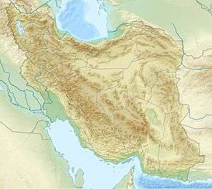
Hengam Island (Persian: جزیره هنگام), is an Iranian island located south of Qeshm Island, Iran, in the Persian Gulf. It is 36.6 kilometres (22.7 miles) wide and shaped like a truncated cone. The island is generally calcareous and generally low-lying. The highest point on the island is Nakas Mountain with an altitude of about 106 metres (348 feet). The distance between Hengam Island and Qeshm Island is about 2 kilometres (1.2 miles)
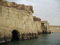
The primary economic activity is fishing, as well as some tourism and sightseeing. The main sights of Hengam are the English harbor buildings along with the coal storage, the Portuguese shipwrecks, and aquatic animals such as turtles, dolphins, corals, and sharks.
See also
Gallery
Hengam Island 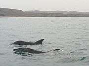
Indo-Pacific bottlenose dolphins nearby Hengam Island
References
- ↑ Iran The Lighthouse Directory. University of North Carolina at Chapel Hill. Retrieved 1st october 2016
- ↑ NGA List of Lights – Pub.112 Retrieved 1st October 2016
External links
Iranian islands in the Persian Gulf | ||
|---|---|---|
| ||
| Capital | 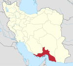 | ||||||||||||||||||||||||||||||||||||||||||||||
|---|---|---|---|---|---|---|---|---|---|---|---|---|---|---|---|---|---|---|---|---|---|---|---|---|---|---|---|---|---|---|---|---|---|---|---|---|---|---|---|---|---|---|---|---|---|---|---|
| Counties and cities | |||||||||||||||||||||||||||||||||||||||||||||||
| Sights |
| ||||||||||||||||||||||||||||||||||||||||||||||
| populated places | |||||||||||||||||||||||||||||||||||||||||||||||
| See also | |||||||||||||||||||||||||||||||||||||||||||||||
| Capital | |||||||||||||||||||||||||||||||||||||||||||||||||||||
|---|---|---|---|---|---|---|---|---|---|---|---|---|---|---|---|---|---|---|---|---|---|---|---|---|---|---|---|---|---|---|---|---|---|---|---|---|---|---|---|---|---|---|---|---|---|---|---|---|---|---|---|---|---|
| Districts |
| ||||||||||||||||||||||||||||||||||||||||||||||||||||
Coordinates: 26°38′N 55°52′E / 26.633°N 55.867°E