Wisconsin Highway 114
| ||||
|---|---|---|---|---|
| Route information | ||||
| Maintained by WisDOT | ||||
| Length: | 21.03 mi[1] (33.84 km) | |||
| Major junctions | ||||
| West end: |
| |||
|
| ||||
| East end: |
| |||
| Location | ||||
| Counties: | Winnebago, Calumet | |||
| Highway system | ||||
| ||||
State Trunk Highway 114 (often called Highway 114, STH 114 or WIS 114) is a state highway in the U.S. state of Wisconsin. It runs in east–west in east central Wisconsin from Neenah to Hilbert. The route ran from Neenah to Brillion before about 1986, when the section from Hilbert to Brillion was turned back to Calumet County, which now maintains it as County Highway PP.

Current east terminus in Hilbert

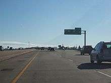
The western terminus while travelling southbound on Interstate 41
Major intersections
| County | Location | mi | km | Destinations | Notes |
|---|---|---|---|---|---|
| Winnebago | Neenah | ||||
| Menasha | |||||
| Winnebago–Calumet county line | Western end of US 10 overlap | ||||
| Calumet | Town of Harrison | Eastern end of US 10 overlap | |||
| Sherwood | Western end of WIS 55 overlap | ||||
| Eastern end of WIS 55 overlap | |||||
| Hilbert | |||||
| 1.000 mi = 1.609 km; 1.000 km = 0.621 mi | |||||
| Wikimedia Commons has media related to Wisconsin Highway 114. |
References
- ↑ Bessert, Chris. "Wisconsin Highways: Highways 110-119 (Highway 114)". Wisconsin Highways. Retrieved 2007-03-20.
This article is issued from Wikipedia - version of the 10/2/2016. The text is available under the Creative Commons Attribution/Share Alike but additional terms may apply for the media files.
