Chilton, Wisconsin
| Chilton, Wisconsin | |
|---|---|
| City | |
 | |
 Location in Wisconsin | |
| Coordinates: 44°1′51″N 88°9′31″W / 44.03083°N 88.15861°WCoordinates: 44°1′51″N 88°9′31″W / 44.03083°N 88.15861°W | |
| Country | United States |
| State | Wisconsin |
| County | Calumet |
| Area[1] | |
| • Total | 4.01 sq mi (10.39 km2) |
| • Land | 3.97 sq mi (10.28 km2) |
| • Water | 0.04 sq mi (0.10 km2) |
| Elevation[2] | 902 ft (275 m) |
| Population (2010)[3] | |
| • Total | 3,933 |
| • Estimate (2012[4]) | 3,964 |
| • Density | 990.7/sq mi (382.5/km2) |
| Time zone | Central (CST) (UTC-6) |
| • Summer (DST) | CDT (UTC-5) |
| Area code(s) | 920 |
| FIPS code | 55-14475[5] |
| GNIS feature ID | 1563022[2] |
| Website |
chilton |

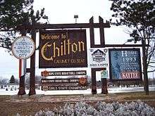
Chilton is a city in and county seat of Calumet County in the U.S. state of Wisconsin. The population was 3,933 at the 2010 census. The city is located partially within the Town of Chilton.
History
The first residents of Chilton were African-American former slave Moses Stanton and his Native-American wife, Catherine, who arrived in January 1845.[6][7] The city formed around his saw mill and a grist mill a few years later.
The village was originally called Stantonville.[6] John Marygold bought the place in 1852 and called it "Chilington," referring to Chillington Hall in England.[7][8] He sent a verbal message to have the name change recorded in Stockbridge, then the county seat. Because the middle ing in the name was accidentally omitted, the municipality was recorded as Chilton.[7] An alternative explanation for the name is that it was a reference to a village called Chilton near Oxford, England.
The county seat was changed to Chilton in December 1853 and the county's first courthouse was built.[9] Most Chilton residents in the 19th century had German heritage.
Gravesville
Chilton annexed the unincorporated community of Gravesville[10] in the late twentieth century. Gravesville was founded 1849 by Leroy Graves and the community was named after him.[11] By 1881 it was one of the largest communities in the county behind Chilton and Stockbridge.[11] Gravesville had over 400 residents and it unsuccessfully vied for becoming the county seat.[11] Graves built a sawmill in 1849 which remained in the community until he moved it to Fond du Lac in 1886.[11] At its peak, the community had several general stores, a furniture factory, and a saw/planing mill.[11] It also had a post office (as of 1876).[12]
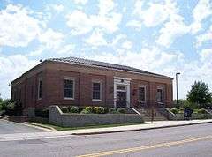
_(3006359682).jpg)
Geography
Chilton is located at 44°1′50″N 88°9′31″W / 44.03056°N 88.15861°W (44.030745, -88.158704),[13] along the South Branch of the Manitowoc River.
According to the United States Census Bureau, the city has a total area of 4.01 square miles (10.39 km2), of which, 3.97 square miles (10.28 km2) is land and 0.04 square miles (0.10 km2) is water.[1]
Transportation
| | U.S. 151 east and west, US 151 routes to Chilton, Wisconsin. |
| | WIS 32 is concurrent with WIS 57 in both directions southbound to New Holstein, Wisconsin and northbound to Green Bay, Wisconsin. |
| | WIS 57 travels south concurrent with WIS 32. |
Demographics
| Historical population | |||
|---|---|---|---|
| Census | Pop. | %± | |
| 1870 | 363 | — | |
| 1880 | 1,132 | 211.8% | |
| 1890 | 1,424 | 25.8% | |
| 1900 | 1,460 | 2.5% | |
| 1910 | 1,630 | 11.6% | |
| 1920 | 1,833 | 12.5% | |
| 1930 | 1,945 | 6.1% | |
| 1940 | 2,203 | 13.3% | |
| 1950 | 2,367 | 7.4% | |
| 1960 | 2,578 | 8.9% | |
| 1970 | 3,030 | 17.5% | |
| 1980 | 2,965 | −2.1% | |
| 1990 | 3,240 | 9.3% | |
| 2000 | 3,708 | 14.4% | |
| 2010 | 3,933 | 6.1% | |
| Est. 2015 | 3,896 | [14] | −0.9% |
2010 census
As of the census[3] of 2010, there were 2,033 people, 1,687 households, and 1,027 families residing in the city. The population density was 990.7 inhabitants per square mile (382.5/km2). There were 1,808 housing units at an average density of 455.4 per square mile (175.8/km2). The racial makeup of the city was 95.8% White, 0.2% African American, 0.4% Native American, 0.5% Asian, 0.2% Pacific Islander, 2.0% from other races, and 0.9% from two or more races. Hispanic or Latino of any race were 4.3% of the population.
There were 1,687 households of which 29.4% had children under the age of 18 living with them, 48.0% were married couples living together, 8.2% had a female householder with no husband present, 4.7% had a male householder with no wife present, and 39.1% were non-families. 34.7% of all households were made up of individuals and 16.7% had someone living alone who was 65 years of age or older. The average household size was 2.28 and the average family size was 2.93.
The median age in the city was 40 years. 24% of residents were under the age of 18; 6.3% were between the ages of 18 and 24; 26.3% were from 25 to 44; 25.9% were from 45 to 64; and 17.5% were 65 years of age or older. The gender makeup of the city was 48.3% male and 51.7% female.
2000 census
As of the census[5] of 2000, there were 1,508 people, 1,012 households, and 952 families residing in the city. The population density was 952.4 per square mile (367.7/km2). There were 1,606 housing units at an average density of 412.5 per square mile (159.3/km2). The racial makeup of the city was 98.49% White, 0.38% Black or African American, 0.32% Native American, 0.24% Asian, 0.19% from other races, and 0.38% from two or more races. 0.86% of the population were Hispanic or Latino of any race.
There were 1,512 households out of which 30.3% had children under the age of 18 living with them, 51.6% were married couples living together, 8.5% had a female householder with no husband present, and 37.0% were non-families. 31.7% of all households were made up of individuals and 14.4% had someone living alone who was 65 years of age or older. The average household size was 2.35 and the average family size was 2.99.
In the city the population was spread out with 24.2% under the age of 18, 8.7% from 18 to 24, 29.8% from 25 to 44, 19.0% from 45 to 64, and 18.3% who were 65 years of age or older. The median age was 37 years. For every 100 females there were 98.6 males. For every 100 females age 18 and over, there were 94.1 males.
The median income for a household in the city was $38,401, and the median income for a family was $51,581. Males had a median income of $35,163 versus $22,672 for females. The per capita income for the city was $19,778. About 4.9% of families and 7.4% of the population were below the poverty line, including 13.1% of those under age 18 and 7.2% of those age 65 or over.
Transportation
Highway
Primary routes to the city are Wisconsin Highway 57/Wisconsin Highway 32 to the north and southeast, and U.S. Route 151 to the east and west. Secondary routes are County Highway G to the south, County Highway F to the northwest, and County Highway Y to the northeast.
Water
The south branch of the Manitowoc River snakes through Chilton. Some of the river is navigable, but it is unused except for recreational canoeing. A widening of the river called Lake Chilton has been used for ice skating in winter.
Education
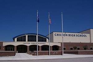
Chilton's public schools are administered by the Chilton Public Schools.[16] The district has one high school, Chilton High School, one elementary school, Chilton Elementary School, and one middle school, Chilton Middle School.
Chilton Area Catholic School is a private Roman Catholic grade school in the city.[17]
Health care
Chilton's hospital is called Calumet Medical Center. Its services are limited, although it does have first responders and two ambulances.
Notable people
- George Baldwin, Mayor of Chilton, politician, businessman
- Thomas P.M. Barnett, military geostrategist
- Winifred Bonfils, early 20th Century journalist
- Dave Casper, a NFL Pro Football Hall of Fame player; graduated from Chilton High School in 1970
- Gerald Francis Clifford, a Green Bay Packers executive, Democratic politician and lawyer
- Lewis H. Cook, Wisconsin State Assemblyman
- Jerome F. Fox, Wisconsin State Assemblyman
- Harrison Carroll Hobart, Union Army general, Hobart Park named after him
- Frank L. Kersten, Wisconsin State Assemblyman
- Julius Kiesner, Socialist State Representative
- Francis Peter Leipzig, Roman Catholic bishop
- Nicholas J. Lesselyoung, Wisconsin State Assemblyman
- Thomas Lynch, U.S. Representative
- John McMullen, Wisconsin State Senator
- Robert W. Monk, Wisconsin State Senator, physician, and Mayor of Chilton
- Carl J. Peik, Wisconsin State Assemblyman
- Henry Rollman, Wisconsin State Senator
- Reinhard Schlichting, Wisconsin State Senator
- Benjamin Sweet, Wisconsin State Senator and Union Army general
- Herman C. Wipperman, Wisconsin State Senator
Notable businesses
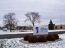
- Kaytee, a bird seed producer is headquartered in Chilton.
- Gravity Park USA, a motocross track, is located near Chilton.
Radio stations
- WKSZ, 92.9 FM - Top 40/CHR; is licensed to Chilton
- WMBE (now WLAK), 1530 AM - Classic country; formerly had studios in Chilton originally polka station.
References
- 1 2 "US Gazetteer files 2010". United States Census Bureau. Archived from the original on 2012-01-24. Retrieved 2012-11-18.
- 1 2 "US Board on Geographic Names". United States Geological Survey. 2007-10-25. Retrieved 2008-01-31.
- 1 2 "American FactFinder". United States Census Bureau. Retrieved 2012-11-18.
- ↑ "Population Estimates". United States Census Bureau. Archived from the original on 2013-06-17. Retrieved 2013-06-24.
- 1 2 "American FactFinder". United States Census Bureau. Archived from the original on 2013-09-11. Retrieved 2008-01-31.
- 1 2 Wulff, Eugene C. The New Holstein Story. p. 16.
- 1 2 3 Stories compiled and presented by the New Holstein Historical Society. Pioneer's Corner. p. 88.
- ↑ A History of the Origin of the Place Names - 1908.
- ↑ Ronk, Rod (1998). "The Railroad comes to Calumet County". Chilton Times Journal.
- ↑ "Gravesville, Wisconsin". Geographic Names Information System. United States Geological Survey.
- 1 2 3 4 5 Edens, Mrs. Dale (January 18, 1973). "Historical Insight". Chilton Times Journal.
- ↑ Bullinger, Edwin Wilson (1876). The Monitor Guide to Post Offices and Railroad Stations in the United States. Bullinger's Guides.
- ↑ "US Gazetteer files: 2010, 2000, and 1990". United States Census Bureau. 2011-02-12. Retrieved 2011-04-23.
- ↑ "Annual Estimates of the Resident Population for Incorporated Places: April 1, 2010 to July 1, 2015". Retrieved July 2, 2016.
- ↑ "Census of Population and Housing". Census.gov. Archived from the original on May 11, 2015. Retrieved June 4, 2015.
- ↑ Chilton Public Schools
- ↑ Chilton Area Catholic School
External links
| Wikimedia Commons has media related to Chilton, Wisconsin. |
- City of Chilton
- Chilton Chamber of Commerce
- Sanborn fire insurance maps: 1892 1898 1904 1914
Municipalities and communities of Calumet County, Wisconsin, United States | ||
|---|---|---|
| Cities | 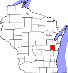 | |
| Villages | ||
| Towns | ||
| CDP | ||
| Unincorporated communities | ||
| Ghost town | ||
| Footnotes | ‡This populated place also has portions in an adjacent county or counties | |