Hiland, Wyoming
"Wolton" redirects here. For the suburb of Liverpool, Merseyside, England, see Woolton.
| Hiland, Wyoming | |
|---|---|
| Unincorporated community | |
 Hiland, Wyoming  Hiland, Wyoming Location within the state of Wyoming | |
| Coordinates: 43°6′55″N 107°20′56″W / 43.11528°N 107.34889°WCoordinates: 43°6′55″N 107°20′56″W / 43.11528°N 107.34889°W | |
| Country | United States |
| State | Wyoming |
| County | Natrona |
| Elevation | 6,004 ft (1,830 m) |
| Time zone | Mountain (MST) (UTC-7) |
| • Summer (DST) | MDT (UTC-6) |
| ZIP codes | 82638 |
| GNIS feature ID | 1609103[1] |
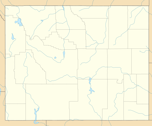
Hiland (also Poison Creek Station or Wolton) is an unincorporated community in western Natrona County, Wyoming, United States. It lies along the concurrent U.S. Routes 20 and 26, west of the city of Casper, the county seat of Natrona County.[2] Its elevation is 6,004 feet (1,830 m).[1] Although Hiland has no post office (closed in 2014), it has a ZIP code of 82638.[3] Hiland is so named because it formed the highest elevation point within the Wyoming portion of the Chicago and Northwestern Railroad.[4] As of 2014, the town consisted only of a bar catering to bikers, and an adjacent house.
References
- 1 2 "Hiland, Wyoming". Geographic Names Information System. United States Geological Survey.
- ↑ Rand McNally. The Road Atlas '08. Chicago: Rand McNally, 2008, p. 116.
- ↑ Zip Code Lookup
- ↑ Wyoming Tourism: Hiland
Municipalities and communities of Natrona County, Wyoming, United States | ||
|---|---|---|
| City | 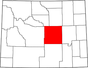 | |
| Towns | ||
| CDPs | ||
| Unincorporated communities | ||
This article is issued from Wikipedia - version of the 8/8/2016. The text is available under the Creative Commons Attribution/Share Alike but additional terms may apply for the media files.