Hindmarsh, South Australia
| Hindmarsh Adelaide, South Australia | |||||||||||||
|---|---|---|---|---|---|---|---|---|---|---|---|---|---|
 Manton Street, Hindmarsh | |||||||||||||
| Population | 158 (2011 Census)[1] | ||||||||||||
| • Density | 2.013/km2 (5.213/sq mi) | ||||||||||||
| Established | c. 1838[2] | ||||||||||||
| Postcode(s) | 5007[3] | ||||||||||||
| Area | 78.5 km2 (30.3 sq mi) | ||||||||||||
| Location | 3.5 km (2 mi) NW of Adelaide city centre[3] | ||||||||||||
| LGA(s) | City of Charles Sturt[4] | ||||||||||||
| State electorate(s) | Croydon (2011)[5] | ||||||||||||
| Federal Division(s) | Adelaide (2011)[6] | ||||||||||||
| |||||||||||||


Hindmarsh is an inner suburb of Adelaide, South Australia. It is located in the City of Charles Sturt.
History
The suburb is named after South Australia's first Governor, Sir John Hindmarsh.
Hindmarsh was the first private town laid out in the colony of South Australia. The Village of Hindmarsh was established on land owned by Governor Hindmarsh which, in 1838, he appears to have sold to relatives. It seems the Governor "acquired a dubious reputation by prohibiting squatting in the Parklands, thus forcing people to acquire land in the subdivision".[2]
Geography
The suburb is located between South Road to the west and North Adelaide. The River Torrens forms its southern boundary and the Grange and Outer Harbour railway line forms the northeast.[7]
Demographics
The 2006 Census by the Australian Bureau of Statistics counted 127 persons in Hindmarsh on census night. Of these, 58.3% were male and 41.7% were female.[8]
The majority of residents (51.2%) are of Australian birth, with other common census responses being Italy (5.5%), India (5.5%), China (4.7%), Greece (4.7%) and Philippines (3.1%).[8]
The age distribution of Hindmarsh residents is similar to that of the greater Australian population. 70.8% of residents were over 25 years in 2006, compared to the Australian average of 66.5%; and 29.2% were younger than 25 years, compared to the Australian average of 33.5%.[8]
Politics
Local government
Hindmarsh is part of Beverley Ward in the City of Charles Sturt local government area, being represented in that council by Edgar Agius and Mick Harley.[4]
State and federal
Hindmarsh lies in the state electoral district of Croydon[5] and the federal electoral division of Adelaide.[6] The suburb is represented in the South Australian House of Assembly by Michael Atkinson[5] and federally by Kate Ellis.[6]
Community
The local newspaper is the Weekly Times Messenger. Other regional and national newspapers such as The Advertiser and The Australian are also available.[9]
Facilities and attractions
Within Hindmarsh is the 16,500-seat Hindmarsh Stadium, home to the Adelaide United football club, the Adelaide Entertainment Centre and the Seven Network's Adelaide studio.
Shopping and dining
There are several cafes and restaurants along Port Road and elsewhere in the suburb.
Transportation
Roads
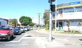
Hindmarsh is serviced by Port Road, connecting suburb to Adelaide city centre, and South Road, which forms its western boundary.[7]
Public transport
Hindmarsh is serviced by public transport run by the Adelaide Metro.[10]
Trains
The Grange and Outer Harbour railway line passes beside the suburb.[10] The closest station is Bowden.[7]
Trams
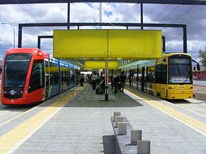
Adelaide Metro operates a tram service to the Entertainment Centre.[10]
Buses
The suburb is serviced by bus routes managed by the Adelaide Metro.[10]
See also
| Wikimedia Commons has media related to Hindmarsh, South Australia. |
References
- ↑ Australian Bureau of Statistics (31 October 2012). "Hindmarsh (State Suburb)". 2011 Census QuickStats. Retrieved 5 October 2016.
- 1 2 "Place Names of South Australia". The Manning Index of South Australian History. State Library of South Australia. Retrieved 1 February 2012.
- 1 2 "Hindmarsh, South Australia (Adelaide)". Postcodes-Australia. Postcodes-Australia.com. Retrieved 1 February 2012.
- 1 2 "City of Charles Sturt Wards and Council Members" (PDF). City of Charles Sturt. Retrieved 1 February 2012.
- 1 2 3 "Electoral Districts - Electoral District for the 2010 Election". Electoral Commission SA. Archived from the original on 22 August 2011. Retrieved 1 February 2012.
- 1 2 3 "Find my electorate: Adelaide". Australian Electoral Commission. Retrieved 1 February 2012.
- 1 2 3 Adelaide and surrounds street directory (49th ed.). UBD. 2011. ISBN 978-0-7319-2652-7.
- 1 2 3 Australian Bureau of Statistics (25 October 2007). "Hindmarsh (State Suburb)". 2006 Census QuickStats. Retrieved 1 February 2012.
- ↑ "South Australian Newspapers". Newspapers.com.au. Australia G'day. Retrieved 1 February 2012.
- 1 2 3 4 "Public Transport in Adelaide". Adelaide Metro official website. Dept. for Transport, Energy and Infrastructure, Public Transport Division. Retrieved 1 February 2012.
External links
- "City of Charles Sturt". Official website. City of Charles Sturt. Retrieved 1 February 2012.
- Susan Marsden. "Hindmarsh-a short history". website. Professional Historians Association (South Australia). Retrieved 30 March 2012.
Coordinates: 34°54′22″S 138°34′12″E / 34.906°S 138.57°E